
Heavy Rain, Flooding, and Chance of Severe Weather Staring Down the Southern U.S.
January 22, 2024
Posted: February 2, 2022 11:54 am


A weather system encompassing a wide range of features is getting ready to take aim at the south-central U.S. beginning on Groundhog Day.
A powerful Arctic front is dipping down into Texas to start the month of February. This front is predicted to merge with a mass of moist air coming up from the Gulf of Mexico by Wednesday. As this happens, it will set off a number of weather makers beginning with heavy rain in the Mississippi Valley.
Those areas located to the north of the front will be subject to cold air. However, those along the Gulf Coast will still experience seasonable temperatures in the 50s and 60s. Some areas closest to the coast may inch above 70 degrees on Wednesday, making it feel more like spring.
The warm and moist air from the Gulf will come to blows with the cold air that is rushing down from the Rocky Mountains, triggering a series of isolated thunderstorms and heavy rain bands along the frontal line. Persistent rainfall is in the forecast for a large swath of the central U.S. stretching from eastern Texas into West Virginia.
Cities in the bullseye for steady rainfall through Thursday include Dallas, Houston, Little Rock, and Nashville. The heaviest rain bands will set up along the Louisiana coastline and up into the western half of Tennessee. Forecasters are warning residents to be ready for the potential of flooding as the rain continues to come down.
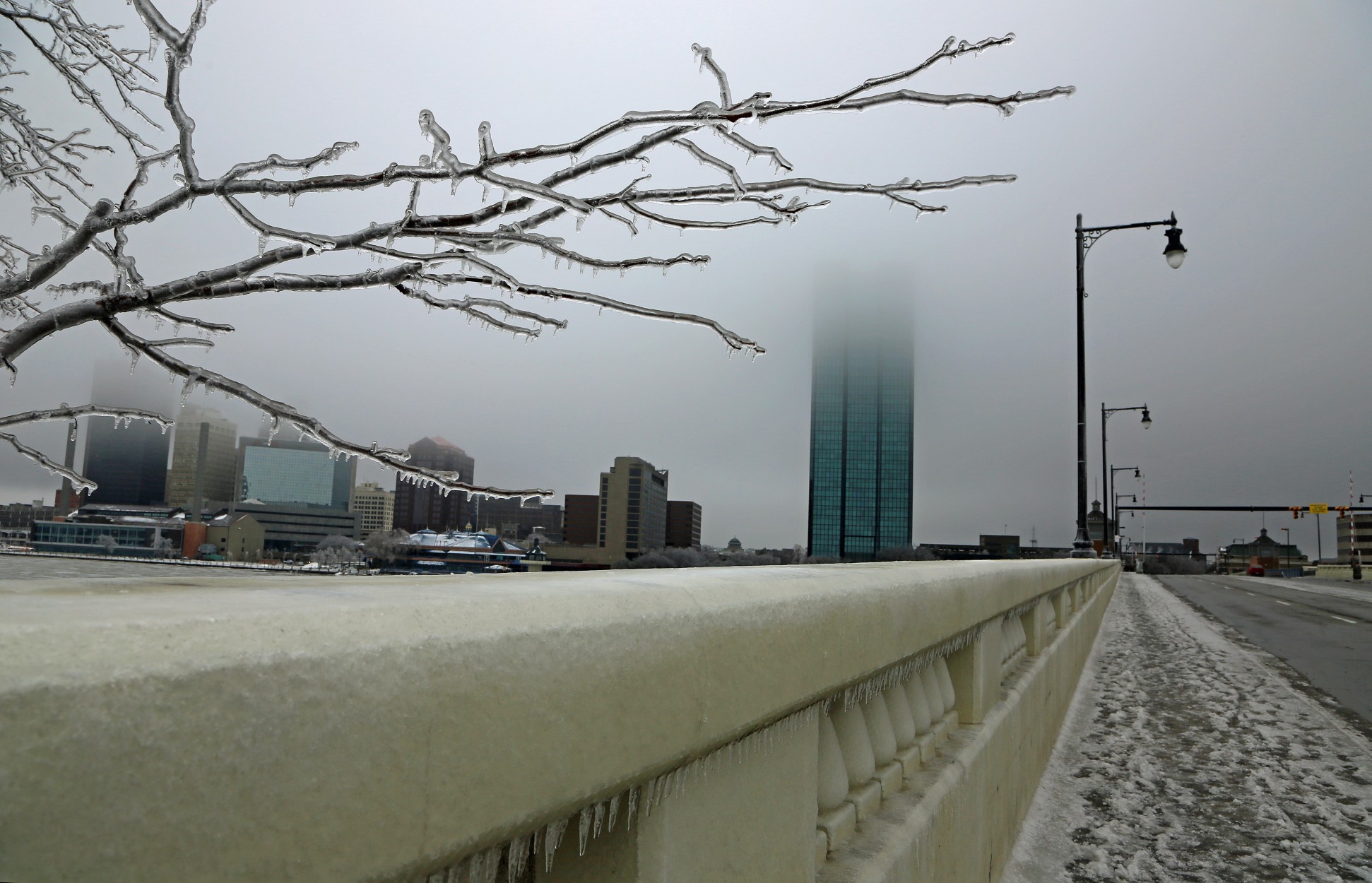
While areas to the south will see only rain out of this system, those farther to the north will be subject to the possibility of freezing rain and ice. This includes a large part of the Mississippi and Ohio valleys. Cities such as Dallas will begin Wednesday with just a dose of rain. However, there is a strong likelihood that this rain will transition to freezing rain as the sun goes down Wednesday night.
This transition to more treacherous weather conditions will happen in areas where the mercury plummets below the freezing level of 32 degrees. The cold air sweeping down from the Upper Plains will make it likely that locations such as Little Rock begin to see freezing rain by late Wednesday night.
Ice accumulations will range between 0.10-0.25 of an inch in areas such as northeastern Texas and southern Missouri. This freezing rain will eventually make its up way through parts of southern Illinois and Indiana before reaching as far northeast as central New York.
The most significant ice accumulation will likely be in a band stretching from central Arkansas into northern Kentucky. This narrow region could see up to 1 inch of ice before the system wraps up.
This amount of ice could cause massive power outages while nearly bringing travel to a halt. Unfortunately, the worst of the ice may affect western Kentucky, an area of the country still reeling after an EF4 tornado ripped through the region in December.
Well to the north of the frontal boundary, it will be snow that is the main story. The storm began earlier in the week by dropping snow on the Colorado Rockies before firing up in Kansas, Missouri, and into the Plains states. This snow will eventually track into the Northeast by the end of the week.
The snow began falling in the Kansas City metro area along the Kansas and Missouri border on Tuesday evening. This snow is predicted to continue through the majority of Wednesday with some areas seeing up to one foot of accumulation.
Other cities that may see a foot of snow include Detroit and Toledo, Ohio. Indianapolis is slated to receive 4 – 8 inches of snow along on top of the ice that it gets.

January 21, 2024

January 19, 2024

January 18, 2024
