
Heavy Rain, Flooding, and Chance of Severe Weather Staring Down the Southern U.S.
January 22, 2024
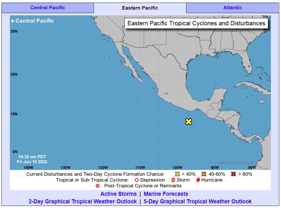
Posted: June 11, 2022 3:25 am


Despite Activity in the East Pacific, the Atlantic Basin Remains Calm
A potential tropical threat in the East Pacific has caught the eyes of hurricane experts just days after parts of Mexico suffered the wrath of a Category 2 Hurricane Agatha.
Hurricane Agatha roared onto southern Mexico as the strongest tropical event to hit this country in the month of May since records began in 1949. Since that time, the East Pacific has been quiet with no tropical activity reported. However, that all could change in the coming days as showers and thunderstorms fire up near Central America and move into warm ocean waters.
A tropical wave is currently spinning near Nicaragua and Costa Rica, triggering the development of thunderstorms across this part of the Pacific. However, forecasters are predicting that this wave will not see the organization and intensification it needs to become a named storm by the early part of the weekend.
Should this wave develop into a named storm, it would most likely happen between Sunday and Wednesday of next week. This predicted date range is based on the likelihood that the tropical feature will track to the west, entering an area of warmer water and less wind shear. These are both features that encourage tropical development.
It is still too early to pinpoint a potential path of this possible tropical feature. However, forecasters are warning that southern Mexico may once again take a direct hit. Even if the feature does not intensify greatly or come on to shore in this region, there could be an increase in shower activity and strong winds by next week.
There is also the chance that the storm organizes farther to the west. Should this happen, it would only track through the open waters of the Pacific not near any land. This would also steer it away from Mexico. This scenario would be most likely if the storm takes its time strengthening.
If the system gets going by the end of this weekend, it is more likely to impact Mexico. In short, the timing of the strengthening will influence if any land masses take a hit from the feature.
Hurricane Agatha roared onto the southern coast of Mexico on May 30 sporting maximum sustained winds of 105 mph. The storm quickly dissipated as it moved over the mountainous terrain of Mexico. However, the storm was not done yet.
Its leftover energy reorganized and strengthened when it reached the warm waters of the northwestern Caribbean and the Gulf of Mexico. The system moved into South Florida as an unnamed tropical rainstorm, eventually gaining the status of a tropical storm named Alex when it crossed over the peninsula and out into the Atlantic Ocean.
The next named storm to develop in the East Pacific will take the name of Blas. Forecasters are expecting a normal to slightly above normal tropical weather season in this part of the Pacific this year with 15 – 19 named storms predicted.
What is happening in the East Pacific is the opposite of the conditions in the Atlantic basin. After Tropical Rainstorm Alex dropped more than 10 inches of rain in South Florida last week, this part of the world has become a bastion of calm conditions just as activity is starting to fire up again in the East Pacific. Strong wind shear and large masses of dry air will hinder the odds of any tropical development over the next week.
The large plume of dust originating in the Sahara Desert in Africa is now moving across the Atlantic Ocean, disrupting any potential tropical development in its path.
Did you find this content useful? Feel free to bookmark or to post to your timeline for reference later!

January 21, 2024

January 19, 2024

January 18, 2024
