
Heavy Rain, Flooding, and Chance of Severe Weather Staring Down the Southern U.S.
January 22, 2024
Posted: March 25, 2021 3:59 pm


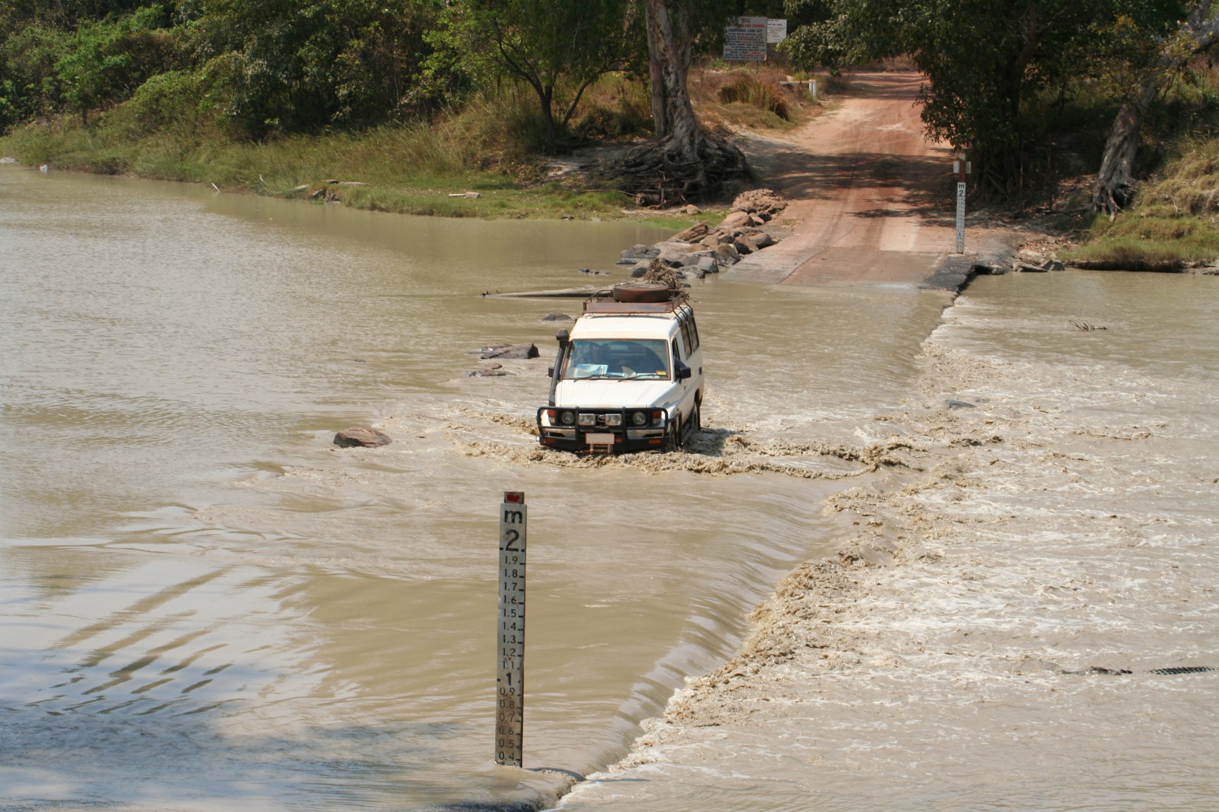
Australia continues to be devastated by severe flooding. An area that is about the size of the U.S. state of Alaska is at the most risk for storminess and rainfall. Coming at a time when weather systems are meeting in the country, its impact has already been seen. Some parts have seen over 35 inches of rain over four days. This is the worst weather event to grapple parts of the nation in over 60 years.
Australia’s Bureau of Meteorology called the event “phenomenal,” as a result of over three times the average amount of rain falling in March. More is expected in the coming days.
Eastern Australia, including New South Wales and Sydney, have been hit especially hard. This part of the country has already been devastated with wildfires that lasted from 2019 to 2020. Over 10 million acres were set ablaze, damaging and killing wildlife, people and buildings.
The New South Wales Premier Gladys Berejiklian could not recall a time in the history of the state when two extreme weather events happened in such quick succession. Over 18,000 people have now been evacuated due to the current dangerous conditions. It was called “violent and dangerous” by the Bureau of Meteorology.
Eastern New South Wales and southeast Queensland have also seen lots of rain this week. Four or more inches of rainfall have accumulated.
The following locations are of note:
The flooding in the Sydney region is the worst since 1961. After the end of a better than normal summer, dams are at capacity. Moisture is coming to the area at a rapid pace, thanks to a tropical low north in Western Australia. An equator part of the jet stream, east of New South Wales and Queensland, has helped draw moisture to the coast.
Pressure from the Tasman Sea has also led to more moisture being drawn to the land, leading to downpours on the coast. Gusts of about 50 mph are also attacking the coast from offshore, leading to flooding on the coast. Water levels could reach record-high tide levels.
Flood warnings are spread across the eastern part of the country, where rainfall has poured into rivers. The burn scars from the past summer’s wildfires put the area at increased risk of landslides.
The life-threatening rainfall should continue through early Wednesday before tapering off, but the risk of flooding still remains. Cooler and drier air masses will need to pass to put an end to the threat of continued flooding and rainfall. Saturated soil way bring wind to trees, so tree fall may increase.
To anyone based in or that has loved ones in Australia: continue to stay diligent, informed and safe in this situation. Pay attention to local and national guidance. As always, we will keep you abreast of any updates. Check the weather app for the latest.

January 21, 2024

January 19, 2024

January 18, 2024
