
Heavy Rain, Flooding, and Chance of Severe Weather Staring Down the Southern U.S.
January 22, 2024
Posted: June 9, 2022 1:19 pm


Residents of Gulf Coast on Alert for Dust Plume Coming From Africa
A new plume of dust is making its way across the Atlantic Ocean, set to bring hazy skies to the U.S. Gulf Coast and through Texas and Florida starting this weekend and continuing through early next week.
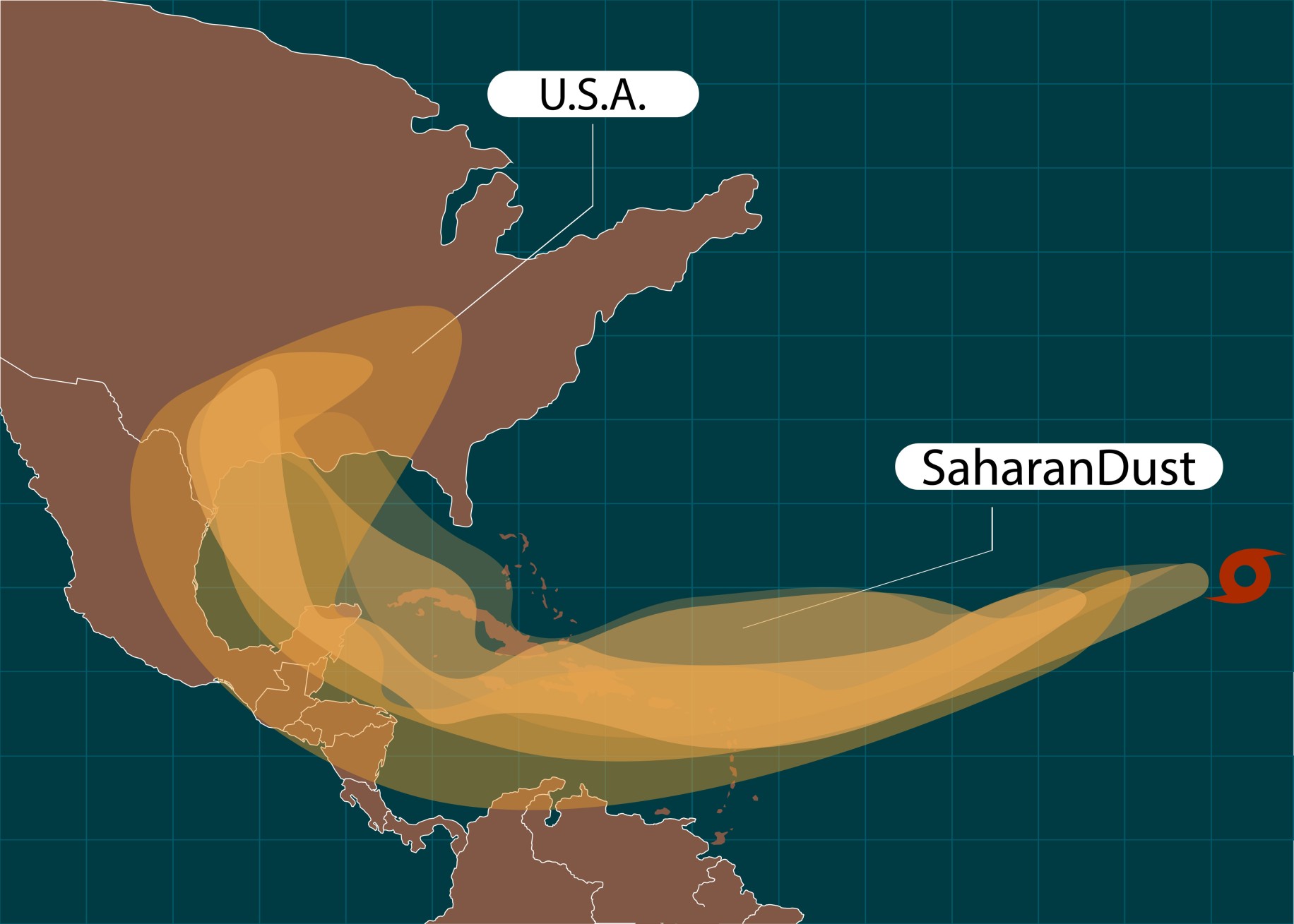
The African easterly jet weather pattern set over that central part of that continent is creating a massive plume of dust that is pushed over the Atlantic Ocean and toward the U.S. Satellite images captured by the National Oceanic and Atmospheric Administration (NOAA) found a strong plume that was developing over the African coast and expanding across the ocean to Cuba, measuring a total of nearly 4,000 miles.
The dust is forecast to filter into the Gulf Coast region by this weekend. However, it may be early next week before most people notice its presence as it takes some time for the dust particle concentration to be high enough to make an impact.
A stretch of land expanding from Florida into southeastern Texas will be where the dust is the most concentrated. Most people will notice its presence through the milky white appearance of the skies. The sky may also appear hazy in the hardest-hit areas, however, most of the particles will stay in the mid to upper levels of the atmosphere.
The strong presence of dust floating in the atmosphere can enhance the natural colors of a sunrise or sunset. This makes the colors pop more vividly as the sun moves through the sky. The dust also creates longer-lasting sunrises and sunsets.
It has been almost two years since a record-breaking Saharan dust cloud affectionately known as the “Godzilla dust cloud” moved across the Atlantic Ocean and delivered some of the most concentrated patches of dust that had been recorded in years. Although this upcoming plume of dust is not forecast to reach this level, it will still be noticeable in a number of areas up and down the Gulf Coast.
The calendar is entering the time of the year when these types of dust plumes from Africa are the most likely. The chances of the plumes increase in the middle of June, peaking in early July through the middle of August.
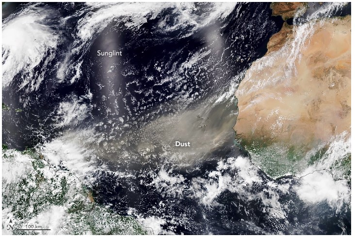
NASA estimates that the winds move about 100 million tons of dust from the Sahara Desert each year with a significant amount of this ending up across the Atlantic Ocean. The amount of dust particles is often so substantial that it impacts the weather patterns in the region.
For example, the creation of dust plumes can work to hinder the development of tropical cyclones over the waters of the Atlantic. This is because the dusty air has approximately 50% less moisture than the air of a typical tropical atmosphere reading. This lack of moisture suppresses the organization of tropical events.
In addition, the warmer air that generally accompanies these dust plumes actually stabilize the atmosphere around it, mitigating the formation of clouds. As the dust moves across the ocean, the particles absorb sunlight and keep the temperature up. Lastly, the winds that pair with the dust plumes also serve to lower the odds of a tropical development.
It is important to understand the potential health risks of these plumes of dust. Air quality levels can drop to unhealthy conditions if enough of the dust builds up. With this upcoming dust cloud, the worst of the air quality will be positioned over Texas and through the Gulf Coast and into Florida.
Individuals with respiratory issues should monitor the air quality levels. If the air quality hits moderate or unhealthy levels, it is a good idea to limit time spent outside.
Sharing is caring. Did you find this content useful? Feel free to bookmark or to post to your timeline for reference later!

January 21, 2024

January 19, 2024

January 18, 2024
