
Heavy Rain, Flooding, and Chance of Severe Weather Staring Down the Southern U.S.
January 22, 2024
Posted: January 30, 2022 11:18 am


Blizzard warnings have been put into effect for a large stretch of the coast from the mid-Atlantic up through New England as a massive nor’easter shapes up off of the Carolinas. The warnings stretch from Salisbury, Maryland to Bar Harbor, Maine, affecting over 10 million Americans.
Forecasters are warning that this storm could deliver over 3 feet of snow paired with wind speeds measuring up to 90 mph in the hardest-hit areas. These conditions would essentially bring life to a halt this weekend for a significant part of the Eastern Seaboard. As of Friday afternoon, the storm was making its way closer to land after coming together and intensifying in the early hours in the Atlantic Ocean.
While forecasters were uncertain early in the week about how the storm would develop and track, the picture has become much clearer over the last several hours. Experts are now saying that this system could rank as one of the top five worst snowstorms in Boston history. This forecast is putting residents up and down the East Coast on high alert as the storm bears down ready to strike.
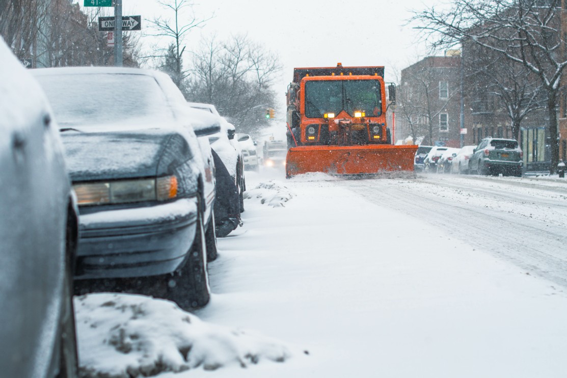
The heavy snow will fall at a rate of 2 – 4 inches per hour during the height of the storm. Combined with the hurricane-force winds, it is almost inevitable that much of the Northeast coastal areas will be under blizzard conditions by Saturday.
Travel will be severely impacted on both the roads and in the skies as a result of this weather maker. The snow drifts may reach as high as several feet off the ground once the winds pick up.
The city of Boston is expected to take the biggest hit with 18 – 24 inches forecasted in the city. This storm could be the biggest to impact the city ever in the month of January. While Bean Town is no stranger to extreme winter weather, this is the first time in four years that Boston has been under a blizzard warning.
The surrounding cities of Providence, Rhode Island and Hartford, Connecticut will also experience a large amount of snow and roads that will likely become impassable. The predicted rapid rate of snowfall could prove to be the most problematic. It is impossible for road crews to keep up with the snow when it is falling at this rate of speed.
New England will not be the only region getting in on this heavy snow. The coastal areas of New Jersey, Delaware, and eastern Maryland will also see meaningful accumulation by the time the snow event wraps up. Atlantic City, New Jersey is bracing for a snowfall prediction of 10 – 15 inches.
New York City is expected to see in the neighborhood of 6 – 12 inches of snow. Forecasters are cautioning that specific accumulation amounts will vary greatly between the boroughs.
While Philadelphia is only forecast to see 3 – 6 inches of accumulation, a slight track of the storm to the west could potentially double this amount. Even the nation’s capital is expected to see snow this weekend, despite being located farther inland and to the south of the epicenter of the action.
The changing nature of this storm makes it important that residents remain vigilant and stay on top of their local forecasts throughout the weekend.

January 21, 2024

January 19, 2024

January 18, 2024
