Heavy Rain, Flooding, and Chance of Severe Weather Staring Down the Southern U.S.
January 22, 2024
Posted: January 12, 2022 11:57 am


As predicted, it was a bitterly cold day on Tuesday for much of the Upper Midwest and the Northeast. Some areas saw the coldest temperatures in years as a massive blast of Arctic air plunged down from Canada to start the week.
Real feel temperatures plummeted well below zero throughout the region late Monday and into Tuesday. Meteorologists in Boston said that it was the coldest day in three years in Bean Town. The frigid air forced the cancellation of the city’s public schools.
In addition, many of the city’s COVID-19 testing sites were also forced to close as the temperature continued its downward trajectory. The closures could not have come at a worse time as the state continues to grapple with an exponential rise in COVID-19 cases due to the Omicron surge.
A water main break on Milk Street flooded a major roadway in the city. Officials are worried that the freezing temperatures will turn the standing water into a sheet of ice covering the road. The forecast high for Boston on Tuesday was only 13 degrees.
Farther to the north in New Hampshire and Maine, numerous locations recorded single-digit high temperatures that struggled to rise above zero degrees. Portland, Maine recorded its coldest day since January 2018.
Although this corner of the nation is certainly used to Old Man Winter showing up this time of year, these mercury readings are well below normal. For example, Albany, New York generally averages a daytime high of about 33 degrees in mid-January. However, the mercury struggled to get out of the lower teens on Tuesday.
Prior to blasting the Northeast with frigid air, this Arctic mass first hit the Upper Midwest and the Great Lakes to kick off the new week. High temperatures hovered in the single digits for a large swath of the Upper Midwest on Monday. Some parts of northwestern Wisconsin never hit the zero-degree mark on Monday.
The Upper Peninsula of Michigan was also under the brunt of the extreme cold. The city of Marquette recorded a high of just two degrees on Monday, breaking the record for the lowest high-temperature reading on that date in history. The previous record of 3 degrees was set in 1999.
Other cities that were forced to bundle up included Minneapolis and Chicago. As a result of strong winds, the real feel temperature in Minneapolis hit 26 degrees below zero as the sun was starting to rise on Monday. These real feel temperatures were stuck below zero for much of the day.
Chicago also was dealing with bitterly cold readings. While the Windy City had enjoyed temperatures that were well above normal for much of December, January has been a completely different story. The month is averaging temperatures that are about 7 degrees below normal for the first month of the year.
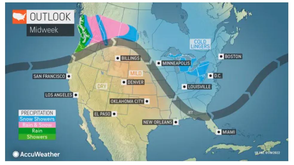
The bulk of the cold air will move out of the area on Wednesday, bringing a bit of relief to those who are tired of the cold. However, a new system is setting up to drop down from Canada for the second part of the week. While there will be some snow associated with this system, it is not likely to result in significant disruptions. There will be an associated mass of cold air that comes just ahead of this system, dropping the mercury just in time for the weekend.

January 21, 2024

January 19, 2024

January 18, 2024