
Heavy Rain, Flooding, and Chance of Severe Weather Staring Down the Southern U.S.
January 22, 2024
Posted: September 10, 2021 10:17 am


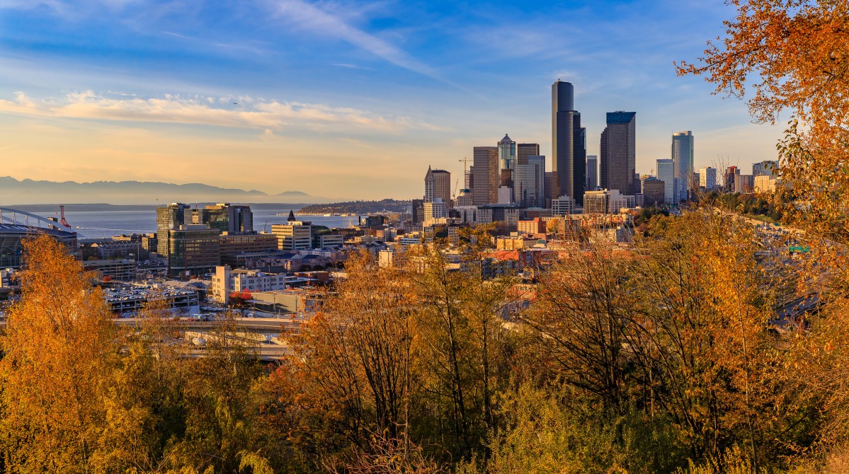
It has been anything but a cool and wet summer for the Pacific Northwest. In fact, 2021 has delivered the driest spring in summer in the 77 years since officials at Seattle-Tacoma International Airport began keeping records. Is this warm and dry pattern about to break for the year?
The Seattle airport has only recorded 6.78 inches of rain since the beginning of March, marking the lowest amount of rain on record for this time period. In addition, rain fell on just 41 days over this time period, beating the previous record of 46 days in both 1992 and 1951.
However, forecasters are predicting that a weather pattern change is in store for the Pacific Northwest. A cooldown that began on Thursday will really get going on Friday, bringing cooler temperatures and the chance of rain to some areas of this region. The change in weather is being attributed to a dip in the jet stream.
A dip in the mercury will be the first sign that change is on the way. Eugene, Oregon reached a high of 91 degrees on Wednesday, well above the average temperature of 80 degrees for this time of the year. However, Friday’s high in this college town is only expected to hit 72 degrees on Friday.
This cool air mass will expand to the north with Seattle struggling to climb to 70 degrees on Friday. The Emerald City saw temperatures around 80 degrees on Wednesday and Thursday. The normal high temperature in mid-September in Seattle is around 74 degrees.
While residents of the Pacific Northwest may welcome a bit of rain after such a dry spell, it does not look like rain will fall in the coastal areas. The bulk of the precipitation is forecast to drop farther inland in the interior Northwest beginning on Friday.
In addition to the drop in the jet stream, a flow of moisture from the Pacific Ocean will bring widespread precipitation to inland areas. This is good news for a region that is experiencing exceptional or extreme drought.
The areas most likely to see rain include the stretch of land expanding from the Cascade Mountains of Oregon to the Rocky Mountains of Montana. This includes cities such as Spokane, Washington, Boise, Idaho, and Missoula, Montana.
Southeastern Washington and eastern Oregon will experience the heaviest rains throughout the day on Friday and into early Saturday. While the rain will certainly be welcome in this drought-stricken region, it may cause isolated instances of flash flooding. This risk is the highest in areas that have been previously charred by wildfires.
Although Boise has not recorded any rain since August 21, Friday will likely be a different story as the persistent precipitation sets up over much of Idaho.
The infiltration of cooler air will also raise humidity levels. This is good news for fire crews going to battle against the many blazes still happening in Washington and Oregon. According to the National Interagency Fire Center (NIFC), at least 13 large fires are burning in Washington with an additional seven going strong in Oregon.
The rain will also help to improve air quality conditions along the West Coast.
The weather is not as promising farther to the south. The presence of strong winds and dry thunderstorms may complicate efforts this weekend to fight fires in California and Nevada. Of particular concern is the ongoing Caldor Fire raging near Lake Tahoe. This fire has burned approximately 218,000 acres with only 53% containment.
The Pacific Northwest will rebound quickly from the below-average temperatures with the mercury climbing once again next week. However, it looks as if the last of summer is gone. Next week’s weather pattern also indicates another drying trend.

January 21, 2024

January 19, 2024

January 18, 2024
