
Heavy Rain, Flooding, and Chance of Severe Weather Staring Down the Southern U.S.
January 22, 2024
Posted: July 1, 2021 12:04 pm


Looks to be a Nice 4th of July for the Central US
Is there finally going to be a break from the rain in the central US? Current forecasts show that this area may finally see some relief from the unrelenting rain of the last several days.
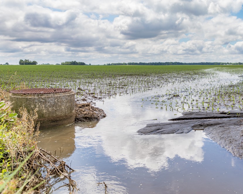
To say that it has been a wet week throughout the central US would be a severe understatement. A large area of the nation stretching from the Upper Plains into the Midwest and down into the southcentral states has been waterlogged over the last few days. The persistent rain brought about numerous flash flooding events, necessitating several severe weather warnings.
Many major US cities have been under the gun over the last week, including Kansas City, Omaha, Detroit, and Chicago. Oklahoma City has been particularly wet over the last few days. The city has seen approximately six inches of rain just since June 26. This measurement compares to less than five inches of rain on average for the whole month of June.
Some of these cities were still under flash flood watches in the overnight hours into Wednesday.
What is Next: While dry air is certainly on the way for the region, it may not arrive in earnest until the end of the week. The current frontal boundary is moving slowly to the east, bringing more rain and severe thunderstorms throughout the central and southern Plains and into the Ohio Valley through at least Wednesday and possibly Thursday.
The biggest threat of this moving system will be heavy downpours and the risk of flash flooding. Some areas may see localized strong winds as the front pushes through. The areas most likely to see flash flooding include Kansas and Oklahoma. This threat may extend as far northeast as Michigan throughout the next few days.
Because the grounds are already so saturated from the week’s previous rainfall, it will not take much additional precipitation to bring rivers and other waterways to the brink. According to the National Weather Service (NWS), the waterways most at risk of cresting in the next day or two include the Blackwater, Illinois, Missouri, Neosho, and Sangamon rivers.
Motorists also need to exercise caution on the roadways when heavy downpours are in the area. Even the shortest duration of heavy rain can cause water to pool on the roadways quickly, leading to a heightened risk of hydroplaning.
High pressure will begin to build over the central US during the middle of the week. This movement will push the frontal boundary farther to the south on Thursday and Friday. The current forecast indicates that the high pressure will set up and stay for a while across the central US leading into the holiday weekend. This is good news for these residents looking for relief from the rain and the chance to get outside and take part in the 4th of July festivities.
The area of the nation most likely to see wet conditions for the holiday is the Gulf Coast states. The East Coast may also experience rain over the long weekend.

January 21, 2024

January 19, 2024

January 18, 2024
