
Heavy Rain, Flooding, and Chance of Severe Weather Staring Down the Southern U.S.
January 22, 2024
Posted: January 10, 2022 1:33 pm


It was a wild week of weather for much of the U.S. with conditions ranging from major lake-effect snow events to deadly flash flooding to tornado outbreaks.
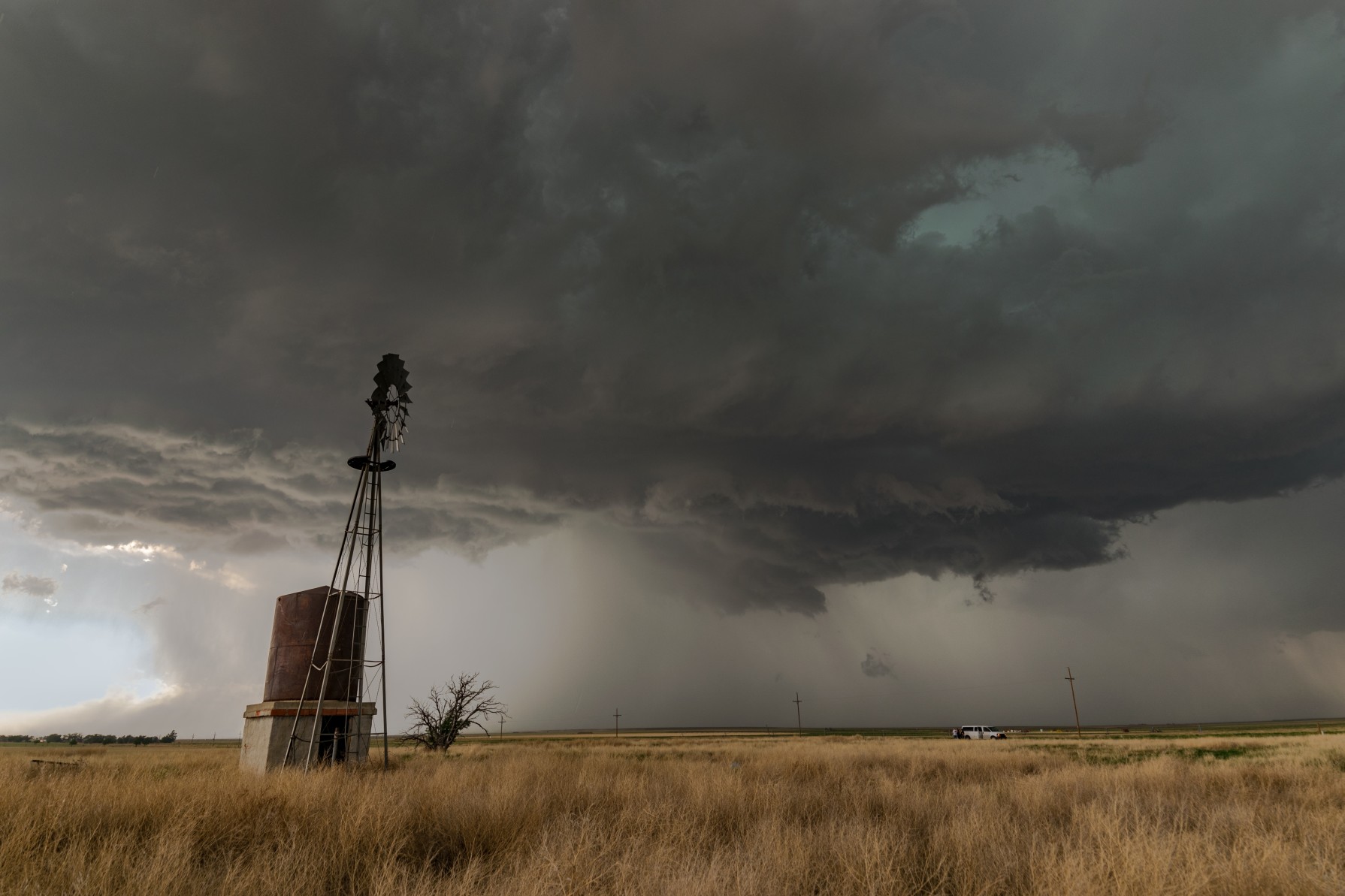
Texas and Louisiana were the target of a severe weather outbreak this weekend with strong winds and tornadoes grabbing the headlines. A cold front moved through the region on Saturday, merging with the warm and humid air coming up from the Gulf of Mexico. This clash of two competing systems triggered the development of severe thunderstorms throughout the region late Saturday and into Sunday.
There were five confirmed tornado touchdowns in Southwest Texas late Saturday. Included in the tally were two EF-1 twisters in Humble and Kingwood that damaged buildings and brought down power lines.
The Houston area was in the bullseye for multiple tornado warnings Saturday afternoon and evening. The busy George Bush International Airport was in the area of a tornado warning, disrupting operations and causing havoc for travelers.
In addition to the tornadoes, heavy rain and hail infiltrated parts of the Lonestar State to end the week. Hail the size of ping pong balls was reported near Nacogdoches, Texas with pea-sized hail falling in Huntsville. Residents in Montgomery County recorded hail the size of dimes Saturday evening.
Southeast Texas experienced heavy rainfall throughout the day Saturday and into Sunday. A flash flood warning was issued for both Liberty and Polk counties Sunday morning as rain deluged the area.
Houston Intercontinental Airport had measured 6.30 inches of rain starting during the middle of the day Saturday by Sunday morning. The counties that saw the highest amount of rain included Harris, Liberty, Hardin, Polk, and Tyler.
The severe weather in Texas eventually expanded to the east late Saturday and into Sunday. The National Weather Service (NWS) confirmed a twister on the ground near Evergreen, Alabama on Sunday evening.
Another Sunday tornado tore through a mobile home in rural Louisiana, injuring five people. This twister was part of a storm that damaged approximately 15 homes and multiple vehicles in Pearson.
The threat of severe weather is forecast to continue this week for the Gulf Coast. Atmospheric energy coming in from the Southwest will set the stage for an active weather pattern and plenty of rain for Texas and eastward through the end of the week.
Out west, heavy rain in Washington state claimed the life of a 72-year-old when his car was swept away by rising floodwaters. Several roadways across the Pacific Northwest were closed on Friday as a result of the flash flooding. In addition, some parts of the Skokomish River Valley in Mason County were evacuated as the river rose above its banks.
A 20-mile stretch of Interstate 5 was closed in both directions in Washington as the Chehalis River flooded and spilled out onto the busy stretch of highway that connects Seattle with Portland. In addition to the heavy rain, rapidly melting snow from earlier in the week were the culprits of the flooding.
Oregon also experienced flooding as the moisture-rich weather system pounded this corner of the U.S. The Oregon Department of Transportation reported a collapse on OR 47 in Mist on Friday. Interstate 84 was also flooded in some parts of the state.
Through January 9, Portland has already measured 80% of its average rainfall for the month of January.
While it has been rain and flooding causing issues for the Gulf Coast and the Pacific Northeast, the lake-effect snow machine has been the story for the Northeast. Heavy bands of lake-effect snow pounded western New York to close out the week. The record-breaking snowfall delivered whiteout conditions, creating a mess as residents tried to get back to work.
Over 17 inches of snow fell in Buffalo on Thursday, shattering the previous record for that date of 7.3 inches set in 1974. Poor visibility and wind gusts of up to 30 mph made travel treacherous for much of the city and beyond.
Prior to this snow event, Buffalo had been in a snow drought. The city had only received 36% of its average snowfall from the beginning of November through January 5 with just 13.6 inches of accumulation compared to the average of 37.7 inches. With last week’s massive lake-effect snow, the city is now sitting at a total of 31.5 inches for this time period.
Buffalo was not the only city to get in on the heavy lake-effect snow. Marquette, Michigan also experienced strong bands of the white stuff, measuring over 15 inches of accumulation on Wednesday with another 8.8 inches added to the total on Thursday.
The Lower Peninsula of Michigan was positioned in the epicenter of last week’s snow event. Gusty winds paired with the rapidly falling snow to produce whiteout conditions and drifting snow.
Another mass of Arctic air is in position to move over the Great Lakes and instigate more lake-effect snow to start the week. Residents should be prepared for slippery roads, ice, and bitterly cold air to kick off the second week of January.

January 21, 2024

January 19, 2024

January 18, 2024
