
Heavy Rain, Flooding, and Chance of Severe Weather Staring Down the Southern U.S.
January 22, 2024
Posted: August 10, 2022 1:18 pm


The oppressive heat that has been in place over the Southeast may be coming to an end soon, however, the relief will come at the cost of wetter conditions. It may be a wet few days for much of the Interstate 10 corridor as a front brings in the chance of heavy downpours, severe storms, and the potential of flash flooding.
Cooler air temperatures and lower humidity levels are forecast to move into Georgia, Tennessee, the Carolinas, and the northern tier of Alabama and Mississippi by the end of the week. Temperatures may fall as much as 10 degrees below average for some areas.
For example, after dealing with high readings in the lower 90s with soaring humidity levels, Atlanta is not forecast to climb out of the mid-80s for the rest of the week. These cooler readings will likely hang around through the weekend, making it a good time to get some outdoor chores done.
The readings in the 80s will be well off the normal high of about 90 degrees for this time of the year in Atlanta. The city will also enjoy lower humidity levels that will help to keep the overnight lows suppressed. Some pockets of the area will see the lows drop into the 60s after the sun sets.
It will also be noticeably cooler in cities such as Charlotte and Norfolk. Rather than seeing highs in the 90s with overnight lows in the 70s, these areas will see the mercury top out in the 80s with lows plummeting into the 60s. The humidity will also drop in this region, bringing the real feel readings down along with it.
It may feel as if fall is in the air across the southern Appalachians. Daytime highs will struggle to get out of the 70s in some areas. Morgantown, West Virginia is not forecast to break the 80-degree mark on Friday. It will only get up into the upper 70s on Thursday for places such as Asheville, North Carolina. The overnight lows are forecast to drop into the upper 50s on Friday and Saturday in Asheville.

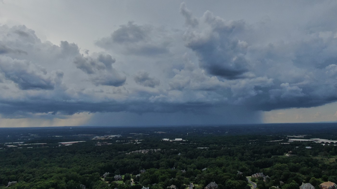
Along with the cooler temperatures, much of the southeastern corner of the U.S. will also see rain and thunderstorms along the leading edge of the cool air mass. This is the same front that is causing heavy rain to fall throughout the Ohio and Tennessee valleys over the last few days. The slow-moving front will arrive in the Southeast by Wednesday, ushering in a good amount of moisture.
Storms are forecast to pop up throughout the Interstate 50 and 85 zones on Wednesday and farther south along the Interstate 20 and 10 corridors on Thursday and Friday. These storm cells could bring damaging winds and torrential rain that may reduce visibility to near zero.
It is a good idea to check the hourly forecast before heading out for a long road trip. Air travel may also be impacted at some of the nation’s biggest airports, including the busy hub of Atlanta. The weather could spell trouble for an industry already struggling to meet passenger demand this summer.
While most of the thunderstorms are forecast to ignite during the afternoon and evening hours, there is always the chance of a late night or early morning storm. Be sure to enable all smartphone notifications if you go to sleep with bad weather in your area.
The cool front will stall once again this weekend when it reaches the Gulf Coast and the coastal areas along the southern Atlantic. This could translate to a dreary weekend at some of the nation’s most popular beaches this time of the year. The pervasive rain could mean a washout for those hoping to catch a few days at the beach before school starts up again.
The areas most likely to experience a soggy weekend include the zone stretching from the upper Texas coast into the southern tier of Mississippi, Louisiana, Alabama, Georgia, and the Florida Panhandle. Forecasters are predicting 1 – 3 inches of rain in this region with the potential of up to 6 inches in highly localized areas. This rain is expected to fall in the greatest amounts on Friday through Sunday.
The sagging front will also deliver a higher chance of heavy thunderstorms to much of the Sunshine State. Central and South Florida will be at risk of high storm activity throughout the weekend and into early next week. This could thwart plans to head to the beach or to the theme parks of Orlando.
A shift to the west in the Bermuda high over the Caribbean may also bring more rain to the Eastern Seaboard by next week. As this area of high pressure moves to the west toward the U.S., it could push any storm systems exiting the coast back inland. It is not unusual for weather systems to reverse and head back into the U.S. when the Bermuda high moves in this direction.
There is also an outside chance that a disturbance that is forming along the stalled front could develop tropical characteristics as it slides off the Atlantic coast. Forecasters at the National Hurricane Center (NHC) will continue to watch this area in the coming days.
Did you find this content useful? Feel free to bookmark or to post to your timeline for reference later.

January 21, 2024

January 19, 2024

January 18, 2024
