
Heavy Rain, Flooding, and Chance of Severe Weather Staring Down the Southern U.S.
January 22, 2024
Posted: August 1, 2022 11:20 am


Brett Carlsen/Getty Images News via Getty Images
Saturated Soil Will Raise Risk of Flash Flooding in Tennessee Valley
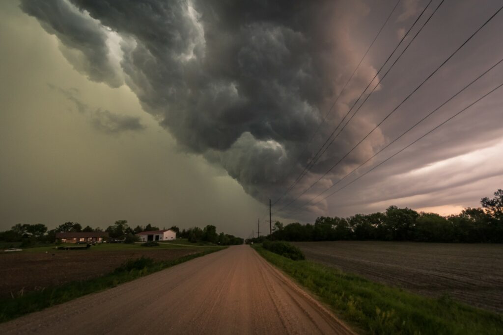
Although it has been a calm few days through much of the Midwest and the Great Lakes, a dramatic change is on the way with severe weather set to make an appearance to start the week. Forecasters are warning that there may be multiple days of stormy conditions on the way for the region as a storm system collides with a warm and moist air mass.
The biggest threats of this particular weather maker will be strong winds and hail. There will also be a risk of flash flooding if the rain comes down too quickly. Monday’s impact zone will stretch from the northeastern corner of Missouri into Ohio and to areas to the north toward the Canadian border.
Cities that may be under the gun for a messy afternoon commute include Indianapolis, Columbus, and Detroit. Although Detroit will wake up to partly cloudy skies, the storms are forecast to fire up later in the day. It will be the same case for places such as Indianapolis with calm conditions to start the work week.
Forecasters are predicting that the storms will stay to the south of the bulk of the Chicago metro area. However, you cannot rule out a stray storm drifting to the north into the south suburbs.
The storms will continue to track to the southeast as the day progresses, bringing a chance of dangerous overnight storms to areas such as Cincinnati and Cleveland. This threat of severe weather may dip as far south as Kentucky.
More severe weather is in the cards for the Upper Midwest on Tuesday to coincide with the return of the heat to the area. Cities in Tuesday’s impact zone include Minneapolis and Sioux Falls. This line of storms will bring the possibility of hail, strong winds, and isolated tornadoes. The powerful jet stream action riding along with these storms may provide enough wind shear for a tornado to spin up.
By Wednesday, the biggest threat of storms will be positioned farther to the east. This threat will include major cities such as Chicago, Milwaukee, Detroit, and Des Moines.
Unfortunately for the water-logged Tennessee Valley, there is more rain in the forecast through Monday. The steady rain and storms will pop up in an area stretching through parts of Tennessee, West Virginia, Virginia, and North Carolina.
Because the grounds are already so saturated in this part of the nation, it will not take a lot of rain for more flooding to occur. Soil that is already past the point of saturation may have a difficult time taking in more moisture, triggering flooding across low-lying areas and near streams and secondary rivers.
Cities that are at the highest risk of flooding this week include Nashville and Knoxville, Tennessee. The flooding risk may spread as far east as Roanoke, Virginia and as far south as Winston-Salem, North Carolina.
The rain may also continue to fall in the same part of eastern Kentucky that experienced a deadly flooding event last week. At least 26 people have been confirmed dead as a result of the flash flooding that happened in the overnight hours of Wednesday into Thursday.
The only silver lining of this round of storms is that it may bring relief to the drought-stricken Southeast. The fact that the soil is also holding a good amount of moisture will also help to keep the temperatures suppressed in the coming days. This is because moist soil does not hold heat as much as dry soil, keeping temperatures at a reasonable level heading into the last full month of summer.
Did you find this content useful? Feel free to bookmark or to post to your timeline for reference later.

January 21, 2024

January 19, 2024

January 18, 2024
