
Heavy Rain, Flooding, and Chance of Severe Weather Staring Down the Southern U.S.
January 22, 2024
Posted: September 24, 2022 9:49 am


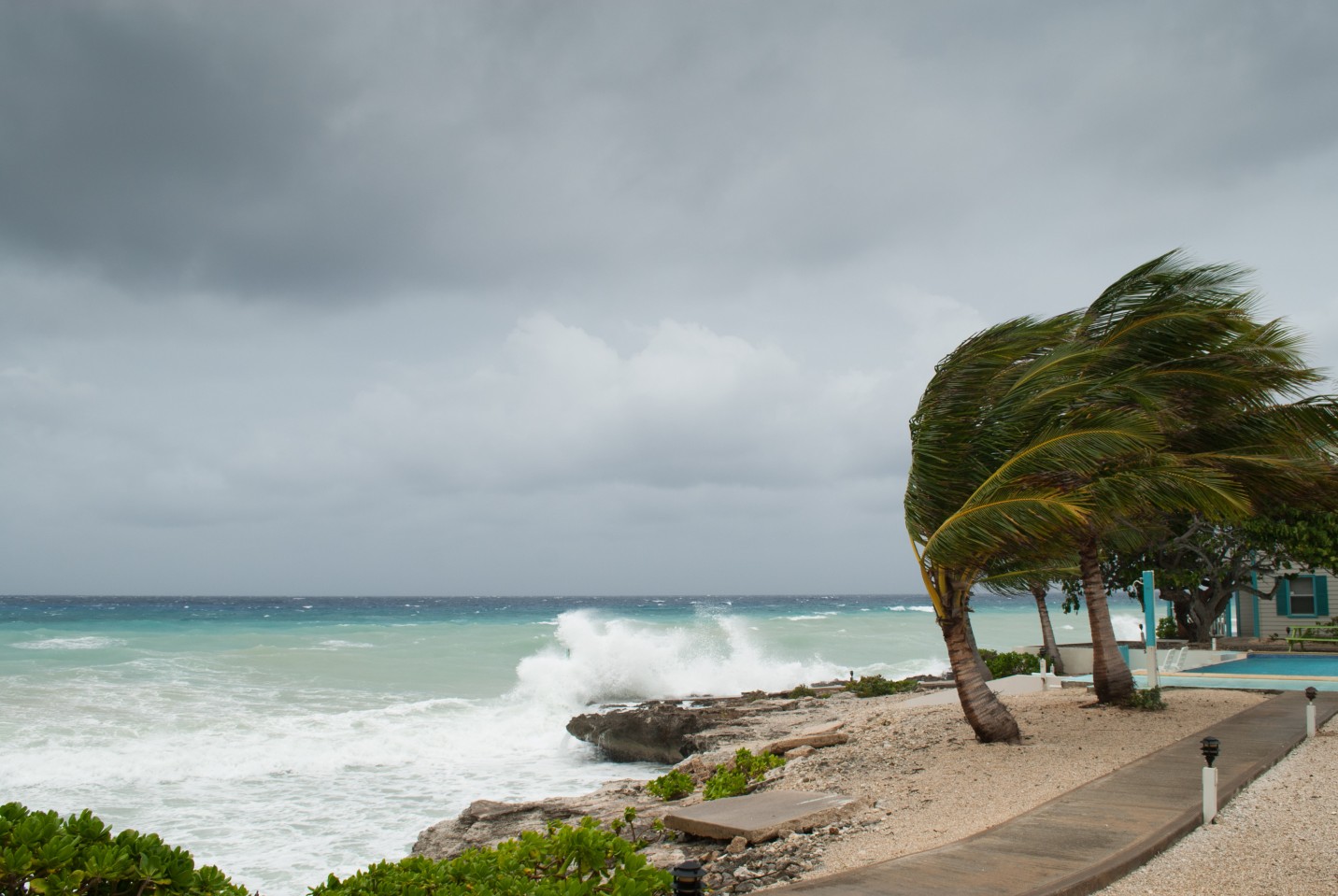
Just as Hurricane Fiona unleashes across Atlantic Canada, hurricane watchers are looking back toward the Caribbean for a potential new threat. Tropical Storm Ian officially formed on Friday over the central Caribbean with forecasters warning that the storm could threaten Florida by the middle of next week.
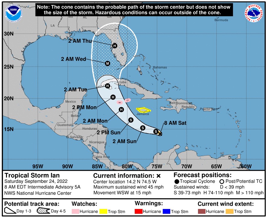
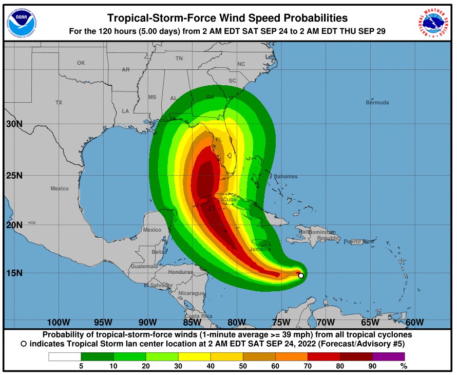
As of early Saturday, Tropical Storm Ian was moving to the west and northwest at a speed of 14 mph with sustained winds of 45 mph. As it moved through the Caribbean, the depression was meeting up with significant amounts of wind shear that was hindering its development. However, forecasters with the National Hurricane Center (NHC) are warning that the storm will likely intensify quickly in the coming days as it moves to the north into warmer waters and away from the wind shear. These factors will set up the feature for the strong possibility of rapid intensification.
The storm is expected to take a northerly journey, meaning that it will not likely hit Texas or the U.S. Gulf Coast. Instead, the storm is projected to move farther to the east, sending it closer to Florida. It is still uncertain what parts of the Florida Peninsula are most likely to take a direct hit.
The storm will move to the north thanks to an area of high pressure over the central Atlantic Ocean. This mass is expected to split in two and allow the jet stream to dip to the south, moving the system to the north in the process. How quickly this happens will influence the path of the tropical feature. This weather pattern will also determine if this storm is able to move closer to the East Coast after potentially hitting Florida.
.
Although the storm’s path will likely take it over the western and central portions of Cuba, the flatter terrain across this part of the island will mean that it will not slow the storm’s speed or intensification to a great degree. Instead, the storm will find extremely warm waters in the Gulf of Mexico or Florida Straits.
Water temperatures in this part of the region are nearing 90 degrees in some places, a factor that could trigger another round of rapid intensification.
While it is still too early to predict where the storm will make its next landfall, forecasters are warning all Floridians to prepare for impacts beginning Tuesday and lasting through Thursday of next week. Areas in the Caribbean that are in the potential line of fire include Jamaica, the Cayman Islands, and western and central Cuba. These areas will begin to see the impacts as early as late Saturday through early Monday.
The NHC is forecasting that the system could hit the western portion of Cuba as a Category 2 hurricane or higher. The storm will bring a great likelihood of widespread power outages and heavy rain.
The heaviest of the rains across the Caribbean are forecast for southwestern Jamaica and western Cuba. For instance, the hardest-hit areas of Cuba are predicted to see 8 – 16 inches of rain out of this intense weather maker.
Although the 2022 Atlantic hurricane season got off to a slow start, the activity is certainly picking up over the last few weeks. As always, your best line of defense is to stay abreast of developing conditions so that you can take the appropriate actions.
Did you find this content useful? Feel free to bookmark or to post to your timeline for reference later.

January 21, 2024

January 19, 2024

January 18, 2024
