
Heavy Rain, Flooding, and Chance of Severe Weather Staring Down the Southern U.S.
January 22, 2024
Posted: October 9, 2021 2:57 am


Second System Could Deliver Even More Severe Weather
While the weekend may start as tranquil and pleasant throughout much of the south-central US, this calm weather pattern is forecast to come to a halt by the end of Sunday.
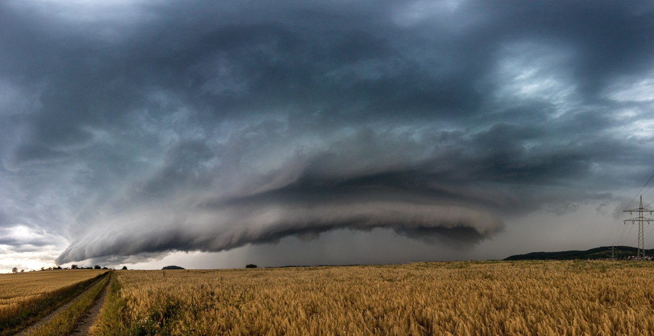
An active weather pattern at the hands of a disturbance in the atmosphere above the West Coast will track to the east through the weekend, triggering the development of a potentially powerful storm system across the south-central portion of the US. Because the month of October has been so unseasonably warm for this part of the country, it is more likely that it will see potent storms more reminiscent of spring than fall as this system pushes through.
The reason for the storm development is being attributed to the meeting of the cool air coming down from the Rocky Mountains with the warm and moist air coming up from the Gulf of Mexico. As the two forces meet in the middle, the area surrounding it will be ripe for the potential of severe weather.
While meteorologists are relatively certain that severe weather will be a possibility to close out the weekend, the exact timing and location are still a bit unclear. The most likely scenario shows the storms exploding late in the day Sunday. The storms will continue to move to the east in the overnight hours with some areas still seeing severe weather during the early hours on Monday.
The region most likely to experience severe weather includes the southeast corner of Kansas, northeastern Texas, eastern Oklahoma, and western Arkansas. This includes the major population centers of Tulsa, Oklahoma City, and Dallas. Forecasters are warning that the storms may ignite quickly, necessitating that travelers be aware of the rapidly changing conditions.
This will be no ordinary fall storm system. In addition to heavy rain and flash flooding potential, the system may also produce strong wind gusts, hail, and isolated tornadoes. In addition, meteorologists are concerned that the worst of the storms may occur during the overnight hours when people are sleeping. Not only will many people not be aware of the developing storms because they are asleep, but the risk associated with these storms is more pronounced during the dark hours of the night. For example, it is harder to spot downed power lines and trees when driving in the darkness.
Although the bulk of the severe weather is forecast to quiet down before dawn on Monday, it will not be a long break from the potential of storms. Monday is shaping up to be a pleasant day in the south-central US, however, another storm system is forecast to possibly move into the Plains states starting on Tuesday. This second round of action could deliver more widespread impacts than the first system. In addition, any potential cleanup efforts due to Sunday’s action may be hampered by the arrival of even more severe weather.
Some residents may be caught off guard during the fall storm pattern. Although the spring season generally delivers a greater number of storm events than any other time of the year, the shoulder season of fall also provides the necessary ingredients needed for severe weather development. This is particularly true for the southern half of the US.

January 21, 2024

January 19, 2024

January 18, 2024
