
Heavy Rain, Flooding, and Chance of Severe Weather Staring Down the Southern U.S.
January 22, 2024
Posted: December 17, 2021 12:06 pm


It felt nothing like the middle of December for much of the central US on Wednesday as a series of dramatic atmospheric changes roared through the region. At least one death was blamed on the complex weather system after a semi-truck driver lost his life when winds knocked over his rig in Iowa.
By the middle of the day Thursday, there were still about 600,000 customers without power after hurricane-force winds ripped through the region. These outages are scattered throughout the Upper Midwest and the Great Lakes areas. Some wind gusts topped over 100 mph on Wednesday.
Dust storms whipped around all over western Kansas and beyond, forcing the closures of schools and prompting officials to tell residents to stay home. Five states recorded wind gusts of up to 107 mph throughout the day with the worst of it happening in the late afternoon and early evening hours.
The winds tipped over semi-trucks throughout many of the nation’s busy interstates. Wind gusts of over 70 mph on Interstate 80 were particularly problematic.
While there has been no official confirmation, meteorologists are relatively certain that a rare derecho formed as a result of the unusual conditions. According to the National Weather Service (NWS) Storm Prediction Center (SPC), the storm trekked over 650 miles for more than 10 hours. A derecho is defined as a storm that sweeps through an area over 240 miles with wind gusts measuring at least 58 mph.
The date was a record-breaker with 55 reports of hurricane-force wind gusts throughout the affected states. Hurricane-force winds are those that are at least 75 mph. The previous record of 53 reports was set on August 10, 2020.
Some of the most notable reports of destruction at the hands of the wind were a damaged aircraft parked at the Santa Fe airport in New Mexico and a roof partially torn off of a fire station in Colorado Springs.
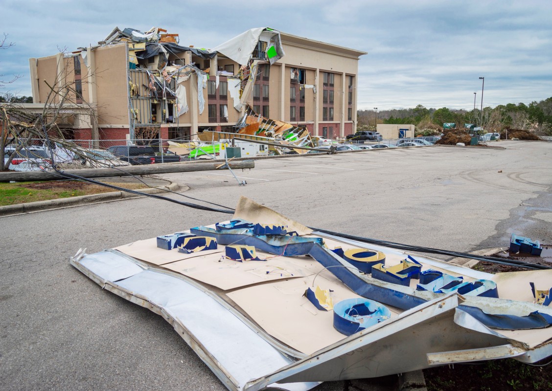
In addition, there were also reports of at least 20 confirmed tornados that spun out of this intense weather maker.
A number of record-high temperatures fueled the development of the storms. For example, Des Moines, Iowa, set a new daily high-temperature record when the mercury rose well into the 70s. While the temperatures were unseasonably warm to start the day, the arrival of the storms caused the mercury to plummet.
As a result of the unstable weather, multiple tornado watches were issued in a large swath of land stretching from the northeastern corner of Kansas into southern Minnesota. While tornados are the norm for the spring season, residents were taken off guard by the potential of this weather in December.
The town of Hartland in Minnesota reported a possible twister. Located approximately 100 miles south of Minneapolis, the town is reporting significant damage after the storm blew through. If a tornado is confirmed, it will be the first time a twister hit the state in the month of December.
The massive storm system also triggered large hail in many areas. The town of Emporia in central Kansas reported softball-size hail.
Cooler and calmer conditions are now settling into the region, allowing residents to begin the clean-up process.

January 21, 2024

January 19, 2024

January 18, 2024
