
Heavy Rain, Flooding, and Chance of Severe Weather Staring Down the Southern U.S.
January 22, 2024
Posted: July 21, 2021 2:35 am


All is Calm in the Atlantic Basin with a Different Story in the Pacific
Following the onslaught of Hurricane Elsa, the Atlantic basin has been generally quiet over the last few weeks. This was followed by a burst of tropical activity in the Eastern Pacific with the formation of Hurricane Felicia out in the open waters. The hub of tropical activity this week is out in the Western Pacific. Here is a recap of what is happening now in the ocean waters around the world.
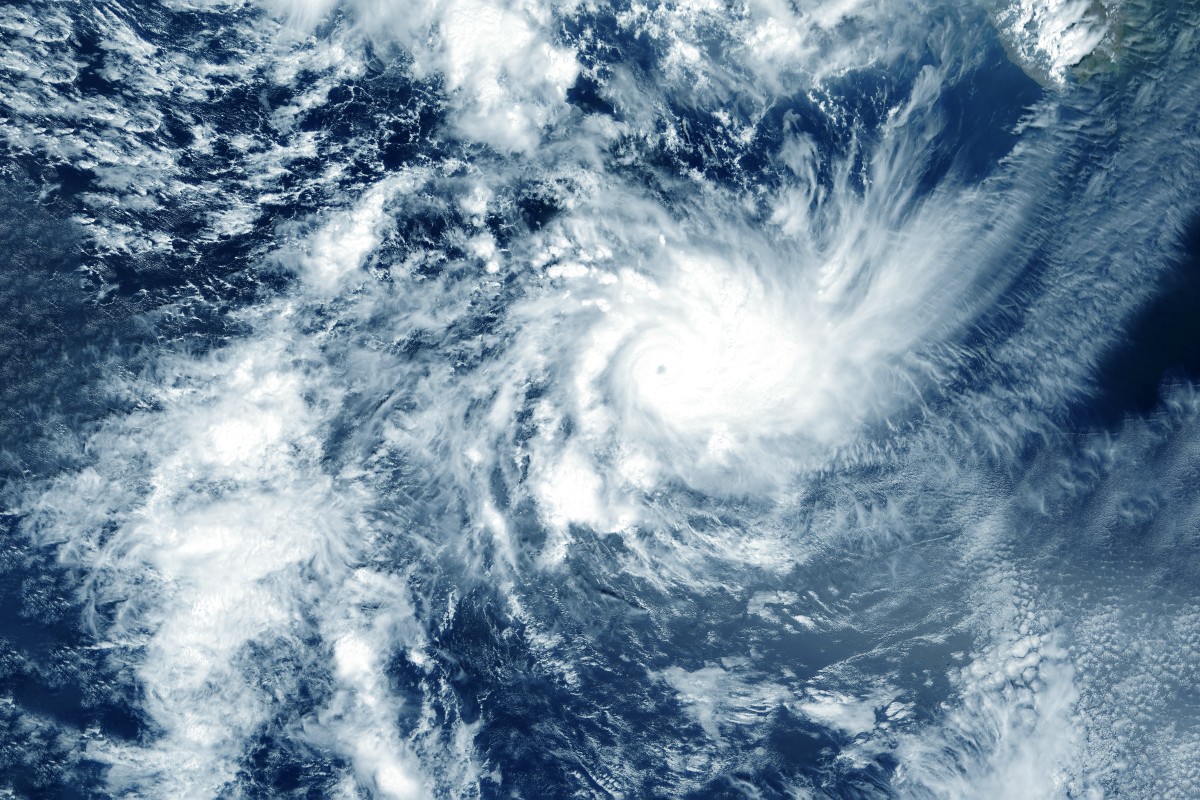
The Western Pacific is seeing the bulk of the tropical activity this week. Multiple tropical events are on tap this week in this corner of the world. Typhoon In-fa got its start as a tropical depression last Friday. The storm intensified rapidly, reaching tropical storm status by Sunday morning. The system reached the designation of a typhoon on Tuesday night local time.
As of Tuesday night, In-fa was moving to the west at a speed of 9 mph as it whipped up waters in the western Philippine Sea. Storms of this magnitude in the Western Pacific are referred to as typhoons. However, the sustained wind speeds of In-fa would put it at a Category 1 hurricane when using the Saffir-Simpson Hurricane Wind Scale.
In-fa is forecast to continue its trek to the west-northwest, impacting parts of Taiwan, China, and the Ryukyu Islands of Japan. The Ryukyu Islands may start to see the effects of In-fa as early as Wednesday morning. Taiwan will likely begin to encounter the outer bands of In-fa by Thursday evening.
The storm is expected to gain intensity as it approaches the Ryukyu Islands, packing winds that are equivalent to a Category 2 hurricane of up to 109 mph. While moderate wind shear in the region will likely keep In-fa from turning into a monster storm, there is still a small chance that the storm will reach wind speeds equivalent to a Category 3 hurricane for a brief time before it weakens again.
The heavy rains and strong winds associated with In-fa will begin to impact Taiwan by Thursday with China seeing the effects by Friday. Depending on any potential wobbles, Taiwan may be spared the worst of the storm. As of Tuesday’s latest models, In-fa is projected to skirt the northern coast of Taiwan sometime late in the day Friday.
This forecast puts In-fa on track to make landfall along the coast of eastern China on Saturday.
In-fa will pack its strongest winds to the east of the center of the storm. This means that the Okinawa Prefecture will be in line to see some of the strongest winds as well as the heaviest rainfall. Wind gusts of up to 120 mph may impact the city of Okinawa. Rainfall amounts up to 18 inches may also torment this region of Japan.
Forecasters are warning that some parts of Japan, China, and Taiwan will see the potential of flash flooding, mudslides, and power outages.
In-fa comes in as the third tropical feature to reach typhoon status in the Western Pacific this year. Typhoon Surigae brought heavy rains in April while Typhoon Champi formed in late June.
In addition to Typhoon In-fa, another tropical storm is moving through the South China Sea. Tropical Storm Cempaka is crawling along at a slow speed, just skirting the coast of China’s Guangdong province. While forecasters expect Cempaka to lose wind intensity as it continues to track closer to land over the next day or two, the heavy rainfall associated with this system will continue to present problems for the western Guangdong province and through the Guangxi province. Because Cempaka is moving at such a slow speed, it will result in a high chance of flash floods and mudslides.
While In-fa is expected to stay well south of the Japanese mainland, another development in the Western Pacific is sending up red flags to organizers of the upcoming Summer Olympic Games in Tokyo. An additional area of concern is expected to develop later this week with the potential of moving toward Tokyo as the games kick off officially on Friday.
After reaching the status of a Category 4 storm, Hurricane Felicia weakened to a tropical storm as it continues to dissipate out in the Pacific Ocean. Felicia carries the distinction of being the strongest storm so far this year in the Eastern Pacific. Tropical Depression Guillermo is following behind Felicia. Neither of these storms are threatening any major landmasses.
Both features are expected to continue to weaken over the next few days. Tropical Storm Felicia is expected to move into the jurisdiction of the Central Pacific by Wednesday. As of Tuesday, there are no other tropical events to note in the Eastern Pacific.
All is quiet in the Atlantic basin. According to the National Hurricane Center (NHC), there are no new tropical cyclones expected in the next five days. This is common for July when the waters generally calm down before firing back up again in August and September just in time for the peak of hurricane season. There has already been more tropical activity in 2021 than there was during the record-breaking 2020 hurricane season.

January 21, 2024

January 19, 2024

January 18, 2024
