
Heavy Rain, Flooding, and Chance of Severe Weather Staring Down the Southern U.S.
January 22, 2024
Posted: April 6, 2023 10:43 am


Now is the time to start thinking about the upcoming Atlantic hurricane season. Officially kicking off on June 1, forecasters are now beginning to hone in on their predictions for 2023.
Looking back at 2022, the season delivered an average number of named storms with 14 in the Atlantic basin. This number was significantly lower than what 2020 and 2021 produced, however, there were a few exceptionally deadly and destructive storms in hurricanes Fiona and Ian.
What does the 2023 season have in store for this corner of the Atlantic? Forecasters are predicting that the season will be less active than what the last several years have brought, coming in at about 11 – 15 named storms. Approximately four to eight of these storms are predicted to hit hurricane strength with one to three of these reaching the threshold of a Category 3 storm or higher, classifying them as major hurricanes.
The experts are also forecasting that the U.S. will take up to four direct hits. A typical season produces 14 named storms, including seven hurricanes, three hurricanes at Category 3 or higher, and four hits to the U.S.
There are a variety of environmental factors that influence the severity of a tropical weather season. For instance, the arrival of an El Niño pattern replacing the La Niña phase of the last few years will influence the sea surface temperatures in the Atlantic. This transition will also change the wind patterns over Africa that can influence the developments of tropical waves coming off of the continent and moving across the Atlantic toward the Caribbean and the U.S.
During a typical El Niño phase, winds swirling at the top levels of the atmosphere move to the south toward the equator with greater frequency. This translates to an increase in vertical wind shear, breaking up the development of tropical features as they try to gain strength.
This is in opposition to the La Niña phase in which this wind shear is not as widespread across the tropics. Less wind shear gives tropical systems more room to breathe and intensify. As such, the basin typically sees more named storms during a La Niña phase when compared to an El Niño pattern.
The National Oceanic and Atmospheric Administration (NOAA) Climate Prediction Center (CPC) officially declared the end of the La Niña in early March. This pattern had been in place for three hurricane seasons, resulting in the record-breaking number of named storms during this time period.
The CPC now believes that a neutral phase is in effect, meaning that sea surface temperatures in the equatorial East Pacific are trending right about average. Experts are predicting that these waters will begin to warm above what is considered to be average, ushering in an El Niño phase by the end of the summer. Whether or not this forms prior to the end of hurricane season will likely determine the amount of wind shear present in the tropics.
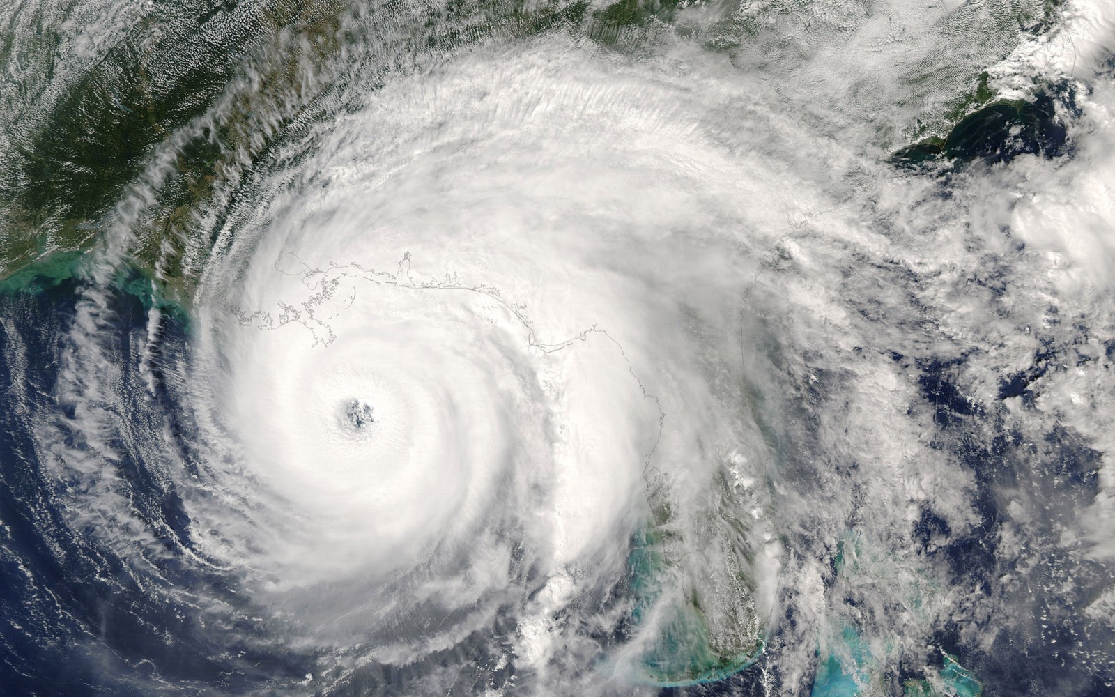
The big question is what parts of the U.S. will see the greatest risk of tropical development this year? During the years 2020 and 2021, it was the Gulf Coast that experienced the greatest amount of direct hits. This area received a reprieve in 2022 with Florida, Puerto Rico, and the Carolinas seeing the activity during this time period.
Florida will once again be in the crosshairs of the worst of the storms this upcoming season. The predicted arrival of the El Niño pattern starting in August will increase the risk to all of Florida and up the Carolina coast. Conversely, the western Gulf of Mexico and the Northeast will see a lower risk of strikes this year.
Forecasters use a variety of historical data points to predict what parts of the country will experience the highest activity. By looking at the years that saw the transition from La Niña to El Niño, experts can provide educated guesses regarding what the upcoming season will look like.
Hurricane watchers also pay close attention to the area of high pressure known in scientific circles as the Bermuda Azores high. The position of this high can alter where a storm tracks. For instance, a weak Bermuda Azores high generally pushes tropical activity away from the U.S. coastline. However, stronger highs move the storms closer to the U.S. By monitoring the development of this high, forecasters can predict the odds that the U.S. experiences a direct hit.
While the official start of the season is not until June 1, activity firing up prior to this date has been increasingly more common over the last 10 years. Experts are predicting a high chance for preseason tropical activity this year because of the exceptionally warm waters churning in the Gulf of Mexico. These above-average water temperatures have already produced a greater number of early season severe storms for the Gulf Coast and the south-central U.S.
Despite the other factors that may hinder tropical development this year, the warmer water temperatures in this part of the basin can power a greater number of storms, particularly early in the season. Climatologists warn that it just takes one intense storm to cause mass destruction and immense loss of life.
The 2022 season was distinguished by its high number of storms late in the season. An unusually high amount of tropical activity took place in November of 2022. Hurricane experts are not expecting a repeat of this late-season development in 2023 due to the anticipated arrival of the El Niño pattern.
Although the start of the hurricane season seems far down the road, it is never too early to begin to prepare for what may lie ahead. The impacts of climate change have created storms that tend to hold onto their strength for longer periods of time, impacting communities up to 100 miles from the nation’s coastline.
It is also important to note that tropical storms can also produce a great amount of damage, making it important that you are prepared for a myriad of conditions. Good steps to take now include organizing your hurricane preparedness kit, familiarizing yourself with your local hurricane evacuation routes, making a family communication plan, and reviewing your property insurance plans.
Did you find this content useful? Feel free to bookmark or to post to your timeline for reference later.

January 21, 2024

January 19, 2024

January 18, 2024
