Heavy Rain, Flooding, and Chance of Severe Weather Staring Down the Southern U.S.
January 22, 2024
Posted: August 16, 2022 2:44 pm


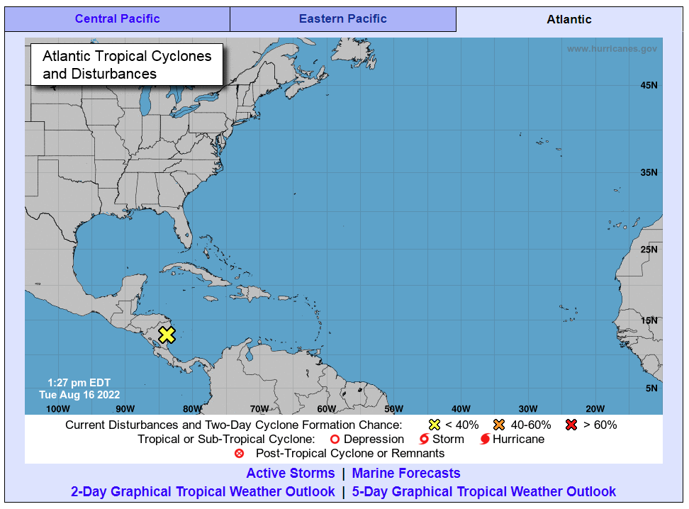
It has been a soggy few days for much of southern Texas on Monday thanks to a tropical rainstorm that barreled inland. While forecasters with the National Hurricane Center (NHC) had originally warned that the disturbance over the western Gulf of Mexico could turn into a named storm, it ended up simply developing into a tropical rainstorm.
The system began ramping up on Saturday, even developing pockets of convection in the northwestern corner of the Gulf. Despite not evolving into a named storm, the weather maker began delivering significant rainfall to the South Texas coast by late Saturday. The system is forecast to continue to dump rain through Wednesday in some areas as it moves farther inland to the north and the west. The rain may reach as far inland as Phoenix and Las Vegas by the time that it wraps up.
Meteorologists estimate that up to 10 inches of rain has already fallen in the hardest-hit areas over the last few days. For instance, an area to the southwest of Corpus Christi measured over 7 inches of rain while the Corpus Christi Airport saw over 6 inches of rain. Flour Bluff, Texas measured 9.13 inches of rain over a three-day period.
While the worst of the downpours ended by the middle of the day Monday along the South Texas coast, it was just getting started across the Rio Grande Valley. Forecasters are predicting that a large area of heavy rain will churn as the storm continues its movement to the northwest, creating between 4 – 8 inches of rain stretching from northern Mexico into southern Texas.

While the system will bring some strong winds, the biggest impact will be the drenching downpours. Flash flooding will be a concern, particularly in the higher terrain of Mexico that is susceptible to mudslides. The underdeveloped infrastructure in northern Mexico will also be threatened by the risk of flooding.
Although the rain may cause havoc in northern Mexico, the moisture will be beneficial for Texas. According to the U.S. Drought Monitor, 88% of the Lone Star State is under the designation of a severe drought. Additionally, over two-thirds of the state is under the classification of an extreme drought.
For example, South Texas has only seen about 10 – 20% of its normal rainfall in its coastal areas since the beginning of June. The border town of Laredo has only recorded 0.61 of an inch of rain since June 1. This compares to the average amount of nearly four inches.
The rain will move out of Texas by the middle of the week. A good portion of the moisture from the system will fall apart as it crosses the higher terrains of northern Mexico. However, there may be enough moisture left to drop meaningful rain into the southwestern corner of the U.S.
This rain will complement the usual moisture provided this time of the year by the North American monsoon season. As is typical for this part of the summer, the monsoonal weather pattern has brought plenty of rain to parts of Arizona, Nevada, Utah, Colorado, and New Mexico.
Las Vegas is currently dealing with its wettest monsoon season in the last decade. Torrential rain last week flooded the Las Vegas Strip and sent water rushing into some of the casinos.
The additional bit of moisture left from the tropical rainstorm could meet with the monsoonal weather pattern and trigger heavier downpours and severe storms during the afternoon hours for the Four Corners season. This rain may hang on through the weekend in some areas.
There will be an elevated risk of flash flooding because this part of the Southwest has already been hit with so much precipitation over the last several weeks. Cities that have seen rainfall amounts that are far greater than normal for August include Albuquerque, New Mexico and Yuma, Arizona.
South Texas and the Four Corners will not be the only areas of the U.S. dealing with a risk of flooding. A clash of two weather systems will put parts of the central U.S. at risk of severe weather over the next few days. The cool air positioned over the northeastern corner of the U.S. is in direct contrast to the hot and humid air over the southern Plains. It is the area between these two competing weather patterns that will be under the gun for stormy conditions beginning Tuesday and continuing through Wednesday.
It has not been an easy summer for the nation’s heartland. In addition to the multiple heat waves, the area has also experienced heavy rain and major flooding events. This week will bring a slow-moving weather maker that will create fertile conditions for thunderstorm activity, triggering the possibility of flash flooding.
It was the eastern portions of Colorado, Wyoming, and Nebraska that saw the severe weather over the weekend. This system is now moving through the Plains states and to the south. As it moves in a southward direction, it has been able to pull up moisture from the Gulf of Mexico to fuel these storms.
The highest chance of flooding will happen throughout South Dakota, Iowa, and Missouri. The eastern edge of Kansas, including the Kansas City area, may also be at risk of flooding as multiple rounds of storms fire up over the same areas over the next 48 hours. Other cities that may be at risk for heavy rainfall include Des Moines, St. Louis, and Sioux Falls.
Unfortunately, this round of moisture is not forecast to hit the regions of the southern Plains that are suffering from the ongoing drought the most.
Did you find this content useful? Feel free to bookmark or to post to your timeline for reference later.

January 21, 2024

January 19, 2024

January 18, 2024