
Heavy Rain, Flooding, and Chance of Severe Weather Staring Down the Southern U.S.
January 22, 2024
Posted: September 13, 2022 12:55 pm


Typhoon Muifa Could Complicate Cleanup Efforts from Typhoon Hinnamnor
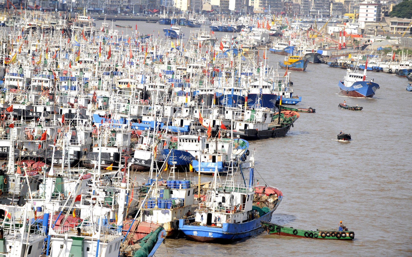
The largest city in China is bracing for a strike from Typhoon Muifa. The storm is the second typhoon over the last week to strike this part of the Pacific.
It is about to get messy in Shanghai, China as Typhoon Muifa nears closer. The typhoon first slammed into the Ryukyu Islands of Japan, only one week after Typhoon Hinnamnor hit the area. Here is what this region of the world can expect in the coming days from the latest tropical threat.
It has been extremely active in the West Pacific basin over the last several weeks. Typhoon Muifa is just another in a line of tropical systems that have put a number of populated land masses in the crosshairs of severe weather. Muifa developed last Thursday in the Philippine Sea before heading toward the Ryukyu Islands.
Governed by Japan, this chain of islands is positioned southwest of Kyushu, stretching to Taiwan. The island chain took the first blow from Muifa over the weekend, experiencing days of heavy rainfall. Some stations across the islands recorded almost one foot of rain in a period of just 48 hours, speaking to the magnitude of the moisture in this storm system.
The typhoon also brought damaging winds along with the torrential rain. The Yaeyama Islands in the Okinawa Prefecture measured winds of 90 mph at Iriomotejima Island. Nearby Ishigakijima Island recorded a gust of 89 mph that paired with 11.30 inches of rain. The wettest area was Hateruma, reporting in with over 14 inches of rain in only 24 hours.
The timing of Muifa’s arrival could not have been worse. This part of Japan was still cleaning up after Typhoon Hinnamnor battered the islands with heavy rain and gusty winds. Hinnamnor was distinguished as the strongest storm of its kind in this part of the world this season. The typhoon was particularly dangerous because of its slow speed, drenching the region with massive amounts of rain.
The immense moisture associated with Muifa also impacted parts of Taiwan over the weekend and into the start of the week. The small country saw over 23 inches of rain near New Taipei City from Saturday to Tuesday. The persistent rainfall triggered a New Taipei City river to overflow, sending people fleeing for safety.
The latest forecast shows that Muifa will start to pick up speed by Wednesday, moving to the northwest on a crash course with eastern China. The country’s largest city, Shanghai, is forecast to see about 3 – 6 inches of rain later in the week along with strong winds as the storm makes its way to the area.
The major port city needs to be ready for flooding issues with low-lying areas expected to see the greatest risk. The good news is that Muifa’s wind speeds are forecast to be less severe than what the region experienced with Hinnamnor. This is because Hinnamnor’s passage through the Pacific brought down the ocean water temperatures, limiting how quickly and strongly Muifa could intensify.
Unfortunately, Muifa still has the potential to unleash significant damage because of its slow speed. Like Hinnamnor, Muifa will strike the southern portions of the Ryukyu Islands. Winds are forecast to hit over 100 mph over this region, creating rough seas and some infrastructure damage. This danger will be especially high for parts of the islands that are already dealing with weakened structures at the hands of Typhoon Hinnamnor.
Did you find this content useful? Feel free to bookmark or to post to your timeline for reference later.

January 21, 2024

January 19, 2024

January 18, 2024
