Heavy Rain, Flooding, and Chance of Severe Weather Staring Down the Southern U.S.
January 22, 2024
Posted: October 12, 2022 11:07 am


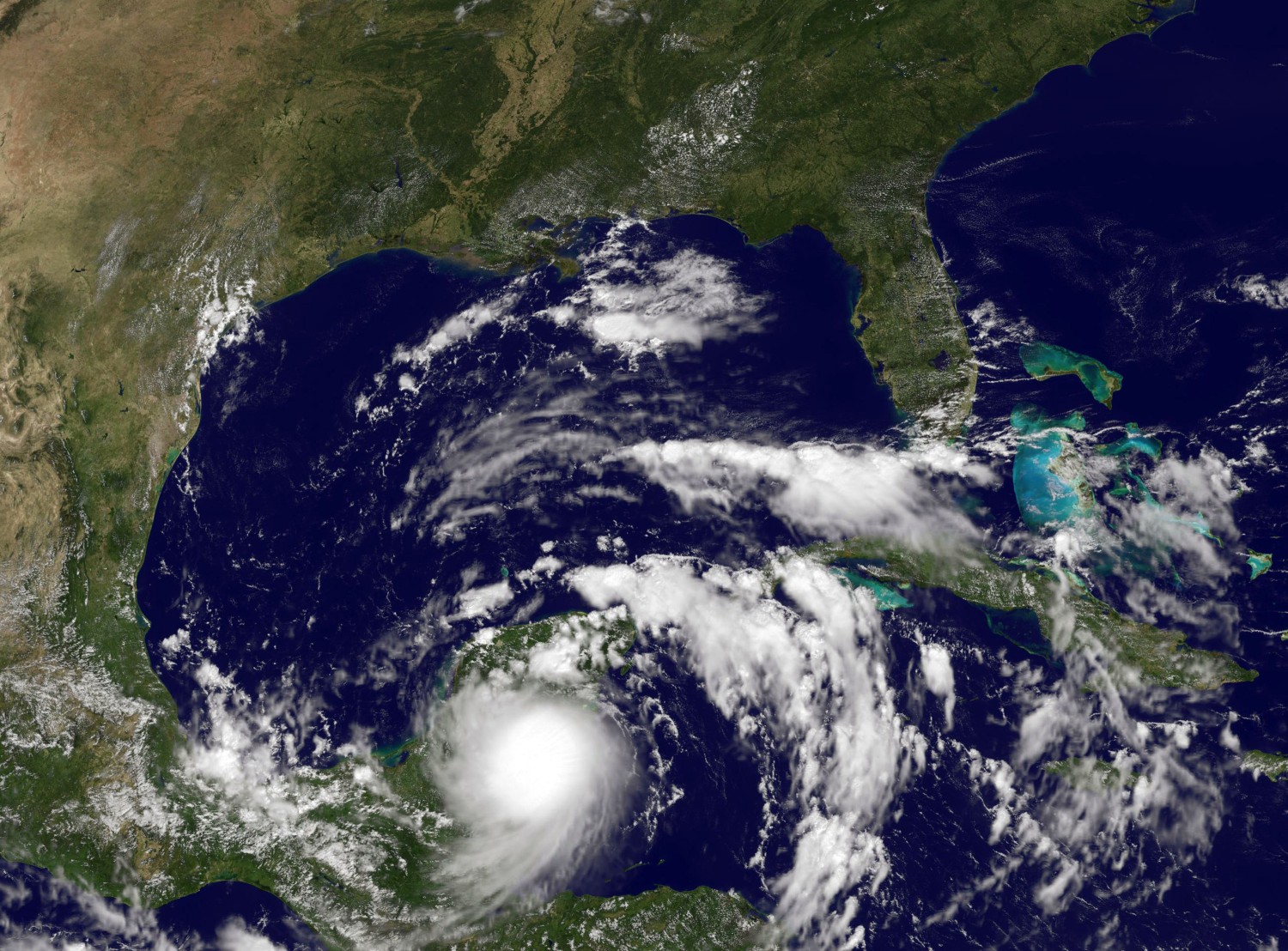
Just as forecasters have been predicting, the Gulf of Mexico is brimming with tropical activity these days. Tropical Storm Karl came to life Tuesday afternoon, forming at about 4 pm local time. Karl is distinguished as the 11th named storm of the 2022 Atlantic basin hurricane season.
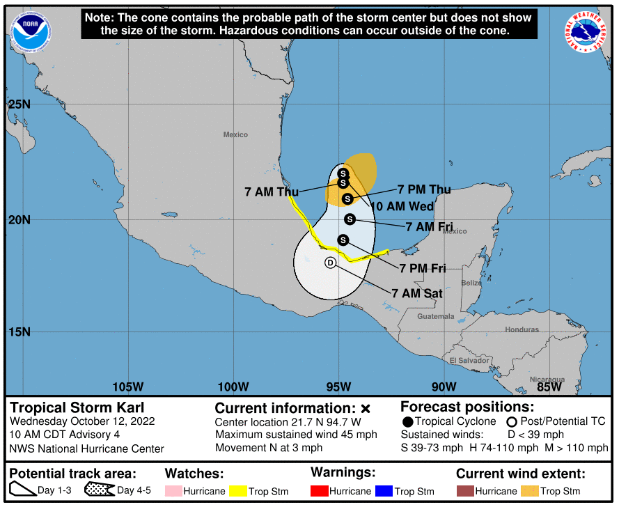
As of the time of its formation, the storm was located about 120 miles to the east-northeast of Veracruz, Mexico. Karl was packing maximum sustained winds of about 40 mph as it moved to the northwest at a slow speed of 6 mph. The tropical-storm-force winds extended out up to 115 miles.
A tropical storm watch has been issued for the coast of Mexico stretching from Cabo Rojo down to Puerto Veracruz. Tropical storm conditions are a possibility in this impact zone through Thursday afternoon.
The southwestern corner of the Gulf of Mexico is bursting with tropical moisture, helping to feed the formation and intensification of Karl. In addition, a zone of high pressure located to the top of the storm could help trigger more thunderstorms in the vicinity, providing the feature with plenty of fuel to continue to grow.

Surface water temperatures are also running into the 80s in the Gulf. While this will certainly help with further development, the water temperatures below the surface are trending in the lower 70s. This could mitigate the intensification later down the road, particularly if this cooler water comes to the surface as a result of upwelling.
The amount of wind shear in the area surrounding the storm is forecast to increase by the end of the week. Higher amounts of wind shear is typically associated with a storm’s weakening as it works to break up the strong circulation.
As such, forecasters with the National Hurricane Center (NHC) are predicting that Tropical Storm Karl will continue to intensify for a short period of time before quickly weakening when the wind shear and upwelling pair with the interaction with land to cut off its development.
However, even if it weakens as predicted, Karl will still have the ability to bring heavy rainfall to Veracruz and beyond. Up to 8 inches of rain is forecast to fall in this area through Mexico.
At this time, Karl is not expected to threaten the U.S., mostly because the storm is largely stationary. There is always the chance that steering breezes can pick up and bring the storm closer to American shores.
It is also possible that the storm could make a direct landfall on Mexico before it begins to weaken. This would bring a strong chance of damaging winds and flooding rainfall.
One thing that is certain is that Karl will churn up the seas across the southwestern Gulf of Mexico. These large swells could reach as far as the Texas coast by the end of the week, leading to strong rip currents.
Forecasters are also warning that any moisture left from Karl could move to the north through the weekend, leading to strong storms and persistent rain showers in an area stretching from southeastern Texas to Louisiana and up into Arkansas beginning on Sunday and lasting through Tuesday. This amount of rain could be enough to trigger localized flooding.
While this rain would be a nuisance, it would also be beneficial to an area that needs the moisture. According to the latest data from the U.S. Drought Monitor, much of the region is under a designation of abnormally dry to exceptional drought.
In addition to keeping an eye on the Gulf for new tropical development, weather experts are also watching the area of the north-central Atlantic and the Caribbean. This part of the Atlantic basin is known for its high amount of tropical activity heading into the tail end of hurricane season.
The official end of the Atlantic hurricane season is November 30.
Did you find this content useful? Feel free to bookmark or to post to your timeline for reference later.

January 21, 2024

January 19, 2024

January 18, 2024