
Heavy Rain, Flooding, and Chance of Severe Weather Staring Down the Southern U.S.
January 22, 2024
Posted: November 4, 2022 2:17 pm


Although what was once Hurricane Martin is not currently threatening any land as it churns in the northern Atlantic Ocean, the system is on a crash course to run into northwestern Europe later this weekend and into next week. Here is what you need to know about this major weather maker.
Hurricane Martin formed Wednesday in the Atlantic basin, becoming the seventh hurricane of the 2022 Atlantic season. Over the last few days, the feature gained size and intensity as it moved over the open waters of this part of the basin. While the storm has devolved into a post-tropical system, it is forecast to remain a force as it nears closer to the coast of Europe over the next few days.
It is not unusual for a storm with tropical characteristics to transition into a post-tropical system once it reaches the colder waters that inhabit this part of the Atlantic Ocean late in the season. In addition to finding much colder waters as it moved to the north, Martin also met up with a non-tropical system that was coming off the coast of eastern Canada. This merger killed Martin’s momentum and strength, weakening it in the process.
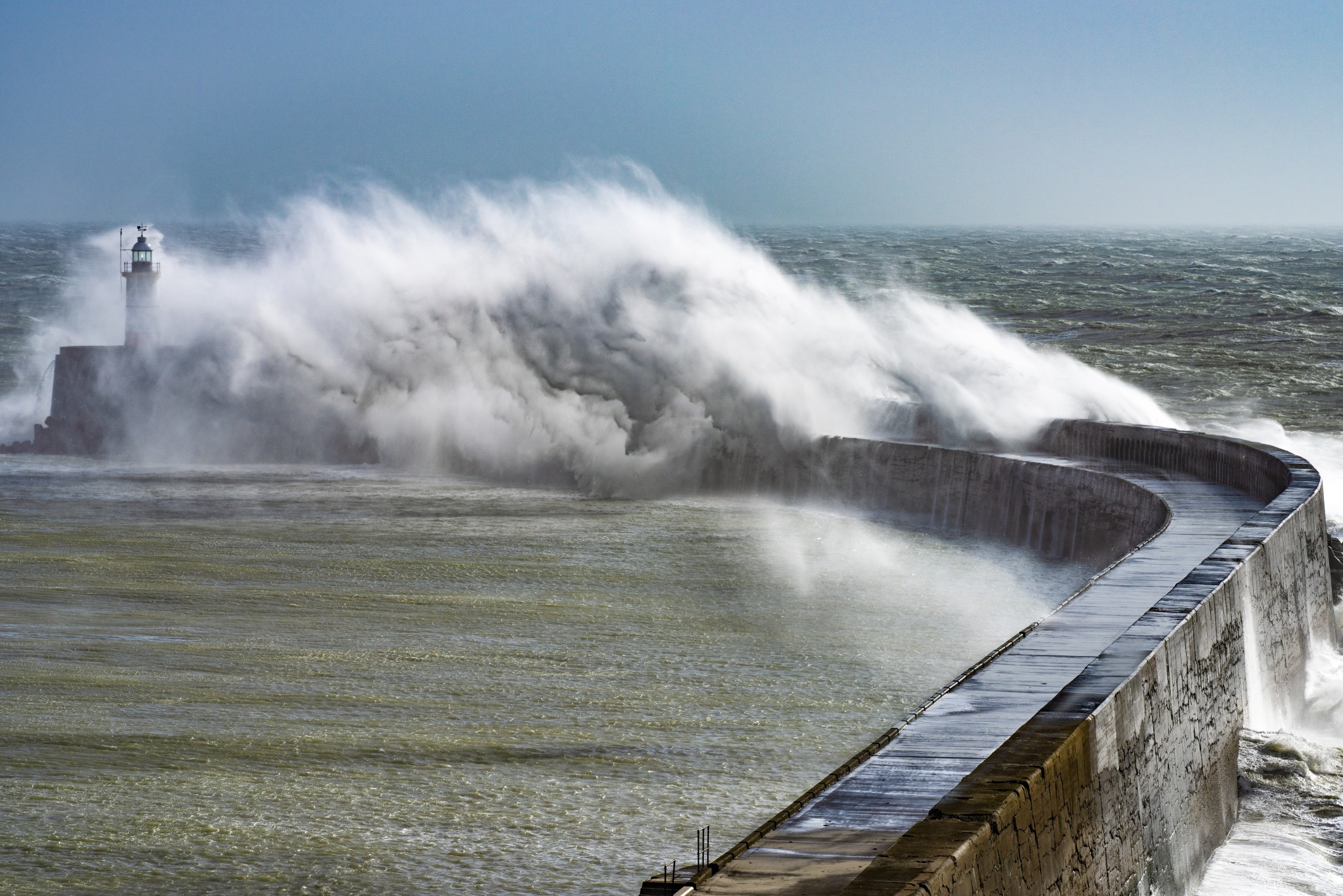
Martin is predicted to bring heavy rain and gusty winds to the northern tier of the United Kingdom and Ireland. Even though Martin does not carry any tropical characteristics at this time, it is still a powerful storm that will bring a number of significant impacts as it moves closer to Europe.
Ireland and the UK will be the first to feel the impacts of Martin beginning on Saturday. The system is forecast to eventually move into portions of Spain, Portugal, and France later in the weekend.
The presence of strong winds hovering in the upper atmosphere will allow Martin to grow in size. This will translate to the effects being felt over the course of a few days to a larger area of impact. For instance, the torrential rain and strong winds will hammer the western coastal areas of Ireland and across the northwestern corner of the UK through the weekend and into early next week. Rough seas, beach erosion, and some minor coastal flooding will also be an issue with this system.
The first round of impacts to the UK, Scotland, and Ireland will likely be in the form of rain. The wind is not expected to pick up into later Sunday and Monday. You can expect these blustery conditions to hang around until Tuesday morning.
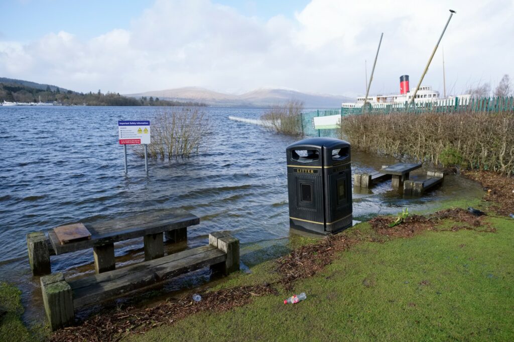
The worst of the weather will likely come along with the second and third rounds of the system. Residents need to be prepared for gale force winds of at least 39 mph or greater as well as the potential of flooding. There is also the possibility of hurricane-force winds, defined as 74 mph or greater, inflicting damage to this part of Europe on the tail end of the storm. Winds of this strength could cause minor infrastructure damage and bring down trees or power lines.
Portugal, Spain, and France will also be in the impact zone on Monday and Tuesday as the storm spreads to the south and the east. However, the impacts are predicted to be less severe in this part of Europe when compared to the UK.
Additionally, parts of the UK are still recovering from Storm Claudio, an intense weather maker that slammed into the central and southern portions of the country in recent days with flooding rainfall and strong winds.
Did you find this content useful? Feel free to bookmark or to post to your timeline for reference later.

January 21, 2024

January 19, 2024

January 18, 2024
