
Heavy Rain, Flooding, and Chance of Severe Weather Staring Down the Southern U.S.
January 22, 2024
Posted: November 11, 2022 10:44 am


Cool Temperatures Will Filter in Behind Nicole and Stick Around
After what is left of Hurricane Nicole gets done hammering Florida and the Southeast, it is forecast to take a path up into the interior Northeast by Friday and Saturday. This is going to translate to inclement weather for much of the Interstate 95 corridor over the next few days.
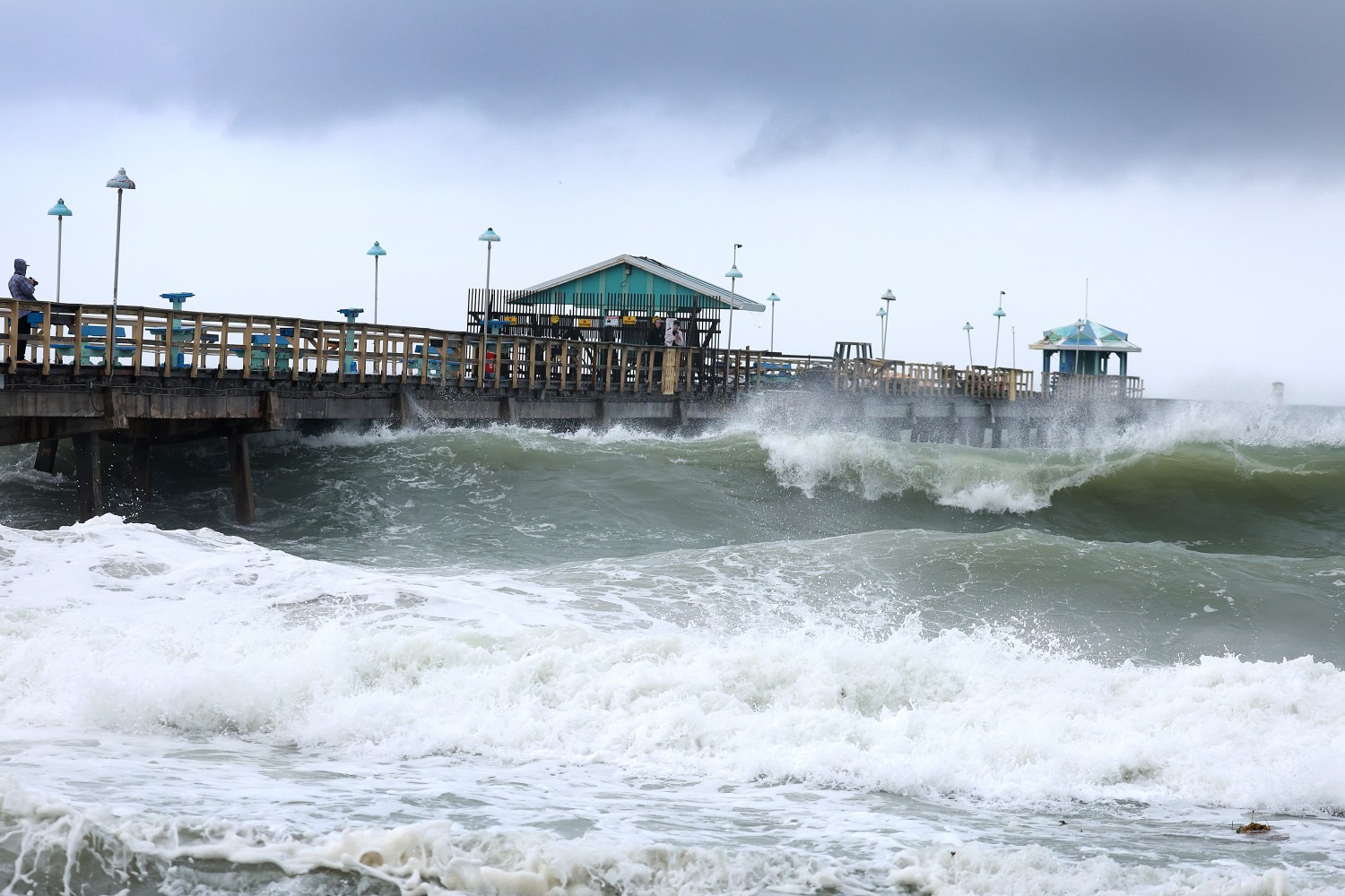
Nicole made landfall as a Category 1 hurricane near Vero Beach, Florida early Thursday morning. The storm is already being blamed for at least four deaths as it continues to set much of the East Coast in its sights. After moving across the Florida Peninsula, the storm took a northward jog that took it into the southeastern corner of the country.
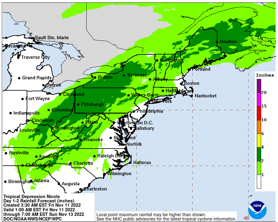
A large swath of the interior Northeast began to see the effects of Nicole by late Thursday. The rain is forecast to reach the populated areas of Baltimore, Washington, D.C., and Pittsburgh by the morning commute. Residents can expect a general rainfall amount of 2 – 4 inches in an area stretching from Virginia, into the Ohio Valley, through the Appalachians, and up into the northern reaches of New England through late Friday and early Saturday.
The hardest hit areas of eastern Ohio and the mountainous terrains of western Virginia may see in excess of 4 inches of rain from this intense weather maker. The higher elevations may see widespread flooding as the tropical moisture clashes with the cool temperatures.
Complicating the flooding concerns will be the fact that some of the heaviest rain is expected to fall over an area that has been dealing with dry conditions over the last few months. Abnormally dry soil is typically not able to absorb precipitation when it falls at a fast rate.
A few inches of rain in a period of just as many hours may be enough to trigger flooding in this vulnerable area. Parts of the interior Northeast that have seen below-average rainfall this fall include western portions of New York and Pennsylvania, eastern Ohio, and parts of West Virginia. This will put the Appalachians and the Ohio Valley most at risk for flooding. The presence of leaves on the ground could speed up this process as they get stuck in storm drains.

The major cities of the Northeast, including Philadelphia, New York City, and Boston, are forecast to see an inch or two of rain out of this system. The current warm and humid temperatures will increase the threat of severe thunderstorms firing up on Friday.
The zone of potential thunderstorms will expand as far south as Raleigh, North Carolina and up into upstate New York and into western Massachusetts. These thunderstorms will also bring the chance of waterspouts or isolated tornadoes up and down the Atlantic Seaboard.
While the most significant impact from the remnants of Nicole will likely be the torrential rainfall, the system will also create strong winds. The strongest winds are forecast to be positioned to the east of the storm’s primary center of energy. This will put coastal areas under the zone of impact to see winds of up to 40 mph on Friday.
The winds will carry the potential of causing beach erosion and coastal flooding over the weekend. Atlantic Canada will be most at risk of experiencing damage to the coastline because of the winds. Wind speeds of up to 80 mph are a possibility in the Canadian provinces of Newfoundland and Nova Scotia. In addition, coastlines that face to the southeast or due south will see greater winds and a higher chance of erosion.
Nicole will also usher in much cooler temperature readings for the Northeast and the Great Lakes in the coming days. Residents in this region should be prepared for the mercury to drop as much as 20 degrees from Thursday into Saturday. The chilly air is expected to stick around through the balance of next week. Forecasters are predicting that average readings in the eastern half of the country will read as much as 5 – 10 degrees below normal for the middle of November.
Did you find this content useful? Feel free to bookmark or to post to your timeline for reference later.

January 21, 2024

January 19, 2024

January 18, 2024
