
Heavy Rain, Flooding, and Chance of Severe Weather Staring Down the Southern U.S.
January 22, 2024
Posted: November 18, 2022 11:28 am


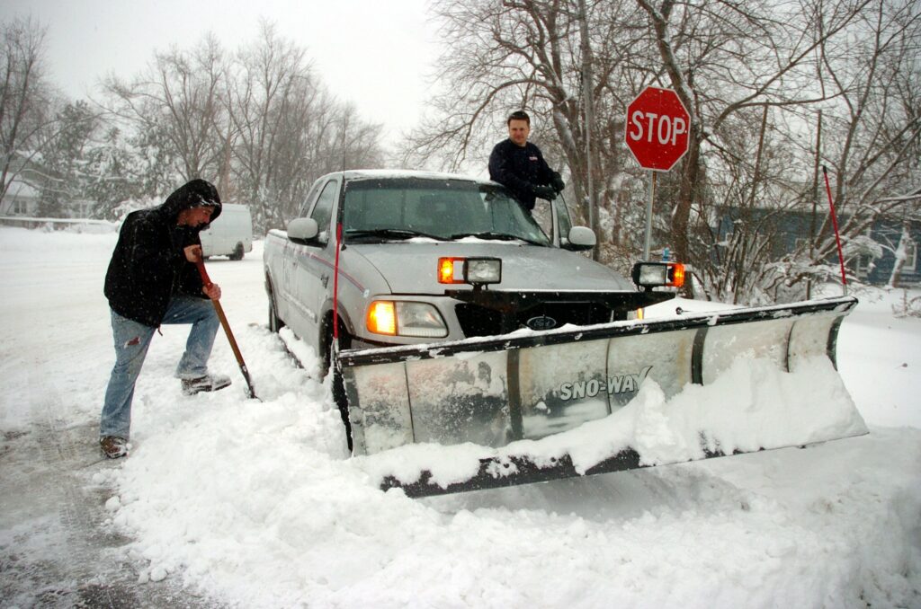
Winter storm warnings are being sent out for areas where millions of Americans live about the massive, early snowstorm already dumping snow on cities on Thursday, November 17. This strong lake-effect snowstorm began on Wednesday and weathercasters expect it to continue to make travel challenging by producing dangerous road conditions through at least Friday.
The National Weather Service in Buffalo warns “This event will have the very real potential to produce a paralyzing snowfall that could be measured in feet for the Buffalo and Watertown metro areas.” Local authorities may face difficulties as the storm may cause road closures as well as potentially cause cities to be shut down for days while citizens dig out from under the deep snowfall that is expected to pile up.
Some areas have already seen almost a foot of snow accumulation with this winter storm. As of Wednesday, South Wales, a town southeast of Buffalo, New York, by less than 30 miles has experienced 10 inches of snow from the big winter storm while neighboring Coldon is now under 8 inches of recent snowfall.
People in the five Great Lakes States are in the greatest danger from this storm. CNN Meteorologist Dave Hennon notes that around 6 million citizens are affected by the snow alerts, from New York to Wisconsin to Ohio.
But weather forecasters say that this is just the start of the snow that this major storm is expected to bring to the area.
Weather models predict that snow will continue into the weekend with the heaviest snowfall first starting on Thursday and Friday, but then additional heavy snow is also anticipated to pile up again over the weekend.
National weather forecasters are warning residents east of Lake Ontario and Lake Erie that this lake-effect snowfall may stick around for a while so they should be prepared. Jon Hitchcock of CNN warns that it will be a “very long-lasting” snow event. But snow is not all that residents of these areas have to worry about.
Along with the snowfall and frigid weather, residents downwind of Lake Ontario and Lake Erie should be on the lookout for thunder and lightning, adding to the already treacherous weather the area is expecting.
But other areas are also expected to receive a large dump of snow from this mega storm. The New York area of Watertown and northwest Pennsylvania are in danger of receiving multiple feet of snow accumulation as well between Thursday through Friday, according to the National Weather Service reports.
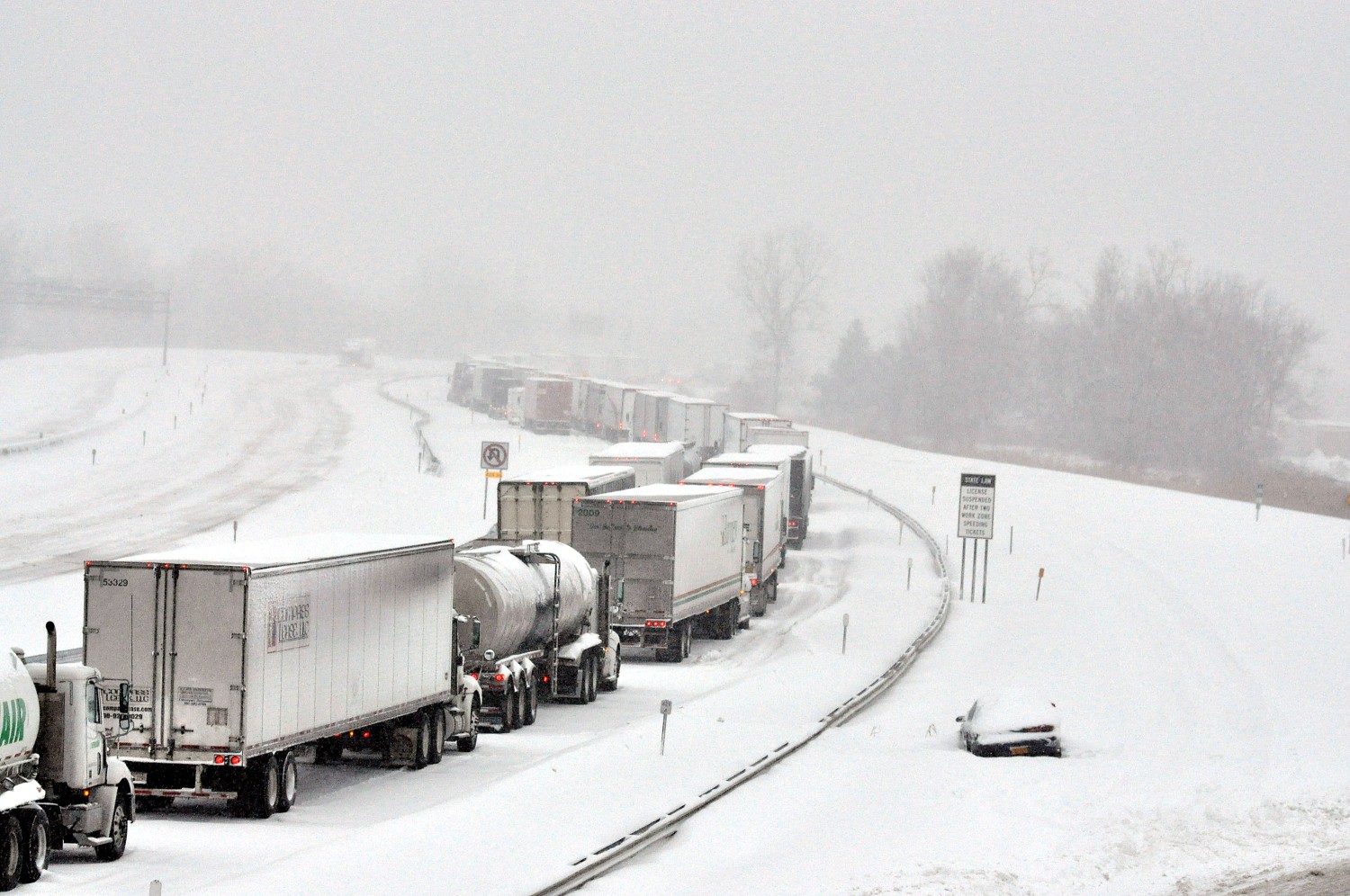
Driving on roads in the area is anticipated to be difficult due to snow buildup. In Buffalo, between Thursday night and early Sunday, forecasters are expecting that up to 42 inches of snow will pile up.
All of this snow is likely to impact driver safety as the National Weather Service indicates that visibility will be low during these days. “Visibility will drop to near zero at times and roadways will be covered with snow making travel hazardous to nearly impossible,” says a National Weather Service spokesperson.
While the current snowfall is coming fast and piling up quickly, forecasters are saying that the worst of the storm is still on its way with heavy snowfall coming down at the rate of 3 inches of snow per hour for some locations. This heavy snowfall could cause up to 4 feet of snow to pile up rapidly.
According to Dave Hennon, a CNN Meteorologist, over 12 inches of snow has already accumulated in northeast Ohio as well as in some areas of Indiana.
People in the five Great Lakes States are at the most significant risk of danger from this storm. CNN Meteorologist Dave Hennon notes that around 6 million citizens are affected by the snow alerts, from New York to Wisconsin to Ohio.
But weather forecasters say that this is just the start of the snow that this major storm is expected to bring to the area.
Weather models predict that snow will continue into the weekend with the heaviest snowfall first starting on Thursday and Friday. However, the snow is expected to continue with additional heavy snow also anticipated to pile up again over the weekend.
Some other areas are also at great risk for heavy lake effect snow from this November snowstorm. The National Weather Service in Burlington, Vermont sent out a November 17, 2022, social media message about the lake effect snow they anticipate arriving in their area.
A heavy lake effect snow band is expected to develop late Thu pm across the Tug Hill of NY, and shift NW into S St. Lawrence Co early Fri am. Snowfall rates of 1-2″/hr are possible Fri with the heaviest accum. S of Route 68 where total accum. are expected to range from 1-2 ft.NWS Burlington Twitter 11/17/22
States surrounding the Great Lakes are particularly susceptible to the impact lakes can have on cold winter blasts. But any area can be affected by lake-effect snow when windy and very cold conditions build up over a lake that has not yet chilled as much as the atmosphere. Just like in warmer weather patterns when two different temperatures clash, strong weather can be the result.
Lake-effect snow forms when icy weather forms atop a less cold lake. If air temperatures are below freezing but the lake water has not yet dipped below 32 degrees, lake-effect snow can form and affect the surrounding areas. And according to CNN Meteorologist Miller, “That differential in temperatures creates some instability and the water provides a moisture source. When it gets over land, it deposits water vapor as snow.”
The intensity of lake-effect snowstorms can cause these winter storms to be deadly. Not only do they produce large amounts of snow rapidly due to their massive moisture source, but the associated winds can also push the snow into unprepared areas quickly and produce a dangerous situation. In western New York, a deadly storm occurred in November 2014 when heavy lake-effect snow caused at least 13 deaths resulting in roof collapses and hundreds of major structural failures according to the National Weather Service.
The state of New York is taking the potential for dangerous driving situations seriously and is asking New Yorkers not to underestimate the potential power of this snowstorm. Governor Kathy Hochul’s office announced that as of Thursday, commercial traffic will be banned on the New York State Thruway (I 90) between Rochester, Buffalo and the Pennsylvania border area.
New Yorkers should anticipate that a state of emergency will be called on Thursday as well due to the severity of the storm that should be hitting the state. A NY state news release from Gov. Hochul also noted that “My team and I are deploying emergency response assets ahead of the storm, remain in constant contact with local officials, and are laser-focused on the forecast.”

January 21, 2024

January 19, 2024

January 18, 2024
