
Heavy Rain, Flooding, and Chance of Severe Weather Staring Down the Southern U.S.
January 22, 2024
Posted: November 18, 2022 11:11 pm


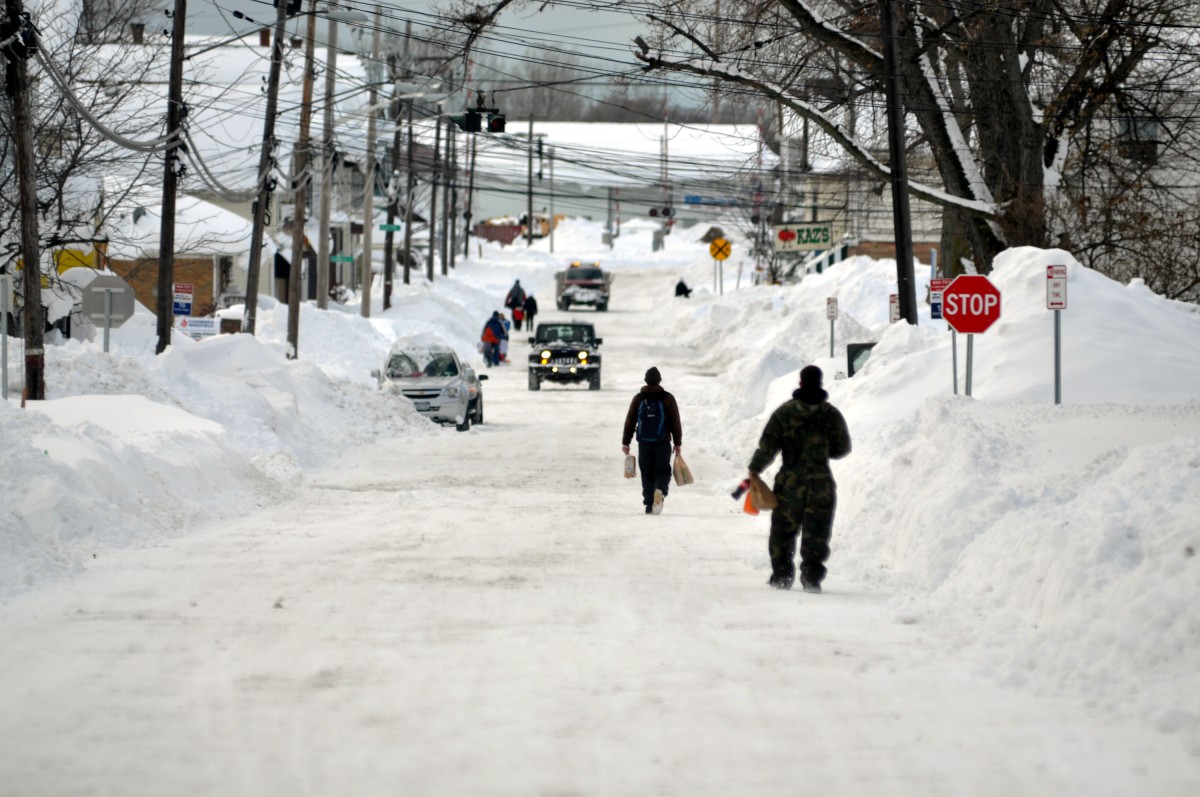
The snow continues to fall in and around Buffalo. As of late Friday night, up to 37 inches of new snow has been reported in Hamburg, New York. What is next for this historic lake-effect snowstorm? Read on for the latest details.
Hamburg is not the only part of the region that has been buried in snow over the last 24 hours. The Buffalo airport has recorded about 20 inches of snow so far with the flakes still flying. Other areas of the Great Lakes stretching into Michigan have also seen up to two feet of snow out of this intense weather maker.
The snow is not expected to let up for Buffalo heading into Friday evening. A band of heavy snow is setting its sights on the city for the evening hours with snowfall rates predicted to exceed 2 – 4 inches per hour. Local officials are urging residents to stay home and off of the roads.
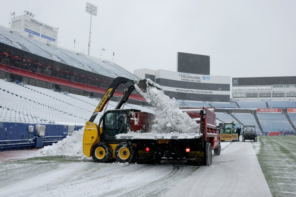
The Sunday NFL game between the Buffalo Bills and the Cleveland Browns was moved to Detroit’s Ford Field due to the weather. In addition to Buffalo’s Highmark Stadium being buried under snow, team officials were worried about fans trying to travel to the game. The team also canceled practice on Friday because of travel difficulties.
The Buffalo region will remain under a lake-effect snow warning until Sunday afternoon. Total accumulations of 2 to 4 feet are expected in this area. The highest snow totals are expected to fall in an area stretching from South Buffalo to West Seneca and into Elma. The heaviest snow bands are forecast from Friday night into early Saturday. Winds in excess of 30 mph will trigger blowing snow.
Because the snow is forecast to come down in narrow bands, conditions will vary greatly within a small area of impact. Officials warn that travel will be close to impossible as the snow continues to pile up. Additionally, snow of this magnitude will also likely bring down power lines and tree limbs, leaving many people in the dark.
In addition to the lake-effect snow machine, a new round of strong energy in the atmosphere will pair with more incoming cold air to create a different threat of snow across the Northeast heading into the weekend.
Snow squalls are in the forecast for a large part of the region on Friday and Saturday. These bursts of heavy snow move at a fast clip, triggering potentially dangerous travel conditions as visibility drops to near zero. It is not unusual for snow squalls to lead to pileups on the roads as motorists do not have time to react to the heavy snow that seemingly comes out of nowhere.
The worst of the snow is forecast to hit on Friday as the evening commute is getting started in Pennsylvania, eastern Ohio, western Maryland, southern New York, northern West Virginia, and northwestern portions of Connecticut and New Jersey. Areas of concern for motorists include sections of interstates 79, 80, 81, 90, 95 and Pennsylvania Turnpike.
The heavily populated Interstate 95 corridor is not forecast to see significant snowfall due to warmer temperatures. However, a few snow showers are not out of the question. The precipitation will likely arrive as rain before transitioning to snow as the temperature drops.
Temperatures will continue a free fall behind the snow. The mercury may drop below freezing and stay that way through the weekend. The longevity of this cold may create icy spots on sidewalks and roads that hang around for days thanks to the freezing temperatures.
The road conditions could complicate travel ahead of the Thanksgiving week holiday. Motorists are being advised to check with local road conditions before heading out on their journey.
Did you find this content useful? Feel free to bookmark or to post to your timeline for reference later.

January 21, 2024

January 19, 2024

January 18, 2024
