Heavy Rain, Flooding, and Chance of Severe Weather Staring Down the Southern U.S.
January 22, 2024
Posted: December 14, 2022 2:35 pm


The rash of severe storms across the South will just not break. Wednesday marks the third straight day of severe weather with more tornadoes in the forecast for the Gulf Coast and into the Southeast.
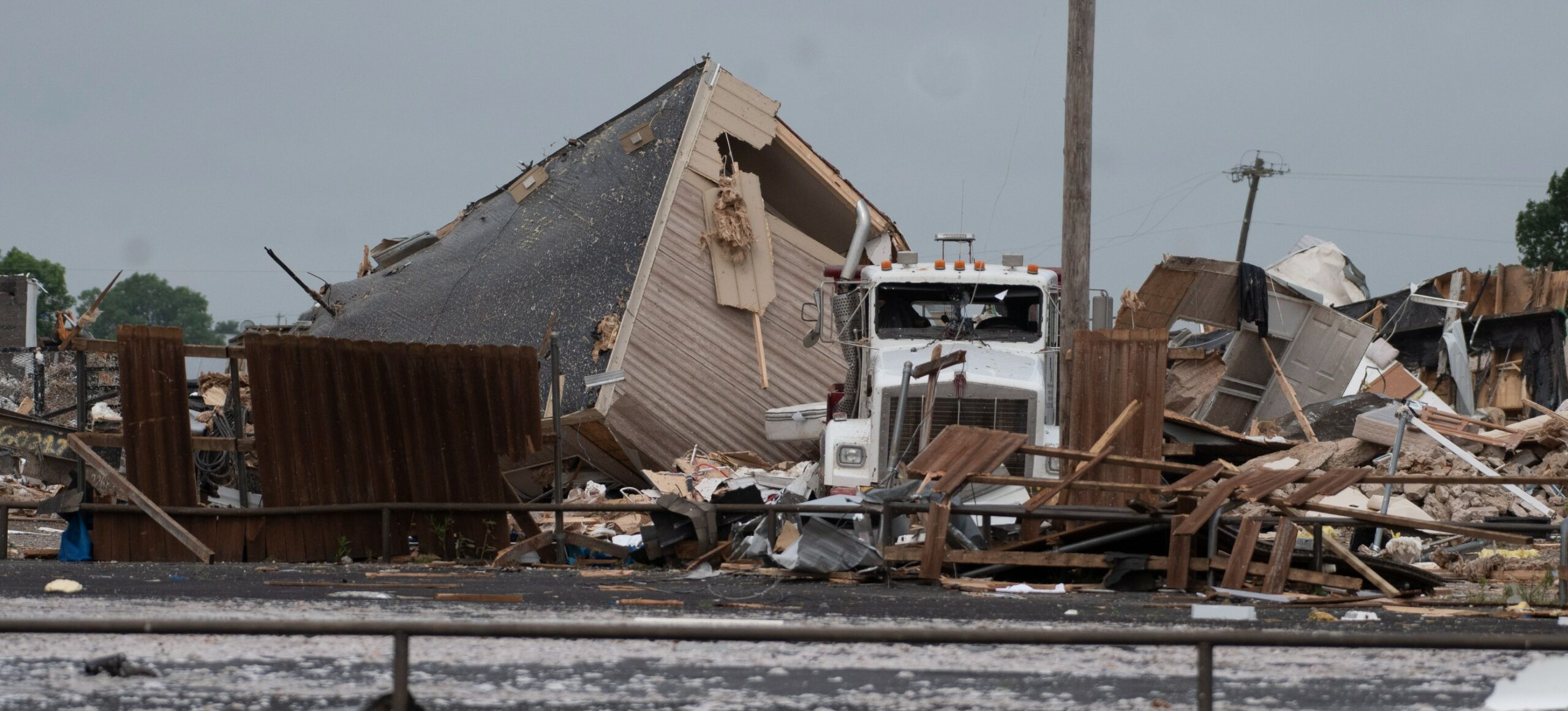
Tuesday’s storms first fired up in the Dallas area and up through Oklahoma with multiple reports of confirmed tornadoes to start the day. The line of storms then moved to the southeast, causing even greater destruction.
At least two people are dead after a tornado ripped through an area near Four Forks, Louisiana, located about 25 miles southwest of Shreveport. According to local authorities, a young boy’s body was found dead in the small town of Pecan Farms. First responders later found the deceased mother under a pile of debris not far from the family’s destroyed home.
Another tornado destroyed a handful of homes in Farmerville, Louisiana, located approximately 100 miles northeast of Shreveport. This twister is also responsible for dozens of reported injuries.
Before the deadly outbreak in Louisiana, the storms roared through North Texas. Tornado warnings were issued during the Tuesday morning commute in the populated area of Grapevine, a suburb of Dallas. Five people were hospitalized with injuries, however, none of the injuries were life-threatening.

The severe weather outbreak will continue through Wednesday evening with the threat of tornadoes firing up in the afternoon and evening hours. Heavy rain in the forecast will also raise the risk of flash flooding. Multiple tornado warnings were put in place on Wednesday morning, getting the day off to a nefarious start.
An influx of more humid air from the Gulf of Mexico combined with a powerful jet stream will provide the fuel for these storms. The areas most likely to see the potent storms include the southeastern corners of Louisiana and Mississippi stretching through southern Alabama and into the western edge of the Florida Panhandle.
This zone of impact includes the cities of New Orleans, Biloxi, and Mobile. In addition to heavy rain and tornadoes, the storm cells may also produce large hail. There is also the possibility of waterspouts forming along the Gulf Coast.
The immense moisture associated with this storm system will usher in the threat of flooding on Wednesday evening. This threat will be the greatest across the Tennessee Valley and its environs. A series of storm systems over the past several weeks have made the ground particularly wet. Ground that is overly saturated is often not able to absorb downpours, triggering the fast flooding of streams and secondary rivers.
You can expect about 2 to 3 inches of rain in an area stretching from central Mississippi and northwestern Alabama into the southern and middle sections of Tennessee. Some isolated areas may see up to 6 inches of rain. The rain is expected to move out of this region by Thursday morning.
By Thursday, the highest risk of storms will be in southeastern Georgia, the Florida Peninsula, and as far as the eastern Carolinas. Like prior days, the risks will include heavy rain, tornadoes, and waterspouts.
Chillier air will move through the south-central U.S. behind the storm system. While not a certainty, the temperatures may nosedive enough to support snow or ice development in some parts of northern Louisiana and Texas by Friday.
The lingering impacts of the storm will then track into the Northeast to end the week, bringing a host of weather issues such as snow, ice, and rain.
While the southern tier of the U.S. has been dealing with severe weather, the northern edge of the storm has produced blizzard conditions. The National Weather Service (NWS) confirmed on Wednesday morning that the snow and wind impacting the northern Plains were significant enough to fall under the classification of a blizzard. In addition to the blizzard conditions, Duluth, Minnesota confirmed a rare thundersnow event on Wednesday morning.
The snow is finally starting to wind down in this part of the country, however, a mess has been left in its wake. Numerous areas in South Dakota reported snow accumulation of over 20 inches.
Large portions of interstates 80, 90, 94, and 29 were closed as a result of the heavy snow and treacherous driving conditions.
Did you find this content useful? Feel free to bookmark or to post to your timeline for reference later.

January 21, 2024

January 19, 2024

January 18, 2024