
Heavy Rain, Flooding, and Chance of Severe Weather Staring Down the Southern U.S.
January 22, 2024
Posted: December 21, 2022 2:54 pm


Kona Low Forecast to Lift in Coming Days, Ushering in More Seasonable Weather
Unless there is a volcano erupting or a rare hurricane headed in that direction, the Hawaiian islands tend to be forgotten about in weather discussions. However, these islands are not immune to severe weather events. In fact, one is happening this week as a Kona low is unleashing across parts of the normally idyllic group of islands.
The strong winter storm has slammed into the islands in recent days, delivering heavy rain, strong winds, and even snow to the highest elevation of the islands. While the weather is forecast to improve just in time for the Christmas holiday, the Kona low will ruin some of the vacation plans of visitors who hoped to get an early start to the festivities.
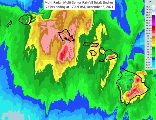
The Kona low has been affecting the weather in a large area of the islands stretching from Oahu to the Big Island. It has been anything but calm and tranquil across most of the region with some of the hardest hit areas picking up almost 10 inches of rain in a period of just 36 hours.
Additionally, the strong winds have triggered power outages to thousands of customers. The height of the power outages happened late Monday with most of the area being restored by Tuesday until the next expected rounds of winds hit.
Some of the highest rain totals have been recorded on the Big Island. For instance, 9.84 inches have fallen in Waimea with 8.89 dropping in PuuWaawaa. The west coast of the Big Island saw wind gusts reach over 55 mph in Kahului.
It has been almost as miserable on the island of Maui. Winds and rain have forced tourists indoors, putting a damper on many vacations. Locals and tourists woke up Tuesday morning to a number of weather warnings, including high wind warnings, flood warnings, and high surf warnings.
A Kona low is a unique weather pattern distinctive to the Hawaiian islands. The low is most common during the winter months, ushering in consecutive rounds of stormy conditions across the islands.
Most specifically, a Kona low is a special type of subtropical cyclone that happens in the north-central Pacific during this time of the year. These lows typically trigger torrential rain, hail, strong winds, severe thunderstorms, and the potential of flash flooding.
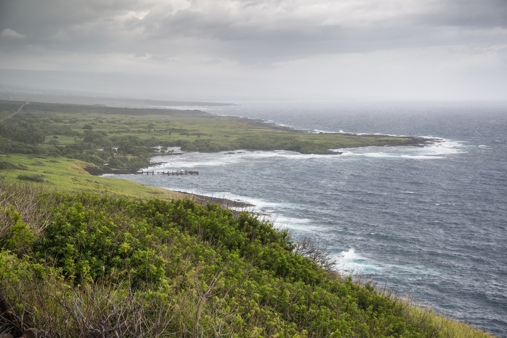
While all of the island group is at risk of seeing the weather impacts of a Kona low, the worst of the rain generally hits the leeward sides of the islands the hardest. This is part of the island that faces in the opposite direction of incoming winds. Because of this position, this part of the island usually sees less rain when compared to the windward side facing the wind.
The leeward side of the Big Island is what locals call Kona, translating to the word leeward in Hawaiian. As a general rule, the leeward sides of the island are more dry while the windward side offers a lush and green landscape because of the prevalence of more moisture.
Another rare occurrence with a Kona low is the appearance of snow and ice across the top of the volcanoes that dot the landscape of the Big Island. The summit of Mauna Kea plunged to a temperature of just 21 degrees on Monday with winds closing in at 85 mph.
There is good news for those headed to the islands for the holiday at the end of the week. The Kona low is forecast to move out of the region, bringing in warmer and drier conditions.
Did you find this content useful? Feel free to bookmark or to post to your timeline for reference later.

January 21, 2024

January 19, 2024

January 18, 2024
