
Heavy Rain, Flooding, and Chance of Severe Weather Staring Down the Southern U.S.
January 22, 2024
Posted: December 29, 2022 7:31 am


An atmospheric river is setting up over the West Coast, ushering in low-elevation rain, snow for the mountains, and potentially damaging winds to close out 2022 and ring in 2023. Here is what you can expect in the coming days on this side of the U.S.
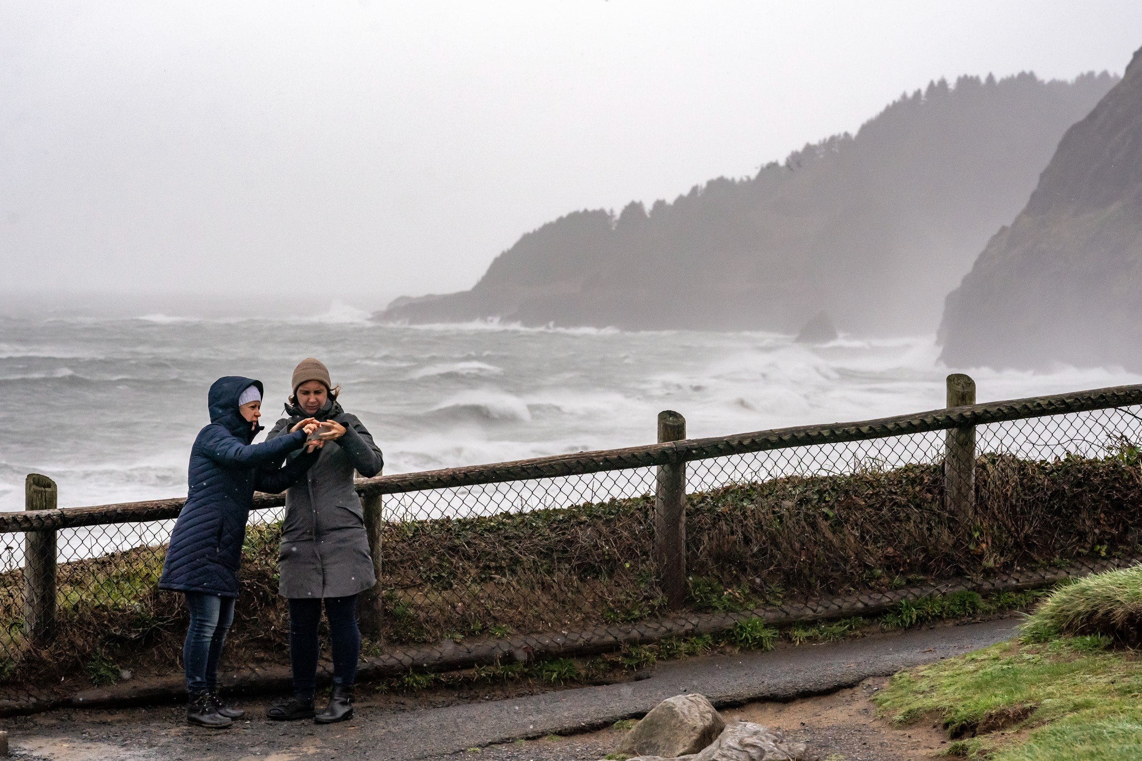
The first in a series of storms coming in from the Pacific Ocean slammed into the region on Monday, knocking out power to over 75,000 customers in Washington, Oregon, and California. At the height of the outages on Tuesday, nearly 200,000 people were left in the dark.
The power outages are coming at the hands of strong winds battering the coast areas and beyond. Astoria, Oregon came close to breaking the 70 mph mark on Monday night with other areas of California and Idaho hitting 80 mph.
The storm made its push inland to start the day Wednesday. Heavy snow is forecast for the Wasatch Mountains in Utah as the system continues to move to the east. Over a foot of snow is in the forecast for this part of the interior West before it moves into the Denver area.
This storm is just the start of a parade of weather makers that are setting up to move in from the Pacific in the coming days. The rain on Thursday and Friday is expected to be lighter in nature than what pounded the region to start the week. However, the next storm moving in over the weekend will bring greater impacts, particularly to Northern California.
Meteorologists are forecasting that an atmospheric river will set up and drench the area with heavy rain that brings about a good chance of flooding. This plume of moisture will impact Northern California in an area stretching from San Francisco to Sacramento and through the western-facing slopes of the Sierra Nevada starting late Friday and continuing until early Saturday.
San Francisco is expected to see 2 – 4 inches of rain with up to 8 inches falling near Sacramento. This excessive rainfall will likely trigger widespread urban and small-stream flooding. Mudslides are also a significant risk for rainfall of this magnitude.
The silver lining is that the constant barrage of storms may take some of the area reservoirs to full capacity. This is great news for an area of the country that continues to grapple with an ongoing drought.
In addition to delivering substantial amounts of water to the Shasta, Folsom, and Oroville reservoirs, the storm may also bring a good amount of snow to the Colorado River basin. This is another part of the country that has been experiencing dangerously dry conditions over the last several months.
For instance, Lake Mead hit historically low levels when it dropped to 1,041 feet last summer. The water level at Hoover Dam on Lake Mead was measuring only 1,044 feet this week. Climatologists are hopeful that a wet winter season could go a long way in helping to replenish the water supplies in the Colorado River basin ahead of the spring thaw.
The region is off to a good start with snowpack amounts hitting up to 165% of normal in parts of the West this season. This includes the Sierra Nevada and other mountainous areas of the region.
The downside of all of the moisture is that this much rain and snow in such a short period of time will raise the risk of debris flows along burn scars as well as the danger of avalanches. Travel may also be impacted through the New Year’s holiday weekend because of ponding on roadways and reduced visibility.
Air travel may be impacted in some of the West Coast’s major airline hubs, including Seattle and San Francisco. In addition to the heavy rain and strong winds, storms at this time of the year also tend to increase the risk of fog.
There will also be a domino effect on air travel complications as the storm that hit the West Coast to start the week will move into the eastern third of the nation by the end of the week. This will translate to more rain and fog that could impact travel out of the hubs on the East Coast just as the year wraps up.
After dealing with unseasonably cold weather leading up to Christmas, those in the Northwest will certainly welcome the warmer air that is associated with these storms that originate in the Pacific Ocean. However, the warmer temperatures will also come with the risk of rapidly melting snow at the higher elevations. This quick melt can create flooding and rushing waters down the western slopes of the Cascades, the Sierra Nevada, and the Siskiyous.
The strong winds will also increase the risk of shifting snow in the mountainous area. This shift is what can cause avalanches as the snow breaks loose. Motorists heading up over the passes of the Sierra Nevada and the Cascades will want to be aware of potentially dangerous weather conditions in the coming days.
Another storm is forecast to move in over the weekend that will bring snow to lower elevations. A general 2 – 4 feet of snow is on tap for the high country of the Sierra Nevada. Colder temperatures in Washington and Oregon for the weekend will bring the snow levels down farther, complicating travel over areas such as Snoqualmie Pass on Interstate 90.
More storms are forecast in from the Pacific as the calendar flips to 2023. While the storms will continue to cause travel headaches for many people, the moisture will undoubtedly help to build the snowpack for the area’s mountain ranges. This is welcome news for winter sports enthusiasts as well as for the long-range drought forecast.
Did you find this content useful? Feel free to bookmark or to post to your timeline for reference later.

January 21, 2024

January 19, 2024

January 18, 2024
