
Heavy Rain, Flooding, and Chance of Severe Weather Staring Down the Southern U.S.
January 22, 2024
Posted: January 8, 2023 7:49 am


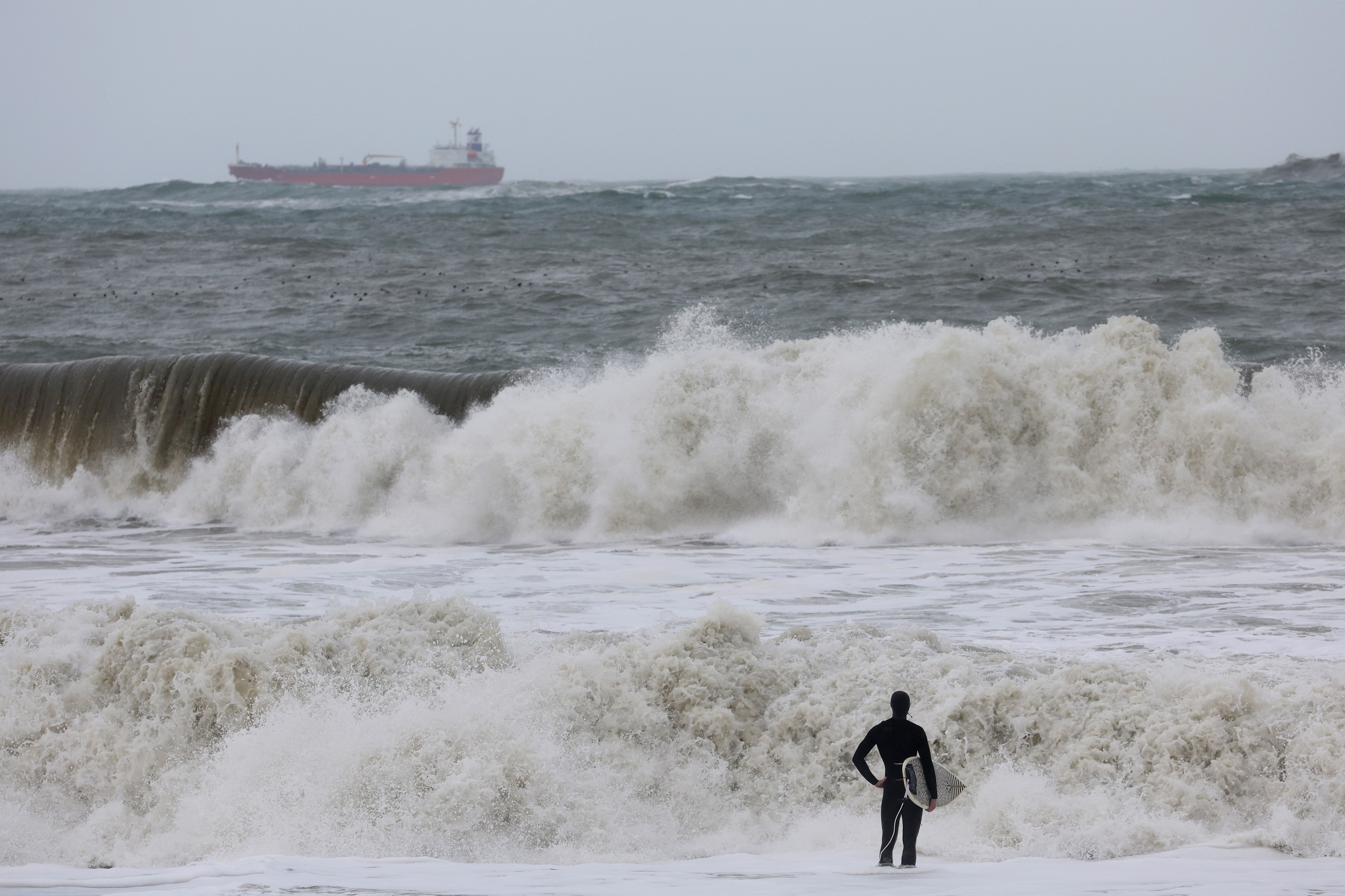
The state of California has been under a constant barrage of moisture thanks to an atmospheric river setting up over the region and acting as a fire hose. Just how wet has it been in California over the past few weeks? Here is a look at some of the most impressive precipitation totals.
San Francisco is no stranger to the rain this time of the year but the weather as of late has certainly been excessive. The city by the bay notched its rainiest 10-day period since the Civil War when it hit 10.33 inches of rain over the time frame ending on January 4. The record was set in January of 1862 when 14.37 inches of rain was recorded between January 8 and 17.
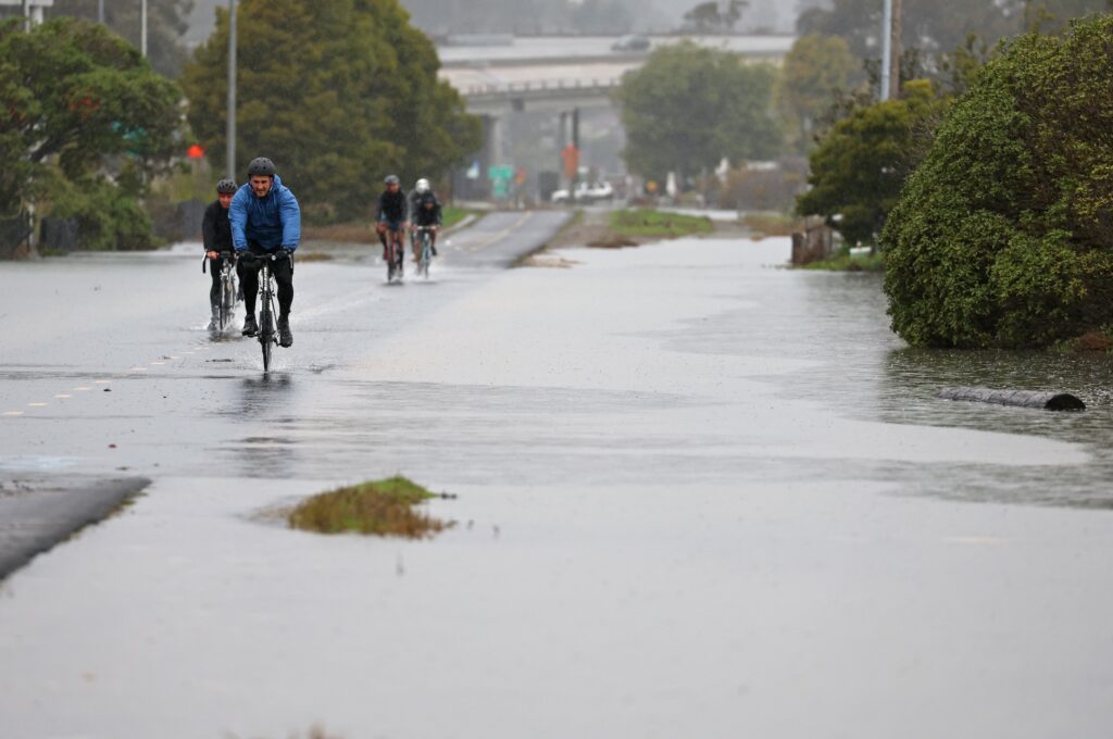
Air travel has been disrupted across the Bay Area because of the persistent rain. San Francisco International Airport recorded 8.84 inches of rain since the day after Christmas. It has been even wetter at neighboring Oakland International Airport, notching 10.43 inches over the same time period. This translates to over 750% of normal for this time of the year.
While it has been rain causing the issues in the coastal areas of the state, the higher terrains are dealing with record amounts of snow. This is a welcome weather pattern for those concerned about the ongoing drought. The Sierra Nevada is now nearing the average amount of snow that it typically receives over an entire season, coming in at a 10-year high.
According to the latest data from the California Department of Water Resources, the southern portion of the Sierra Nevada is hovering around twice the average for the season to date. This equates to 80% of normal for the whole season. Although the northern and central parts of the range are behind this figure, they are still well above normal for the season.
Once again, La Niña is influencing the weather pattern across California. A weakening La Niña pattern is causing the persistent parade of storms that continue to impact the Golden State. Although the subtropical jet stream ushering in these storms usually stays north of the state during the winter season over a La Niña year, the weakening of this pattern is sending this moisture-rich stream to the south and into California.
In a typical weather pattern, an El Niño pattern brings more moisture to California during the winter. But this current weakening of the La Niña is causing the moisture to track southward and back into California, reversing the shield typically provided during these years.
Will this early push of moisture translate to a wetter spring and summer? The long-range forecast says yes. Forecasters are predicting that the constant parade of storms will stay in place for the foreseeable future. Mass amounts of moisture is on tap to start the week for much of California after a break in the rain and snow over the weekend.
Looking ahead, the fire hose effect is forecast to stay intact in the coming weeks. However, it will take more than one of these mass moisture events to reverse the damage caused by the drought. Experts warn that it will take moisture of this magnitude into February and March to finish the drought recovery effort.
All of this precipitation will come with a cost. While it is good news for the state’s major reservoirs and other waterways, this amount of moisture over such a short time period may also trigger the risk of life-threatening flooding, landslides, mudslides, and widespread power outages.
Did you find this content useful? Feel free to bookmark or to post to your timeline for reference later.

January 21, 2024

January 19, 2024

January 18, 2024
