Heavy Rain, Flooding, and Chance of Severe Weather Staring Down the Southern U.S.
January 22, 2024
Posted: May 29, 2023 5:24 am


The Philippines is bracing for a near landfall of a powerful typhoon in the coming days. Typhoon Mawar has already delivered heavy rain and damaging winds to the U.S. territory of Guam as it continues to churn through the western Pacific Ocean. Here is the latest on the projected path of this potent typhoon.
Typhoon Mawar has been distinguished as the strongest tropical cyclone to churn up so far in 2023. The storm is expected to hang on for a few more days and head toward the Philippines, Taiwan, and the southern portions of Japan next week.
Mawar was spinning around the central Philippine Sea on Sunday afternoon, packing sustained winds that put it in the same field as a Category 3 hurricane. According to the Japanese Meteorological Agency (JMA), Mawar made it all the way to the equivalent of a Category 5 hurricane on Friday after it brushed by the island of Guam.
Forecasters are predicting that Mawar will begin to lose its wind strength as it moves across the Philippine Sea in a west to northwest direction. This sea is bordered by the Philippines Islands on the western edge and the Mariana Trench located to the east.
Typhoon Mawar is predicted to douse northern Luzon in the Philippines with heavy rain in the coming days. The center of the storm is forecast to stay to the north of Luzon as it makes its approach. Despite likely missing a landfall, the storm will still usher in torrential rain and strong winds equivalent to a Category 3 storm.
The typhoon is likely to track to the north as it nears the Philippines. The timing of this turn will determine the severity of the impacts across the islands. Even if the storm takes a turn sooner than expected, the outer rain bands are still going to bring significant impacts to the group of islands.

The Philippine Atmospheric, Geophysical, and Astronomical Services Administration (PAGASA) has assigned the storm the name of Betty. Officials in the Philippines have suspended sea trips and cautioned fishing interests about the potential of severe weather.
The storm will track close to Taiwan and Japan by the middle of the week. This part of the Pacific basin can expect consecutive days of heavy rain beginning Tuesday and continuing through Friday. Eastern and northern Taiwan will be the area most at risk of seeing the torrential rain and potential flooding. The typhoon is expected to remain far enough away from the mainland to mitigate the odds of damaging winds.
Japan’s Ryukyu Islands are also in the potential danger zone heading toward the end of the week. The typhoon may also impact the southern portions of the mainland of Japan.
Typhoon Mawar left a trail of destruction as it made its way across the Pacific. The feature first became an official tropical system on May 19, becoming the first named typhoon of the 2023 season on May 21. Despite being no stranger to tropical weather events, Typhoon Mawar was the most destructive storm to hit Guam since Typhoon Damrey inflicted mass amounts of damage in 2000.
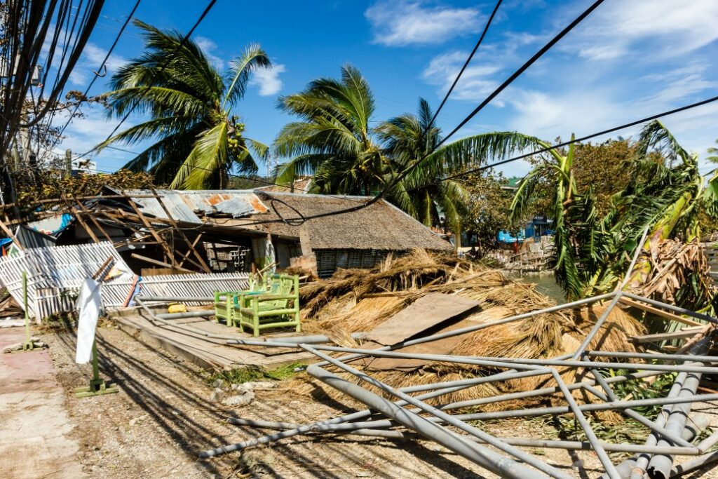
Mawar was boasting winds of over 140 mph when it barely missed landfall with Guam last Wednesday. Over two feet of rain fell during a short period of time as the winds brought down trees and power lines. Over 90% of the island was without power during the height of the storm. Plenty of warning gave residents time to prepare, limiting the life-threatening impacts to just a few minor injuries.
U.S. President Joe Biden made the move to approve a disaster declaration for the territory last week. This official declaration has released federal funding to help with the cleanup efforts in the coming months.
Did you find this content useful? Feel free to bookmark or to post to your timeline for reference later.

January 21, 2024

January 19, 2024

January 18, 2024