Heavy Rain, Flooding, and Chance of Severe Weather Staring Down the Southern U.S.
January 22, 2024
Posted: May 30, 2023 3:30 pm


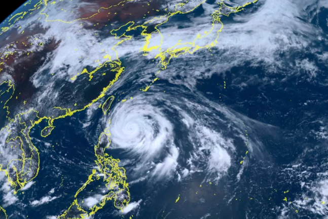
Typhoon Mawar just will not quit. After slamming into the U.S. territory of Guam last week, the monster storm is now headed for the Philippines, Taiwan, and southern Japan.
Evacuations have been put into place across much of the northern Philippines as the storm makes it approach.
Schools have been closed, businesses have been shut down, and thousands of people have been ordered to evacuate across the northern Philippines as Mawar continues moving to the northwest across the Philippine Sea.
A no-sail ban was ordered for the waters located off the northern Philippines while the nearly 5,000 evacuees were sent to emergency shelters in Cagayan and Batanes.
The storm is also responsible for the rough seas that killed at least one person along the eastern coast of Taiwan over the weekend when four people were swept out to sea in two different incidents. Another young girl is still missing after being swept up by the strong undercurrent.
Mawar was packing maximum sustained winds in the range of 96 to 110 mph as of late Tuesday local time. The storm is churning several hundred miles northeast of the Philippine island of Luzon.
It has been a long road for Mawar, once a potent typhoon that measured the equivalent to a Category 5 hurricane. The storm is currently distinguished as the strongest tropical event to spin up this year across the entire planet.
The good news for those in its path now is that Mawar is expected to lose some of its wind intensity as it moves to the north and into cooler ocean waters. Mawar is then projected to make a turn to the northeast by Friday, picking up speed as it churns in this direction.
Despite losing some of its wind intensity over the last few days, the storm is still on track to dump heavy rain and produce strong winds across some parts of eastern Asia. The Philippine island of Luzon will take the brunt of the impacts on Wednesday as the outer rain bands pass over this part of the sea.
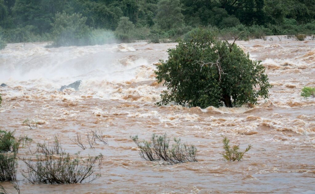
The island should be prepared for flooding as the heavy rain is expected to last for a few days. The strong winds may also create damage along the northern coast of the island.

Eastern parts of Taiwan will be up next, bracing for rain and wind. Both northern Luzon and eastern Taiwan are forecast to see 2 to 4 inches of rain out of this storm.
Mawar is not expected to make a direct landfall on any of these areas. Instead, it will take a similar path as it did when it approached Guam with the eyewall barely missing any major land mass.
Japan’s Ryukyu Islands is likely to be the area most likely to see an official landfall as it approaches the region late Wednesday and into Thursday. The Japan Meteorological Agency cautioned that Okinawa will likely be in the crosshairs of the storm for an “extended duration” beginning late in the week.
Forecasters are warning that winds may hit 110 mph with rainfall amounts coming in at 8 to 16 inches. This amount of rain will almost certainly create some flooding across the northern tier of the Ryukyu Islands and into the southern half of the Japanese mainland beginning Friday.
While Mawar is forecast to be downgraded to a tropical storm, it will still retain a good amount of moisture and wind intensity through the weekend.
A potentially dangerous storm surge is also possible in many areas of this corner of the Pacific, including the eastern shores of the Philippines, all of Taiwan, and southern Japan. The mountainous terrain of this region may see the threat of landslides as the ground becomes unstable because of the persistent rain.
Did you find this content useful? Feel free to bookmark or to post to your timeline for reference later.

January 21, 2024

January 19, 2024

January 18, 2024