
Heavy Rain, Flooding, and Chance of Severe Weather Staring Down the Southern U.S.
January 22, 2024
Posted: August 7, 2023 12:00 pm


The eastern half of the country is being put on high alert as a massive complex of storm development takes root to start the new week. Is your community at risk of being caught in the crosshairs of these storm cells?
Read on to learn more about this potentially hairy forecast.
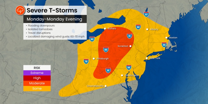
Forecasters are warning it could be a stormy few days across an area expanding from Georgia and up into New York state beginning Monday. It will feel more like spring than the middle of summer with over a dozen states under the gun for severe weather.
The tumultuous weather pattern got going on Sunday in some areas following a relatively calm start to the weekend. It had felt more like the early fall in some areas of the Northeast on Saturday as residents headed outdoors in droves to enjoy the low humidity levels and pleasant temperatures.
This respite from the weather came after a stormy Friday for much of the interior Northeast, bringing along torrential rain, strong winds, and hail.
While Saturday was largely nice for the region, the storms made another appearance early Sunday afternoon, impacting portions of West Virginia, eastern Ohio, and the western edge of Pennsylvania before expanding to the east and the south. Sunday’s severe weather was just a taste of what is to come on Monday.
The stormy conditions are forecast to become more widespread on Monday, putting a number of populated cities at risk of severe weather. Cities that need to be on alert include Pittsburgh, Philadelphia, Cleveland, Atlanta, Washington, D.C., and Knoxville.
The line of storms will make its way from the Midwest, bringing up a large amount of moisture from the Atlantic Ocean thanks to the southwesterly winds. This moisture will translate to the chance of heavy rain for some portions of the interior Northeast throughout the day Monday.
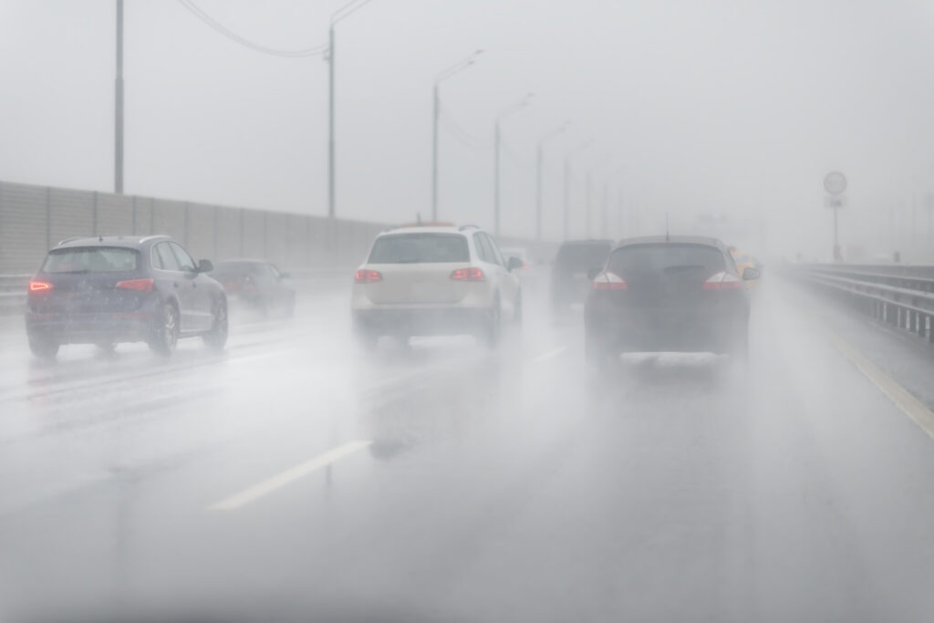
Summer road trippers will want to exercise caution when driving along the impacted areas of interstates 40, 64, 70, 75, 80, and 81. Reduced visibility, ponding on the roadways, and downed tree branches and power lines could slow down motorists.
Wind gusts of up to 70 mph are also possible as the weather maker taps into the large amount of energy circulating in the atmosphere at this time.
The worst of the severe weather should stay away from New England, however, the amount of moisture present in this system could bring enough rain to trigger the risk of flash flooding for the region.
This is a corner of the country that has been hit particularly hard with torrential rain over the last few weeks, saturating the ground and sending streams and rivers overflowing. This will only serve to heighten the risk of flooding with only moderate amounts of rain.
The threat of severe weather will expand east into southeastern New York and north into the southern portions of Maine on Tuesday. This potential impact zone includes Albany, Syracuse, and Boston. The most likely impacts include localized high winds, heavy rain, and isolated tornadoes.
While the rain may prove to be a nuisance, the storms will work to trim the heat this week. The cloud cover and frequent rounds of rain throughout the week will help to keep the typical extreme heat of August at bay.
It has already been a cooler than average August for many areas of the Northeast, including New York City, Washington, D.C., and Boston. Temperatures have trended about 3 – 6 degrees below normal for this time of the month thus far.
For instance, the mercury is forecast to hover in the low to mid 80s in New York City for the entirety of the week. While the week will not be a total rainout, do not rule out the appearance of sporadic rain showers or thunderstorms in the Big Apple.
Temperatures will trend slightly lower in areas farther to the north such as Boston. Like New York City, the days with the greatest chance of rain will be Monday and Tuesday.
However, forecasters are warning that the worst of the summer heat could still be on the horizon for this region. Temperatures are expected to begin to climb again by next week just in time for many students to return to school.
Did you find this content useful? Feel free to bookmark or to post to your timeline for reference later.

January 21, 2024

January 19, 2024

January 18, 2024
