Heavy Rain, Flooding, and Chance of Severe Weather Staring Down the Southern U.S.
January 22, 2024
Posted: August 18, 2023 12:55 pm


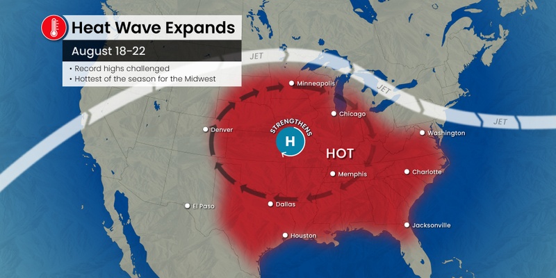
Brace yourself for a dramatic increase in the temperatures if you live in the central U.S. Forecasters are warning that what will likely end up as the hottest weather of the summer is set to impact this part of the country.
Records may fall in the coming days as the heat dome that has been parked over the Southwest and the southern Plains for a great majority of the summer shifts to the northeast. The heat will begin to build by Saturday and is expected to linger well into next week.
A number of daily high record temperatures may be challenged as the mercury continues to soar. While the large area of high pressure will translate to mostly dry conditions, you cannot rule out the chance of daily thunderstorms along the top fringe of the heat dome. These storms will primarily impact a zone stretching from the Great Lakes and into the Northeast.
This is typically the time of the year when the temperatures begin to ease. However, that will not be the case as many communities in the Midwest will see a prolonged stretch of days in the triple digits.
The core of the heat will be focused on the central Plains. Places such as Wichita, Kansas City, and Tulsa are predicted to see consecutive days of temperatures at or above 100 degrees.
The heat will also come as a surprise to the nation’s heartland after what has been a relatively mild summer with cooler than usual temperatures. For instance, temperatures have only hit the 90s just a few times in Des Moines and the surrounding area. But the capital city of Iowa is expecting readings in the upper 90s and low 100s for at least six straight days starting Saturday.
Forecasters are also warning that the increase in humidity will pair with the intense sunshine to send the real feel readings even higher. This means that the temperature will feel as much as 10 degrees warmer than what the thermometer indicates. This will translate to real feel readings of about 115 degrees in the worst of the extreme heat.
Vulnerable populations will want to pay heed to the heat alerts and take the necessary precautions. This includes avoiding outdoor activities during the peak afternoon heating hours and being diligent about staying hydrated.
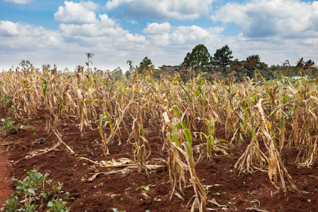
The extreme heat is also not good news for the heartland’s agricultural interests. This is the time of the year when farmers will be carefully tending their corn and soybean crops. The extended heat and the dry conditions could spell trouble for these crops.

Unfortunately for those tired of the extreme heat in Texas, the scorching weather will remain in place over this part of the nation as well. For instance, Houston is forecast to see temperatures in the 100s linger through the weekend and into early next week.
It will be even hotter to the north in Dallas. The metroplex is predicted to land at about 108 degrees for a high on both Saturday and Sunday, flirting with the record high for those days. A lack of clouds and light winds will make it feel even hotter throughout much of the Lone Star State.
There is little to no rain in the forecast through the next week for most of the Plains states and into the Midwest. This lack of moisture will only serve to worsen the existing drought conditions. The Thursday data release from the U.S. Drought Monitor indicates a level of severe to exceptional drought for a large part of the Plains, stretching from northern Oklahoma and into Wisconsin.
The northern edge of the heat dome will see the best chance for rain this week as the colliding warmth and cool temperatures work to ignite thunderstorms for the Great Lakes and beyond. While the rain is a welcome sight during this time of the summer, the storms could also trigger flash flooding and high wind gusts.
Lastly, a surge of tropical moisture from the Gulf of Mexico could bring a bit of relief to the Gulf Coast and over into Texas beginning this weekend and lingering into next week. Houston could see its first shot of rain in over a month by Tuesday as a result of this weather maker.
Did you find this content useful? Feel free to bookmark or to post to your timeline for reference later.

January 21, 2024

January 19, 2024

January 18, 2024