Heavy Rain, Flooding, and Chance of Severe Weather Staring Down the Southern U.S.
January 22, 2024
Posted: January 5, 2022 1:36 pm


While it has been the mid-Atlantic in the news this week because of a monster snowfall, a new Alberta clipper is set to take aim at the Midwest and Great Lakes by the middle of this week.
This storm is forecast to churn up in the northern Plains on Wednesday before moving into the Upper Midwest and the Great Lakes region by the evening hours. The system is predicted to bring snowy conditions and gusty winds as it moves through at a fast clip.
This storm will get its start in southern Saskatchewan and southern Manitoba. It will then rush into the northeastern corner of Montana and through the Dakotas. Winter weather advisories are already in place from Montana, through the Dakotas, and into northern Illinois and the western half of Michigan.
Flakes were flying late Tuesday in the north-central U.S. Cities experiencing snowfall by the time the sun went down included Fargo and Minneapolis. Although the Twin Cities are not forecast to see significant snowfall out of this Alberta clipper, Fargo should be ready to receive several inches of the white stuff.
Snow has been unseasonably light for much of Minnesota and the Upper Peninsula of Michigan this year. This system will hopefully replenish stores heading into the new year.
The presence of gusty winds will lead to the potential of blowing snow on roadways. Combined with icy roads, the reduced visibility may present a significant travel hassle. Be sure to check road conditions before heading out on the roads if you are in the affected area.
In addition, forecasters are warning that a rush of bitterly cold temperatures will come in behind the storm system. It is important to bundle up and plan ahead if you have a long trip on the roads ahead of you.
This storm is predicted to continue its eastward movement throughout the day Wednesday. The moisture from the Great Lakes will provide more fuel as it passes through. Residents should be ready for lake-effect snowfall near the shores of the lakes.
A northeasterly flow just off of Lake Superior will put the higher elevations near Marquette, Michigan in the bullseye for the greatest amount of snow as this system rushes through.
Winds coming off of Lake Michigan will complicate travel in the areas bordering this lake, including Chicago. The Windy City may see light snowfall and flurries out of this system.
It has only been a few days since Chicago recorded its biggest snow event of the season. Over four inches blanketed the city on New Year’s Day, marking the snowiest start to the year since 1985. However, this snow came after the city experienced an unseasonably dry November and December.
By late Wednesday, lake-effect snow is predicted downward of both Lake Erie and Lake Ontario. The southwesterly winds coming off of Lake Erie will dump more snow in the form of squalls in cities in upstate New York, including Buffalo and Rochester.
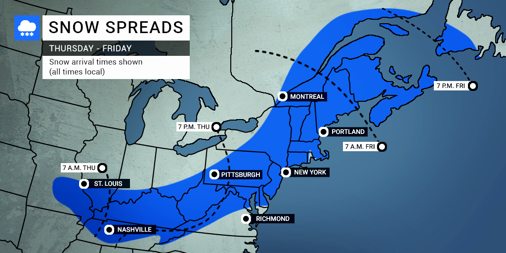
This storm will be a precursor to an even bigger system expected to wreak havoc in the Northeast to end the work week. The system will bring in the cold air needed to fuel the development of this new storm.

January 21, 2024

January 19, 2024

January 18, 2024