
Heavy Rain, Flooding, and Chance of Severe Weather Staring Down the Southern U.S.
January 22, 2024
Posted: December 27, 2022 9:12 am


It will be a wet week up and down the West Coast thanks to a moisture-rich storm coming in from the Pacific Ocean. The storm system will bring a host of effects to the region, including heavy rain to the coastal areas and snow to the higher terrains. The weather maker will pack enough moisture to trigger the potential of flooding as well as strong winds. So while it was snow and ice causing the travel disruptions of last week, the coming days could be just as dicey for many people in the western U.S.
A powerful area of low pressure pushed into the Northwest late Monday, bringing its effects as far south as California’s Bay Area. A lengthy plume of moisture that expands across the Pacific Ocean is fueling the atmospheric river that is setting up over the West Coast. Once the moisture reaches the coastal areas, it is pushed upward by the higher terrain in this part of the region. The result is torrential rain that becomes socked into the area and does not let up.
The rain will begin in the northern tier of the West Coast before moving to the south by the middle of the week. This means that areas as far south as Los Angeles and San Diego can expect to see the significant moisture by late Tuesday and Wednesday. Although the Pacific Northwest has seen plenty of rain already this December, the precipitation will be good news for the drought-stricken portions of Southern California.
According to the latest data drop from the U.S. Drought Monitor, the bulk of California is still under the designation of a severe to exceptional drought. A large area of the Interstate 5 corridor in the Pacific Northwest is also under abnormally dry conditions. Although this next round of moisture will certainly help to alleviate some of the drought conditions, too much of the precipitation at one time may also heighten the risk of flooding.
The threat of flooding will be the greatest in Northern California. There are also concerns of mudslides in this part of the West.
Forecasters are predicting that 2 – 4 inches of rain will fall over the next few days along the coastal areas of Washington and Oregon and into Northern California. Areas as far south as San Luis Obispo, California may see 1 – 2 inches of rain. Southern California will likely top out at 1 inch of rain.
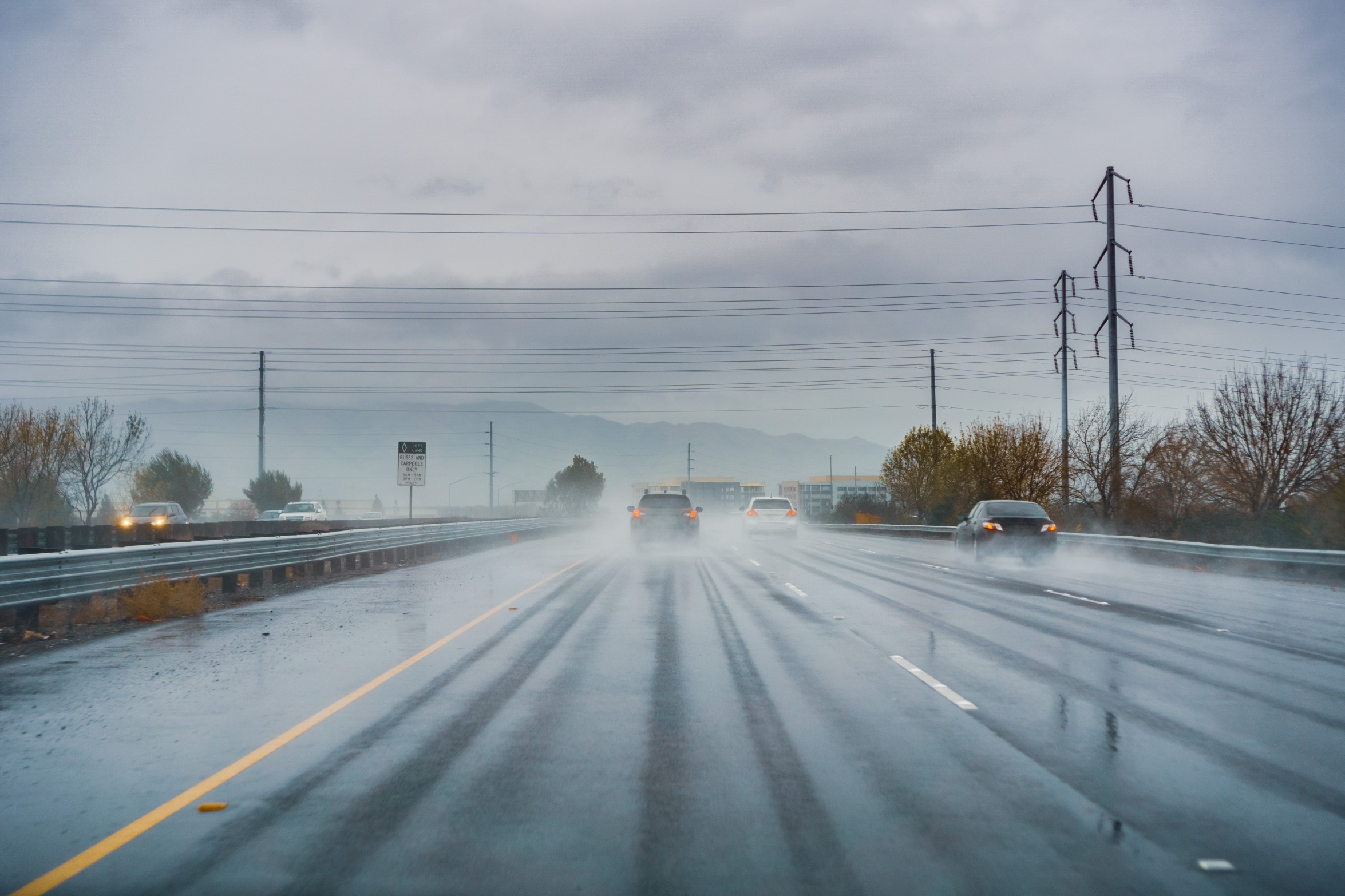
The torrential rain will likely cause slick roads along large portions of interstates 5, 10, 15, and 80. Ponding on the roadways will raise the risk of hydroplaning.
Strong winds will accompany the rain, causing downed trees and power lines. The areas most likely to see high winds include western Washington, Oregon, and Northern California.
As is typical, the higher terrains of the region will see the precipitation fall as snow. Heavy snow is in the forecast for the Sierra Nevada with accumulations of over a foot a possibility in the hardest hit areas, including Donner Pass. As such, motorists should be ready for potentially difficult travel conditions through Wednesday.
The Cascade Mountains in Washington and Oregon will also likely see accumulation out of this storm system. The northern Rockies are also under the gun for a short burst of snow as the system pushes to the east.

Although this particular system will exit the West Coast by Thursday, forecasters warn that this is just the start of the persistent rounds of stormy conditions that may spread across the area in the coming week. A largely unsettled weather pattern will keep heavy rain and winds on the table heading into the new year.
Did you find this content useful? Feel free to bookmark or to post to your timeline for reference later.

January 21, 2024

January 19, 2024

January 18, 2024
