
Heavy Rain, Flooding, and Chance of Severe Weather Staring Down the Southern U.S.
January 22, 2024
Posted: December 3, 2022 9:07 am


A series of storms continues to take aim at the West Coast, bringing an end to the unusually dry fall. Here is what you need to know about this next weather maker.
It was a bit of a topsy-turvy weather week for much of the western U.S. A strong storm system brought the first snow of the season to the Seattle area beginning on Tuesday. Snowflakes were still hanging around the Emerald City on Friday morning, complicating travel in residential neighborhoods and in the surrounding foothills. It is likely that parts of the Seattle metro area will wake up to a new coating of light snow on Saturday as well.
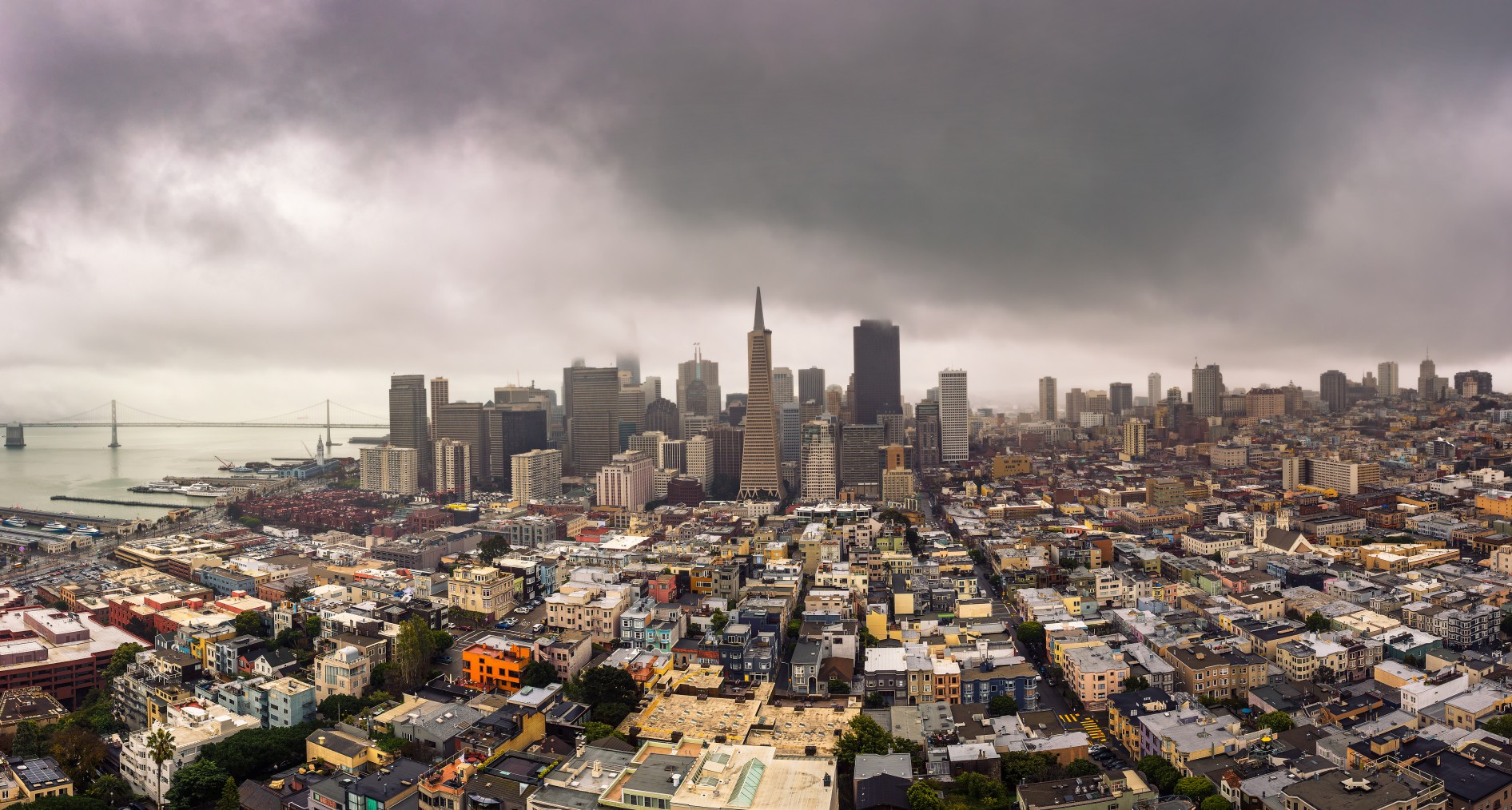
This storm that brought more moisture to the Pacific Northwest on Friday will move into California this weekend, delivering heavy rain and snow to a large area of the Golden State that also experienced significant precipitation earlier in the week. The bulk of the moisture from the weekend storm will focus on Northern and Central California. However, it is possible that some of the rain associated with this system may move as far south as Southern California as the storm merges with a flow of moisture moving onto land from the Pacific Ocean.
Forecasters warn that it is difficult to ascertain the degree of precipitation that this system will bring. Weather makers that hug the Pacific Coast and fail to move far inland can be unpredictable, making it more challenging to predict how much moisture will funnel in from the ocean at any given time.
What forecasters are certain of is that the rain will pick up in intensity by early Saturday along the Northwest coastal areas and into the San Francisco Bay Area. This rain will continue to push to the east into the Central Valley. As this happens, the snow machine will fire up across the Sierra Nevada and Klamath mountains. This part of the interior West already experienced significant snowfall to start the week.
The precipitation will pick up in intensity by late Saturday and into Sunday. This will make travel difficult throughout much of the state, particularly over mountain passes. Donner Pass on Interstate 80 may be impassable during this time.
This is also the most likely time frame for the rain to make it into Southern California. There is the potential for localized flooding in the heaviest hit areas. Rainfall totals may hit up to one inch along the central coast and in the foothills of the Sierra Nevada.
Any precipitation that falls in California will be good news for the ongoing drought. According to the December 1 data release from the U.S. Drought Monitor, all of the state is under the categorization of at least abnormally dry conditions with almost 85% of California under a severe drought or greater.
Once the storm system exits the region, the leftover energy will keep isolated showers in the forecast on Monday and Tuesday. A more potent storm system is expected to approach from the Northwest once again by the middle of next week. However, the long-range forecast indicates an area of high pressure moving into California by next weekend, drying things out and providing warmer temperatures.
Did you find this content useful? Feel free to bookmark or to post to your timeline for reference later.

January 21, 2024

January 19, 2024

January 18, 2024
