
Heavy Rain, Flooding, and Chance of Severe Weather Staring Down the Southern U.S.
January 22, 2024
Posted: January 2, 2023 9:52 am


Signs that La Niña Weather Pattern Weakening
An atmospheric river continues to pound the West Coast with loads of moisture as the calendar flips from 2022 to 2023. While all of the precipitation in the form of both rain and snow may have put a damper on some New Year’s Eve festivities, the moisture is going a long way in helping to replenish reservoirs in desperate need of water.
The large plume of moisture has put some parts of the region under the threat of up to 20 inches of rain over a 24-hour period. Northern California saw the worst of the rain on Friday with over 4 inches recorded in Willow Creek. San Francisco was sitting at 2 inches of rain by late Saturday morning with forecasters warning that 4 to 8 inches of rain may fall in an area near Sacramento.
A portion of U.S. Highway 101 in the southern portion of San Francisco was closed on Saturday afternoon due to flooding. In addition, city officials in San Francisco reported a mudslide in the area. More flooding is possible in the Sacramento and San Joaquin valleys as the snow continues to melt in the higher terrains and send water into the region’s rivers and streams.
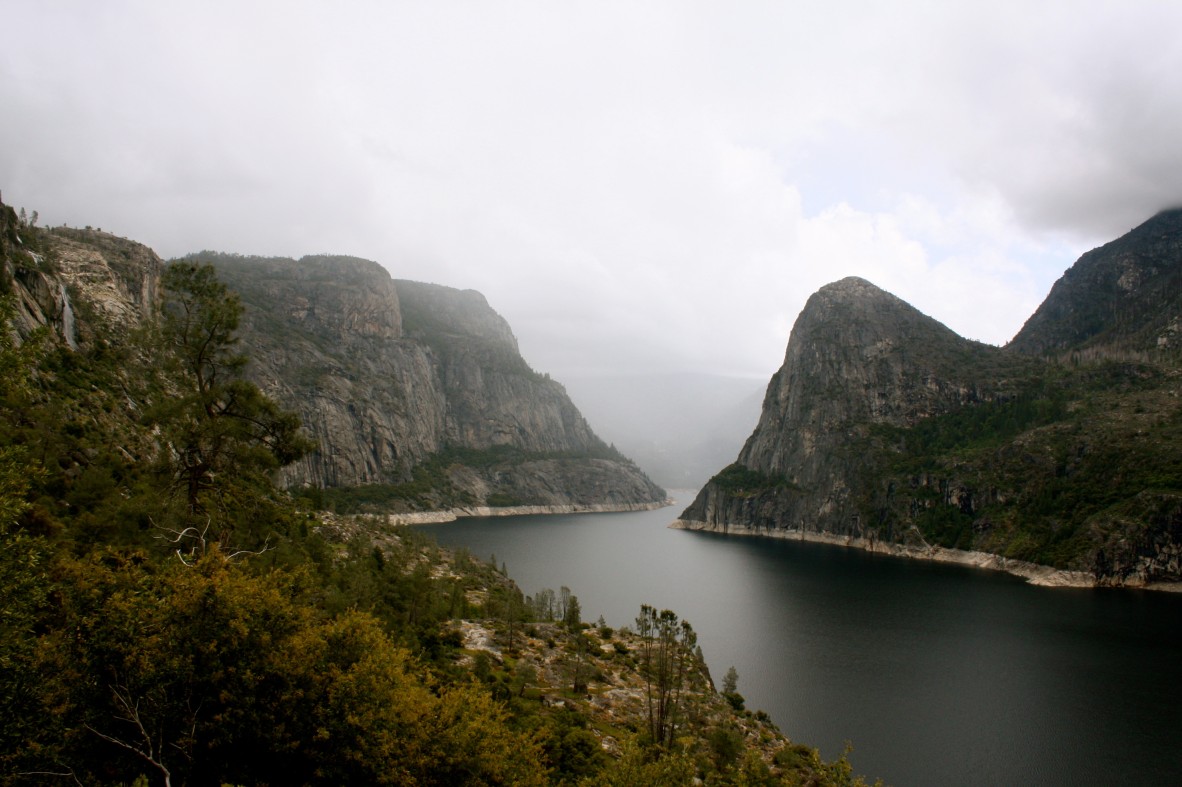
The silver lining of all of the moisture is that some of the state’s most important reservoirs are inching toward full capacity after being woefully low over the last several months. According to the California Department of Water Resources, the Folsom, Shasta, and Oroville reservoirs in the northern part of the Golden State were at one-third of total capacity on Wednesday. Water levels are continuing to increase in these critical bodies of water thanks to the current plume of moisture anchored over the state.
Southern California is also getting in on the action with 0.50 of an inch to 1 inch of rain falling in the Los Angeles and San Diego areas earlier in the week. Forecasters are calling for another 1 – 2 inches of rain through the end of the weekend for the coastal areas of Southern California.
There is a danger of mudslides and additional debris flows across the burn scar locations from recent fires. This threat will increase as the ground becomes more saturated and unstable.
The series of storms will also likely create disruptions to travel in this corner of the country. Slick roads, debris, and other issues may cause delays for motorists.
The snow levels will drop on Sunday as the storm pushes to the east. This shift will likely trigger travel delays across Donner Pass on Interstate 80 in California. While the snow will also move southward, temperatures across the Grapevine in Southern California are forecast to remain warm enough to prevent accumulating snow over these passes.
The Southwest and Four Corners region are also expected to be on the receiving end of this immense moisture. This will put portions of Utah, Nevada, Arizona, and Colorado in the crosshairs for mountain snow and valley rain by Monday. Forecasters are warning that this is just the beginning of a parade of storms expected to set up over the next week throughout the Pacific Coast and into the interior West.
After a few years of being under a La Niña weather pattern, climatologists are predicting that this weather pattern may be giving way to an El Niño pattern. La Niña happens when the sea surface temperatures in the tropical Pacific begin to cool for a long period of time. As a result, there are fewer storms that push into California and the Desert Southwest.
Thus, a strengthening of the stormy pattern is often an indicator that the La Niña weather pattern is weakening. While it is difficult to predict with certainty, most meteorologists are forecasting a re-emergence of an El Niño pattern by the late summer or early fall.
Did you find this content useful? Feel free to bookmark or to post to your timeline for reference later.

January 21, 2024

January 19, 2024

January 18, 2024
