Heavy Rain, Flooding, and Chance of Severe Weather Staring Down the Southern U.S.
January 22, 2024
Posted: October 10, 2023 2:15 pm


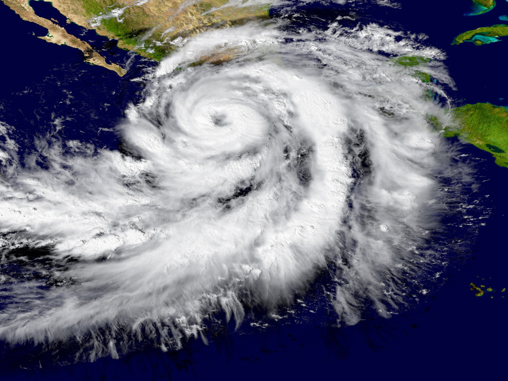
The 12th named storm of the East Pacific Hurricane season is predicted to make landfall late Tuesday in Mexico as a Category 2 hurricane. Here is the latest on this rapidly developing weather situation as Hurricane Lidia nears closer to the coast of Mexico.
Hurricane Lidia Forecast to Make Landfall Near Puerto Vallarta, Mexico
As predicted by forecasters, Tropical Storm Lidia turned into Hurricane Lidia late Monday as it churned in the eastern Pacific Ocean. The storm reached the status of a Category 2 storm early Tuesday when its maximum wind speeds climbed over 96 mph. As of mid-day Tuesday, the storm was spinning about 200 miles from the coast of the popular resort town of Puerto Vallarta, Mexico.
The anticipated track of Lidia has it moving to the northeast throughout the day Tuesday, taking aim at the west coast of Mexico. Landfall is expected to happen between the Jalisco and Sinaloa states of the country some time late Tuesday. While Lidia is predicted to remain a Category 2 storm as it comes on shore, there is still time for it to intensify into a major Category 3 storm.
Dangerous surf conditions, strong rip currents, coastal flooding, and beach erosion will be a concern along the coastline in the coming hours. High swells are already being reported along the Baja California Peninsula. A large portion of west-central Mexico was experiencing gusty winds by early Tuesday. Peak wind gusts will hit up to 100 mph in the states of Durango, Zacatecas, Jalisco, and Nayarit. Gusts as high as 120 may be a possibility near the point of landfall.
These high winds are predicted to remain across the region through Wednesday. Winds of this magnitude will likely trigger localized power outages and tree damage.
How Much Rain to Expect with Lidia
Widespread rainfall amounts of 1 – 2 inches are in the forecast for the same general area that will see the high winds, including the states of Durango, Sinaloa, Nayarit, Zacatecas, and Jalisco. A more localized 2 – 4 inches of rain is in the forecast for the upslope portion of the region stretching from Culiacán to Puerto Vallarta. A maximum amount of 4 – 8 inches could be a possibility near the eye of the storm in southern Sinaloa and Nayarit.
As is typical for tropical weather events that originate in the East Pacific and move across Mexico, the mountainous terrain of this region will impact the amount of rain that falls. It is common for air to cool in temperature as it is pushed up over the higher elevations. This movement leads to the condensation of water vapor, creating more rainfall for the windward side of the mountain ranges.
Most specifically in the case of Lidia, the Sierra Madre Occidental Mountains will see the highest amount of rain. Forecasters are warning that mudslides and flash flooding issues may be a concern in these higher terrains.
Lidia’s storm surge is forecast to land between 3 and 6 feet along the coastline of the states of Jalisco and Nayarit. Higher amounts of 6 to 10 feet are likely in the areas closer to landfall, including the city of Puerto Vallarta. Storm surge of this amount will undoubtedly lead to inland flooding.
Potential Impacts to the U.S.
Looking ahead, the leftover moisture and energy generated by Lidia is expected to move across the Mexican peninsula and into the Gulf of Mexico. These remnants could merge with another area of potential tropical activity that is coming to life in the Pacific. As a result, there is a moderate risk for a named storm to form in the Gulf of Mexico over the next few days.
Even if a feature with tropical characteristics does not develop in the Gulf of Mexico this week, the Gulf Coast of the U.S. will still see a surge of moisture as a result of this budding activity. The states of Louisiana, Mississippi, and Alabama will see the highest amount of rain and the windiest conditions later in the week.
Did you find this content useful? Feel free to bookmark or to post to your timeline for reference later.

January 21, 2024

January 19, 2024

January 18, 2024