
Heavy Rain, Flooding, and Chance of Severe Weather Staring Down the Southern U.S.
January 22, 2024
Posted: September 1, 2023 9:12 am


With the recent development of Hurricane Idalia and Hurricane Franklin, there are now 10 named storms of the 2023 Atlantic season, but forecasters predict that number could reach at least 21. This put this season on track to be nearly as active as the record-breaking 2020 hurricane season, which had 30 named storms. Is this the new normal and why?
There is no doubt that this has been another destructive hurricane season. Looking inside the numbers, an average Atlantic hurricane season pumps out 14 named storms, including seven hurricanes and three major hurricanes. With 10 storms already on the record by the September, this season is already ahead of average. The hurricane season does not officially end until November 30, providing over two more months for additional storms to develop.
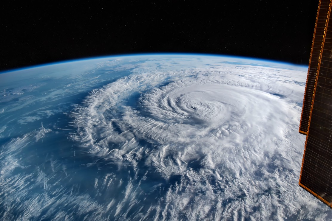
As the most active season on record, the year 2020 produced 30 named storms. Of these 30 storms, 14 intensified into hurricanes with seven of those going on to be major hurricanes, defined as a Category 3 or higher.
Not surprisingly, hurricane experts are putting the blame on climate change as a major factor in the increasing amounts of tropical activity in recent years. The warming waters in the Atlantic Ocean and the Gulf of Mexico are delivering the environmental conditions needed to fuel these strong storms.
The average water temperature in the Atlantic Ocean during this time of the year has risen about 1.85 degrees over the last 100 years. While this may not seem like a lot, it is a big enough increase to provide the necessary conditions for storms to take root and strengthen. The warm waters also make it more likely that a storm will intensify rapidly, catching more people off guard before making landfall.
An increased amount of moisture in the atmosphere because of global warming also translates to more rain associated with the storms that do develop. This could explain the greater amounts of intense flooding happening alongside these storms.
In addition to the effects on the water temperatures, climate change is also leading to an increase in sea-level rise due to the rapidly melting ice sheets and glaciers and thermal expansion. This sea-level rise is a major contributor to a more powerful storm surge when these tropical features move onto the shore.
As people who have lived through major hurricanes know, it is often the storm surge that is the most dangerous part of a tropical event. As the water crashes onto the shore, the quickly rising water levels can flood an area in an instant.
Hurricane experts are also pointing out that storms are moving slower through the ocean and when they do make landfall when compared to the past. The slower speed in the ocean gives the tropical feature more time to strengthen before it crashes onto the land. Once they do make landfall, a slower forward motion gives the storm the ability to drop higher amounts of rain before moving on.
The slower decay of storms was evident this summer when Hurricane Ida spent hours over land as a Category 4 storm before it finally dropped to a Category 3. Even after over 24 hours on land, Ida was still a Category 1 hurricane. This gave the storm loads of time to cause hundreds of miles of destruction as it stalled out in both movement and weakening.
A rise in the number of tropical events earlier in the season has also prompted the National Hurricane Center (NHC) to consider pushing forward the official start of hurricane season. As it stands now, the official season runs from June 1 through November 30. However, NHC is considering making the official start on May 15. In 2021, Subtropical Storm Ana formed on May 22.

January 21, 2024

January 19, 2024

January 18, 2024
