
Heavy Rain, Flooding, and Chance of Severe Weather Staring Down the Southern U.S.
January 22, 2024
Posted: September 29, 2023 12:42 pm


The Northeast is going to be at risk of flash flooding to close out the week as a coastal storm picks up steam in the Atlantic. When can you expect the heavy rain to fall and what areas are the most at risk? Read on for all of the details.
Coastal Storm to Impact Much of Northeast to End the Week
Forecasters are warning that frequent torrential downpours could appear out of nowhere in the coming days, catching residents off guard. Many of the region’s most populated metropolitan areas will be in the potential impact zone, including New York City, Philadelphia, and Boston.
The storm is forecast to develop right off the Northeast coast heading into the weekend. While this storm will not take on tropical characteristics, it will still present significant risks to the region. This is particularly true for areas that were just hammered with heavy rain from the former Tropical Storm Ophelia. This storm system dumped excessive amounts of rain across the area with some communities still dealing with overly saturated grounds.
The heavy rain will likely impact New York City into Friday night. In addition to the massive amounts of moisture, the quickly developing coastal storm will also usher in strong winds, rough surf conditions, and the possibility of beach erosion. In short, Friday could be a messy day from start to finish across the Big Apple and beyond.
While the storm could shift some in the coming hours, the most likely communities to take the brunt of the impacts includes the Tri-State area and up into the southern portions of New England. There is also the chance that the heavy bands of rain could push farther inland, bringing places such as the lower Hudson Valley, Philadelphia, and western New Jersey into the fold.
New York City’s Central Park has already recorded 8.35 inches of rain so far in September. This amount compares to the historical average for the month of 4.31 inches. The exceptionally wet September means that this part of the region will be more susceptible to flooding concerns.
Potential Rain Measurements
How much rain can you expect out of this weather maker? Forecasters are predicting widespread amounts of 2 to 3 inches. A smaller zone of 4 to 8 inches is also in the forecast for areas of western Long Island to the north of Manhattan. This includes the southwestern corner of Connecticut.
For New York City proper, the forecast is calling for about 1 to 2 inches of rain during the day Friday with another half of an inch in store after the sun goes down. Winds will be out of the northeast at 10 to 15 mph. The rain and winds will keep the temperatures in the low 60s for a high. The moisture will hang around into the early part of the day Saturday before moving out of the city.
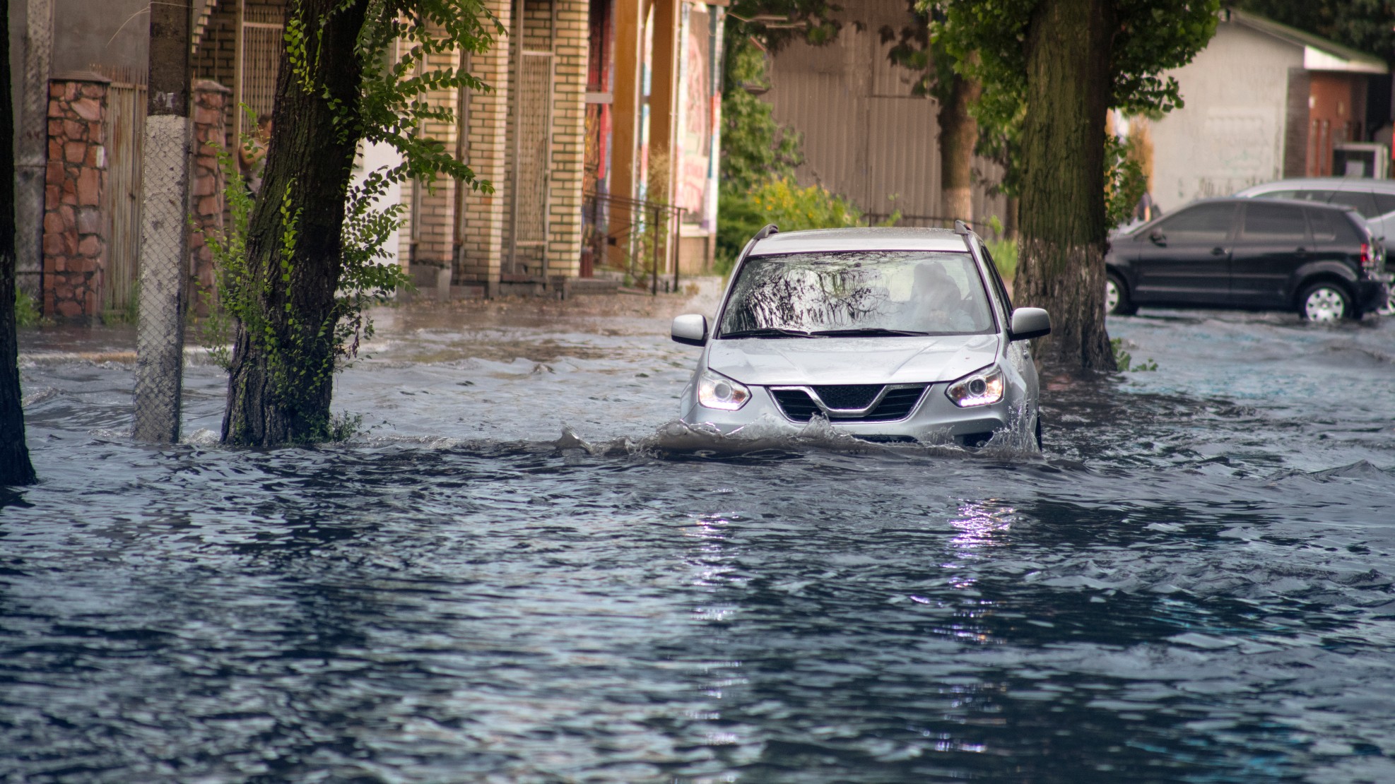
Rainfall rates could top 1 inch per hour during the worst of the downpours. Rain that comes down this fast will almost certainly cause flash flooding issues in some urban areas. Urban areas have a more difficult time absorbing water, heightening the risk of runoff and flooding.
It will not be quite as rainy to the north in Boston. After starting the day on a dry note, the rain will pick up later in the afternoon and evening hours with the heaviest of the precipitation anticipated for the overnight hours. However, it will take longer for the rain to dissipate on Saturday when compared to New York City. Boston will see highs in the low 60s both Friday and Saturday with winds clocking in between 10 and 15 mph.
Several Hazards to be Mindful About
Motorists should be wary of street flooding and exercise caution when approaching roads that may look underwater. Air travel may also be disrupted as a result of this storm. Be sure to check with your airline if you are flying into, out of, or through the busy hubs in New York City, Philadelphia, or Boston.
This intense storm will also keep the beach hazards in place that have been a problem since last weekend when Ophelia crawled up the East Coast. The strong onshore winds will create the risk of coastal flooding.
Warmer and Drier Weather Pattern on Tap for Next Week
Drier and warmer weather will be in store for the Northeast once it gets through this rough patch. An area of high pressure is expected to set up over the region by the end of the weekend. This high pressure will provide an extended stretch of dry weather that pairs with sunny skies.
High temperatures will hover in the 70s for most of the region with some areas to the south potentially cracking the 80-degree mark. These temperature readings equate to levels that are about 5 to 10 degrees above the historical average for the start of October.
After such a rainy and dreary September, residents will be sure to take advantage of the nice weather pattern to finally enjoy some classic fall activities.
Did you find this content useful? Feel free to bookmark or to post to your timeline for reference later.

January 21, 2024

January 19, 2024

January 18, 2024
