
Heavy Rain, Flooding, and Chance of Severe Weather Staring Down the Southern U.S.
January 22, 2024
Posted: January 26, 2023 5:12 pm


The relentless parade of snow events is continuing across a large part of the Great Lakes and the Appalachians. Just one day after a storm moved through the area, another system is gearing up to bring the potential of dangerous snow squalls and damaging winds starting late Thursday and continuing through Friday. Here is what you need to know before you head out on the roads.
Get Ready for More Snow in the Great Lakes and Beyond
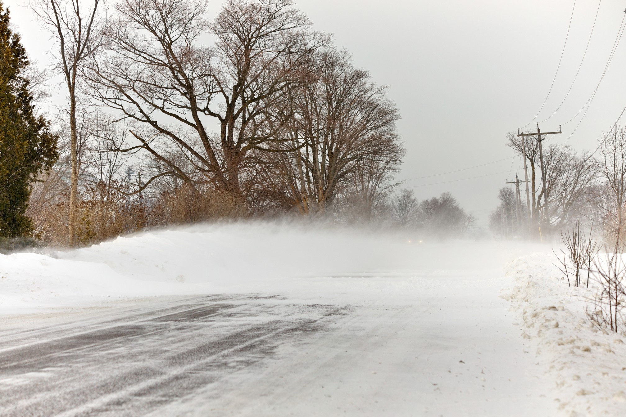
Forecasters are warning that this next threat of snow will likely produce snow squalls, short bursts of heavy snow that pair with strong winds to create dangerous driving conditions due to poor visibility. These snow showers and squalls are predicted to fire up late in the day Thursday, beginning in the southwestern corner of Michigan and moving into northern portions of Indiana. By the evening and overnight hours, the snow will impact much of Ohio, West Virginia, eastern Kentucky, southwestern New York state, and western Pennsylvania.
This next weather event will be triggered by a mass of energy spinning in the upper levels of the atmosphere. The energy will pick up the moisture that hovers over Lake Erie and Lake Michigan to create the necessary conditions to produce the snow squalls. Despite the squalls only lasting for about 30 minutes at a time, the energy and moisture associated with these events will be enough to drop 1 to 3 inches of snow in a fast amount of time.
The quick-hitting snow event often leads to dangerous driving conditions. Not only do roads ice over quickly but the presence of strong winds contributes to visibility that can fall to near zero in a matter of minutes. Snow squalls are often the factor in vehicle pile-ups because they come on so suddenly.
Motorists should be ready for the greatest threat on the roads in the overnight hours as darkness makes the onset of squalls particularly dangerous. The risk of snow squalls will begin to diminish by Friday morning when the energy breaks apart. However, you can expect a few lingering snow flurries in the area for the morning commute.

Looking Back at the Midweek Snow Event
The snow squalls are simply a continuation of the winter weather that has been impacting this part of the country this week. Multiple car accidents were reported across the Midwest on Wednesday as a result of the treacherous travel conditions.
Air travelers encountered disruptions to flight schedules. As of Wednesday afternoon, there had already been over 3,600 flight delays in the Midwest, Great Lakes, and the Northeast. The busy hubs in Chicago and Detroit were hit particularly hard with the delays and cancelations. A ground stop was in effect Wednesday afternoon for Detroit Metropolitan Wayne County Airport because of excessive snow on the runways.
The Ozark Mountains in northern Arkansas and southern Missouri were hit the hardest with the snow. This region experienced widespread power outages as a result of the heavy snow. The accumulation topped the one-foot mark in many areas. Some of the most impressive snowfall totals included Logan, Arkansas coming in at 16 inches and Howell, Missouri recording a foot of new accumulation.
Snowfall amounts over 6 inches were also reported in locations across West Virginia and Maryland.
Did you find this content useful? Feel free to bookmark or to post to your timeline for reference later.

January 21, 2024

January 19, 2024

January 18, 2024
