
Heavy Rain, Flooding, and Chance of Severe Weather Staring Down the Southern U.S.
January 22, 2024
Posted: January 19, 2023 3:22 pm


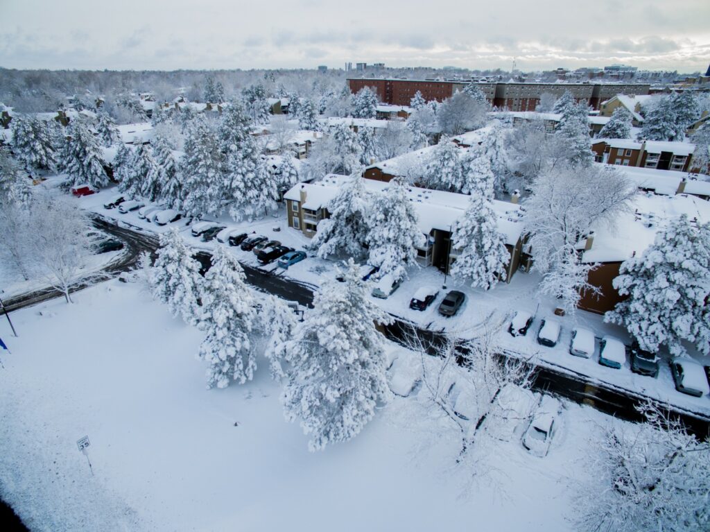
The winter storm that slammed the Rockies and the Upper Midwest is now tracking to the east. Here is a look back and a look ahead at this immense weather system.
A large section of Interstate 70 in Colorado was closed on Wednesday due to the deteriorating road conditions. This major roadway was closed between the area surrounding Denver International Airport all the way to the Kansas border, a stretch of over 150 miles.
By Thursday morning, only a small portion of the highway remained closed as crews worked to remove the debris left from a crash. There were multiple accidents reported along the highway before it was closed for over 16 hours. One crash near Strasburg, Colorado involved over 20 vehicles. Colorado State Patrol (CSP) troopers said that it was a miracle that nobody was seriously injured in this pileup.
The heavy snow also triggered chaos at the Denver airport, a major hub for United Airlines. There were over 175 flights canceled out of the airport on Wednesday with at least 440 more delays. Operations are slowly returning to normal on Thursday.
Not all of the news was bad coming out of this storm. Some of the region’s most popular ski resorts were hammered with snow as the system made its way over the Rocky Mountains. The Wolf Creek Ski Resort in southwestern Colorado reported 52 inches of snow. Nearby Crested Butte saw four feet of new accumulation.
In addition to the Colorado ski resorts, areas of Nebraska also saw jaw-dropping accumulation out of the storm. Milfoil Township reported 23.7 inches of snow while Callaway saw 23 inches. Merna came in at 22 inches. The Nebraska State Patrol (NSP) said that it responded to over 230 calls for help on the roads on Wednesday, including about 30 vehicle crashes. Troopers are cautioning drivers to take it easy on Thursday and be prepared for delays.
By Thursday morning, the heaviest snow bands were moving through Iowa and into the Upper Peninsula of Michigan. Forecasters are calling for 6 – 12 inches of snow in northern Michigan. Some residents of the Upper Peninsula also woke up to the rare weather phenomenon known as thundersnow.
With more cold weather in store for the long-range forecast, this snow is likely to stick around on the ground for some time.
This dynamic storm system is also creating distress in the form of severe thunderstorms. The National Weather Service (NWS) confirmed an EF1 tornado in Waldo, Arkansas on Wednesday. This twister packed a maximum wind speed of 100 mph, leaving a trail of damage and bringing down trees and power lines. There were no fatalities reported as a result of this tornado.
The line of severe weather will continue its journey to the east throughout the day Thursday, putting the Ohio Valley in the line of fire for heavy rain, damaging winds, and the threat of isolated tornadoes.
The storms will also expand to the south, potentially disrupting the afternoon commute for areas of the northern Gulf Coast and into the western Carolinas. This severe weather could potentially creep as far north as Maryland and Delaware by the end of the day. Thursday’s active weather pattern is not predicted to be as severe as what the region saw on Wednesday. In addition, the late day storms will not pack as much energy as what the area experienced earlier in the day.
Did you find this content useful? Feel free to bookmark or to post to your timeline for reference later.

January 21, 2024

January 19, 2024

January 18, 2024
