
Heavy Rain, Flooding, and Chance of Severe Weather Staring Down the Southern U.S.
January 22, 2024
Posted: December 1, 2022 1:09 pm


Right on schedule, the first day of December is going to bring much colder air to much of the U.S. Strong winds will also accompany the colder temperature readings, making it feel like winter for many areas across the northern tier of the country.
It has already been a markedly different weather pattern for the Midwest over the last 24 hours. The temperature plummeted 20 – 30 degrees from Tuesday into Wednesday with the arrival of a powerful cold front. Highs in the 40s through the 60s were forced to make way for readings in the 20s, 30s, and 40s over the course of just one day.
The drop in the mercury will feel like quite the change after a fall that saw temperatures above normal in some places. Temperatures at the beginning of September were up to 10 degrees above average in major cities such as New York City and Chicago. However, these cities will see the thermometer fall to a few degrees below normal to start the month of December due to the Arctic air that began its push through the Midwest on Wednesday.
The cold air is forecast to continue its track to the east on Thursday, reaching the Appalachians and the Atlantic Seaboard by the end of the day. For instance, the high in Chicago will top out at about 37 degrees on Thursday, down from the average of 40 degrees. New York City will only hit about 43 degrees on this day, a departure from the average of 50 degrees on December 1.
The cold air pushing through the Midwest and Great Lakes region is pairing with gusty winds to make it feel even chillier. Gusts up to 60 mph have been in the forecast over the last 24 hours, triggering a good chance of lakeshore flooding and power outages.
The cold weather that settled into the Midwest on Wednesday will make its presence known in the central and northern Appalachians by Thursday with real feel readings in the single digits. The areas surrounding lakes Erie and Huron will also see real feel readings that only register in the single digits. It will be real feel temperatures in the teens and 20s pushing into the Atlantic coast thanks to the strong winds.
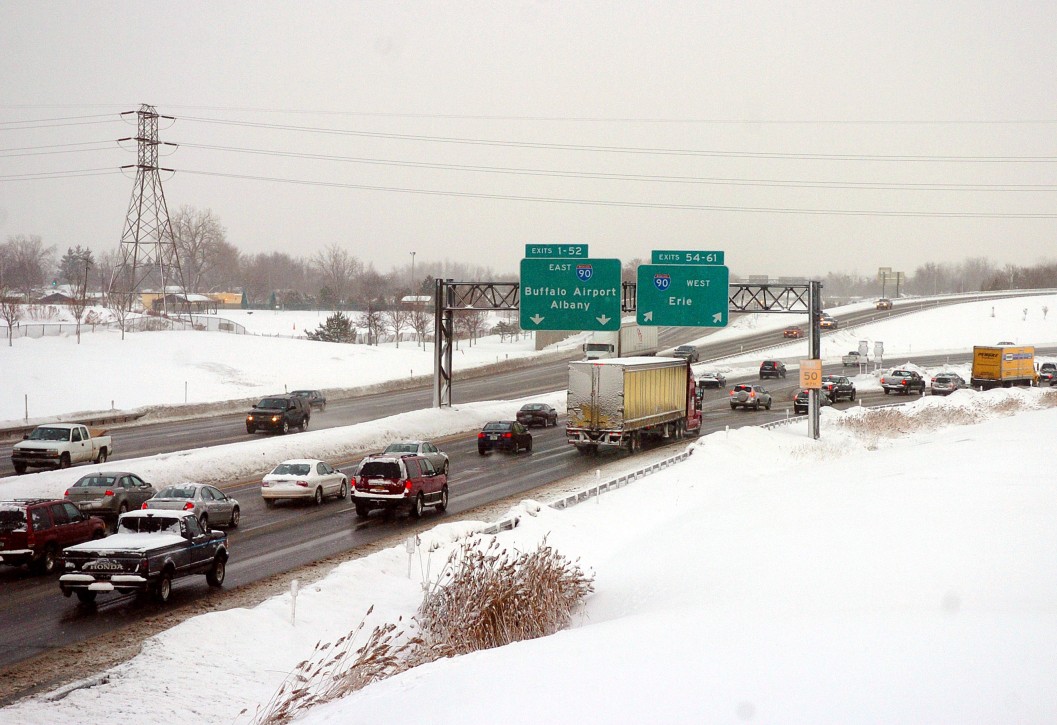
As is typical with this weather pattern, the cold winds moving across the Great Lakes will fire up the lake-effect snow machine. The good news is that this snow event will not come close to equaling the intensity of the lake-effect snow that pummeled the region in the middle of November.
However, the area south of Buffalo downwind from Lake Erie is predicted to be in the primary impact zone. A general 3 – 6 inches of snow is expected for this region with greater amounts in the forecast for the area east of Lake Ontario and the Tug Hill Plateau in northern New York state.
Forecasters are also warning that the lake-effect snow may shift farther to the south than is typical because of the strong winds. The precipitation coming off of Lake Erie may reach as far south as the Catskills and the middle portions of the Hudson Valley. Similarly, the snow generated by Lake Ontario is predicted to hit as far as the Green Mountains in Vermont.
Travelers driving through the Great Lakes region should be ready for rapidly changing conditions, including but not limited to, sudden snow squalls and reduced visibility.
The mercury will start an upward swing on Thursday for the Midwest just as the bitter cold is moving into the Northeast. By Friday and Saturday, the Northeast will be the beneficiary of the warmer weather. For instance, Chicago will enjoy readings inching up near the 50-degree mark on Friday with New York City chiming in with temperatures in the upper 50s by the start of the weekend. These temperatures represent an increase of about 5 – 10 degrees above normal for the first weekend of December.
Did you find this content useful? Feel free to bookmark or to post to your timeline for reference later.

January 21, 2024

January 19, 2024

January 18, 2024
