
Heavy Rain, Flooding, and Chance of Severe Weather Staring Down the Southern U.S.
January 22, 2024
Posted: November 9, 2022 1:15 pm


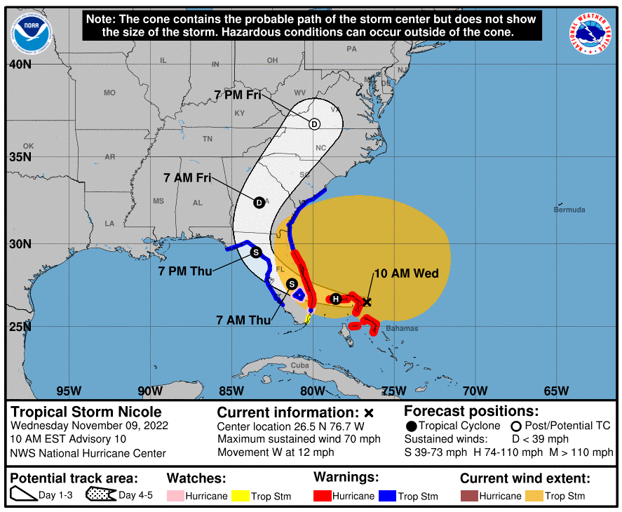
Tropical Storm Nicole is forecast to strengthen into a Category 1 hurricane in the coming hours, ahead of its anticipated landfall early Thursday morning along the east coast of Florida. Here is what you need to know about this developing situation.
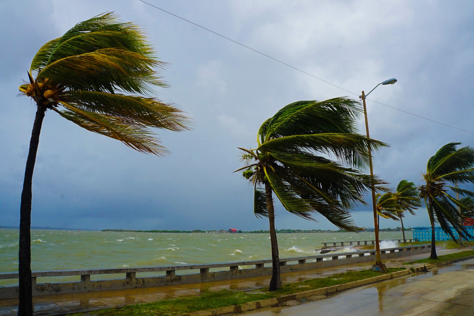
As of Wednesday morning, Tropical Storm Nicole was located about 240 miles east of West Palm Beach. The storm is packing maximum sustained winds of 70 mph, an increase of about 20 mph from the day before. Nicole is moving to the west and southwest at a speed of 13 mph.
Nicole was able to intensify in the overnight hours Tuesday into Wednesday as a more organized area of showers and thunderstorms began to form near the storm’s center. This movement continues to fuel the intensification trajectory that Nicole has been following the last few days.
The storm is predicted to continue to turn to the southwest as it churns over the Bahamas and begins its final acceleration to the northwest just in time to make landfall on the coast of Florida between Palm Beach and Melbourne. The National Hurricane Center (NHC) is predicting that Nicole will slam into the east coast of Florida late Wednesday or early Thursday.
There are a large number of warnings and watches in effect as Nicole nears closer. A hurricane warning is now in effect for a long swath of coastline in Florida and across the northwestern Bahamas. In addition, a tropical storm warning is in effect for the northeastern corner of coastal Florida and up through parts of the Georgia coastline. There is another stretch of Florida coast on the Gulf of Mexico side between Bonita Springs and Indian Pass that is under a tropical storm warning.
More watches were added to the list Tuesday when forecasters issued a storm surge watch in an area stretching from the Savannah River in Georgia northward to the South Santee River in South Carolina. An additional storm surge watch is in place from Florida’s Suwannee River to the Ochlockonee River. Lastly, a tropical storm watch was issued in a zone located north of Georgia’s Altamaha Sound to South Carolina’s South Santee River.
Experts are understandably concerned about the potential of a strong storm surge with this storm. Water levels may rise 3 – 6 feet in the waterways near the location of the landfall. In addition to the primary impact zone, the surge may be an issue to the north of the landfall location.
What is most worrisome about this storm surge is that it is expected to strike areas that were compromised by Hurricane Ian’s wrath, leaving them vulnerable to more damage. Storm surge is a possibility in an area north of West Palm Beach all the way to Tybee Island, Georgia.
The good news for Floridians is that the area of the state that was hit the hardest by Ian will likely be spread the greatest impacts of Nicole. The winds associated with Nicole are not expected to hammer Southwest Florida, translating to minimal effects to this corner of the peninsula. In addition, the storm’s duration will not be long enough to send water from the Gulf of Mexico back into the communities of Cape Coral and Fort Myers Beach, areas that took a direct strike from Ian.
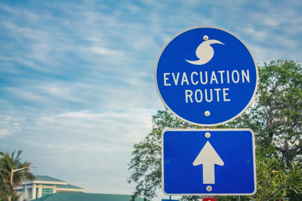
Several Florida counties began issuing evacuation notices on Tuesday in advance of Nicole’s landfall. Palm Beach, St. Lucie, and Brevard counties were all put under some type of evacuation level in some portions of the region on Tuesday. These include barrier islands, those in low-lying and flood-prone neighborhoods, and residents living in vulnerable housing. Local officials are strongly urging all residents to follow the evacuation orders in their area.
Mandatory evacuation orders were also scheduled to go into effect on Wednesday in some areas of Volusia County. This is in addition to the increase in the number of evacuations called for in Palm Beach County.
As with most storms of this magnitude, Nicole’s impacts will not be limited to just Florida. The storm will eventually turn back to the northeast as it makes the transition to a tropical rainstorm. This track will bring it across Georgia and into the Carolinas. Forecasters are predicting that a general 2 – 4 inches of rain will fall along the spine of the Appalachian Mountains and out toward the Eastern Seaboard.
There is also the strong possibility of urban flooding for areas impacted by the heavy rain. This is likely because the bulk of the rain and wind will happen in a short period of time and will be exacerbated by the presence of fallen leaves on the ground that can clog storm drains.
Residents living along the busy Interstate 95 corridor should also be ready for gusty winds that will bring the potential of fallen power lines and tree limbs. Strong storm surge will likely be an issue for coastal cities in the Southeast, including Charleston, South Carolina. This storm surge will get going Thursday night and continue through Friday morning.
Lastly, Nicole may also spawn the potential of locally severe thunderstorms in an area stretching from Florida into North Carolina. These storms carry the risk of isolated waterspouts and tornadoes.
Did you find this content useful? Feel free to bookmark or to post to your timeline for reference later.

January 21, 2024

January 19, 2024

January 18, 2024
