Heavy Rain, Flooding, and Chance of Severe Weather Staring Down the Southern U.S.
January 22, 2024
Posted: August 8, 2023 3:00 pm


Severe storms swept up and down the Eastern Seaboard on Monday, killing at least two people. More severe weather will impact the central and eastern portions of the U.S. in the coming days. Here is the latest on the storm forecast for the nation this week.
The week started with a bang on the East Coast with a large complex of deadly thunderstorms spinning up on Monday. It was the most significant severe weather outbreak since March, impacting a large area from Georgia up through New York State.
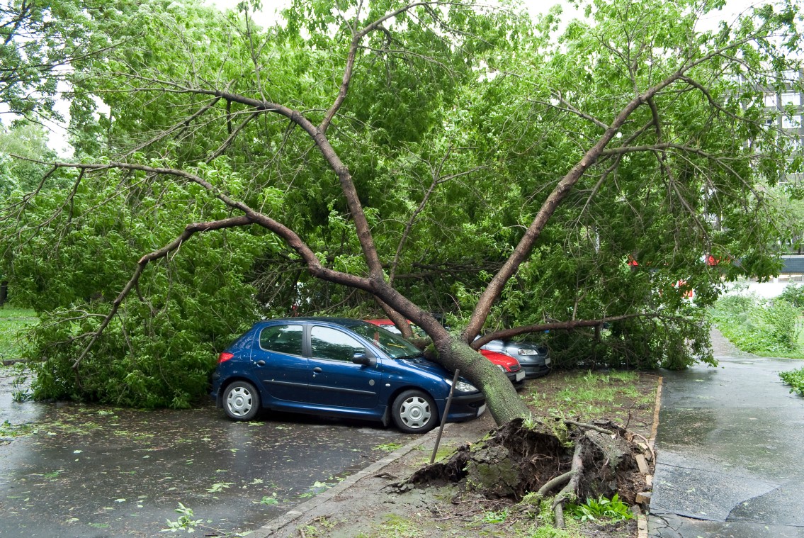
A teen boy was killed by a fallen tree in Anderson, South Carolina while a man in Florence, Alabama was killed by a lightning strike. In addition, falling trees were blamed on at least three injuries in Shrewsbury, Pennsylvania and Westminster, Maryland.
About 400,000 Americans were without power on Tuesday morning although this number hit 1 million at the height of the outages on Monday evening. Restoration crews are warning that some communities could be without power for days.
According to the Storm Prediction Center (SPC), there were over 500 reports of wind damage on file from this event. The total number of overall storm reports chronicled by the SPC on Monday was distinguished as the second-highest day of 2023 thus far, landing behind March 31.
The storms also triggered widespread travel disruptions. Over 1,700 flights were canceled by the time the day was over with nearly 9,000 reported delays. Ground stops were in effect at some point during the travel day for Baltimore, Washington, D.C., Philadelphia, and the New York City airports.
Some of the storm cells also produced hail as large as golf balls. The worst of the hail was focused on Virginia and Maryland.
This same storm system will move up into New England on Tuesday, bringing the risk of flash flooding across Maine, New Hampshire, Vermont, and the northern tier of New York state. This is the same general area that saw flooding rainfall in July.
These storm cells could also produce isolated tornadoes. You will want to stay abreast of changing weather conditions if you live in this area.
Another complex of storms riding along with a cool front will impact the Southeast into late Tuesday. This complex dumped significant amounts of rain across eastern Oklahoma and the western edge of Arkansas to start the day.
The areas most likely to see severe storms erupt later Tuesday include Arkansas, Louisiana, Georgia, South Carolina, and the northeastern corner of Florida. These storms will bring the typical impacts, including strong winds and hail as a possibility.

The Plains will also be at risk of experiencing sporadic storm eruptions on Tuesday and Wednesday. These storms will be fueled by the energy coming down the slopes of the Rocky Mountains, spreading into parts of Nebraska, Kansas, and Wyoming on Tuesday.
By Wednesday, the potential impact zone will shift into the middle Mississippi Valley, encompassing the major cities of St. Louis and Nashville. The heaviest of the rain and the strongest impacts will likely be felt throughout southern Missouri, northern Arkansas, and south-central Kentucky.
The rain will be loaded with enough punch to trigger the chance of urban and small stream flooding for this zone. A good portion of this area already took in up to 12 inches of rain last week, making the grounds more susceptible to flooding.
The southeastern corner of the U.S. will see another round of potentially severe storms on Thursday as the weather maker fires up across the Carolinas and into Virginia. The northern half of Georgia and the eastern edge of Tennessee may also get in on some of this action.
There is also the slight chance that the storms move far enough north to impact the Washington, D.C. area once again. Even if this part of the mid-Atlantic does not see severe storms, it will likely experience a steady rainfall to add to the August moisture totals.
Lastly, a third storm system is on the horizon for the northern U.S. on Thursday and Friday, including a large area of the Dakotas and into Minnesota and into the upper Great Lakes. This system is forecast to bring locally severe storms that should be monitored closely as the end of the week approaches.
Did you find this content useful? Feel free to bookmark or to post to your timeline for reference later.

January 21, 2024

January 19, 2024

January 18, 2024