
Heavy Rain, Flooding, and Chance of Severe Weather Staring Down the Southern U.S.
January 22, 2024
Posted: October 24, 2023 12:00 pm


The Rocky Mountain region and the northern Plains are bracing for what could be the first major snow event of the season this week. In addition to the measurable snow, the incoming weather maker will also usher in bitterly cold temperatures and high winds. Here is what you need to know about this blustery forecast.
Cascade Mountains Take First Shot of Snow
The winter weather has already fired up in some parts of the Northwest to start the work week, bringing in a stark change to the warm and dry conditions of last week. The first snow is expected to make an appearance late Monday and into early Tuesday for the higher terrains of the Pacific Northeast and the northern Rockies. This means that the Cascade Mountains in Washington and Oregon and the top terrains across northern and southeastern Idaho, western Montana, and the northwestern corner of Wyoming should expect snow in the coming hours.
This first round of wintry precipitation will be the appetizer for a bigger snow event later in the week. The early week system will mostly consist of rain for the Great Basin and to the east. However, this moisture will begin to transition to snow as the colder air mass moves in from the north and west.
Temperatures are expected to take a dramatic tumble, falling as much as 50 degrees from the near-record highs of last week. The coldest air of the season thus far will push in behind the second round of moisture set to fire up late this week.
Forecasters are warning that the late week snow could create blizzard conditions. This is the time to start unpacking all of your winter equipment and supplies, ranging from snow coats to shovels to de-icer.
Timing of This Week’s Winter Weather
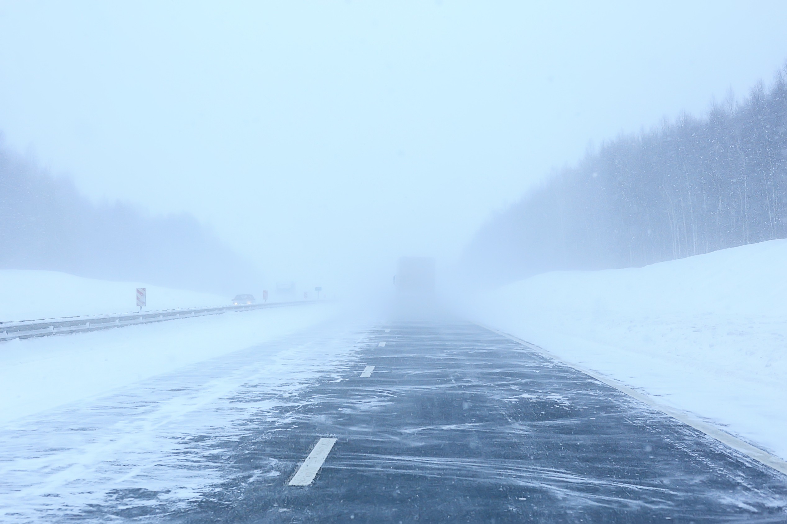
A large area of low pressure will come on shore from the Pacific Ocean into the Northwest on Tuesday, triggering the formation of more snow across the Washington Cascades. This mountain range can expect to see 6 – 12 inches of snow through Wednesday. The snow will fall across some of the region’s most heavily traveled mountain passes, potentially leading to road closures.
Snow will also begin to fall across the northern Rockies during this same time period. The temperatures accompanying this round of snow will drop below freezing, leading to accumulations on roadways and sidewalks. Motorists should be ready for a slow Wednesday morning commute throughout much of Montana, Washington, and Idaho.
The Cascades across Oregon will also see snow ranging from 3 – 6 inches. This amount of snow is in the forecast for central and northern Idaho, northern Wyoming, and the bulk of Montana. Higher amounts of snow are in the forecast for the Bitteroots and Yellowstone National Park.
The central Rockies and the northern Plains will begin to see this snow push into the area by Thursday. This snow will pair with gusty winds to create the possibility of blizzard conditions and reduced visibility for parts of the Dakotas. Portions of interstates 29, 90, and 94 in the northern Plains may see significant snow drifts and other hazardous driving conditions by the end of the week.
Roadways may also be compromised because of the rain that is forecast to precede the snow on Tuesday and Wednesday across the northern Plains. The leftover water on the road may freeze later in the week with the snowfall making the conditions worse on the roads.
Arctic Air Intrusion to Send Temperatures Plummeting
Shortly after the second burst of snow arrives, a blast of Arctic air will move in and send the temperatures tumbling further. This Arctic air mass will be responsible for the coldest air to invade the northern U.S. since last spring. The mercury will land 15 – 35 degrees below the historical norm by late Thursday in Montana and Wyoming.
Some parts of the northern Rockies will experience the first subzero temperatures of the season. Meanwhile, a large portion of the Pacific Northwest and the northern Plains will see widespread readings that fall into the single digits and teens heading into the weekend. As cold as this may feel to those not accustomed to the winter weather yet, these readings will not likely venture into record-breaking territory. The chill in the air is also predicted to hang on into the early part of next week, making for a cold Halloween for the kids.
Did you find this content useful? Feel free to bookmark or to post to your timeline for reference later.

January 21, 2024

January 19, 2024

January 18, 2024
