
Heavy Rain, Flooding, and Chance of Severe Weather Staring Down the Southern U.S.
January 22, 2024
Posted: December 12, 2022 3:34 pm


It has been a rough start to the work week in the Northeast thanks to a winter storm that triggered a host of air delays and snarled traffic.
A snow storm that got going in earnest on Sunday is to blame for the travel difficulties over the last 24 hours. For some parts of the region, it was the first meaningful snow of the season. While the snow created a winter wonderland across several states stretching from Pennsylvania into Massachusetts, it also created a travel headache.
Part of the problem in Massachusetts was a thin layer of ice that formed in the eastern edge of the state before the snow started falling. Worcester was hit particularly hard with the ice storm, leading to at least 70 car accidents on Sunday.
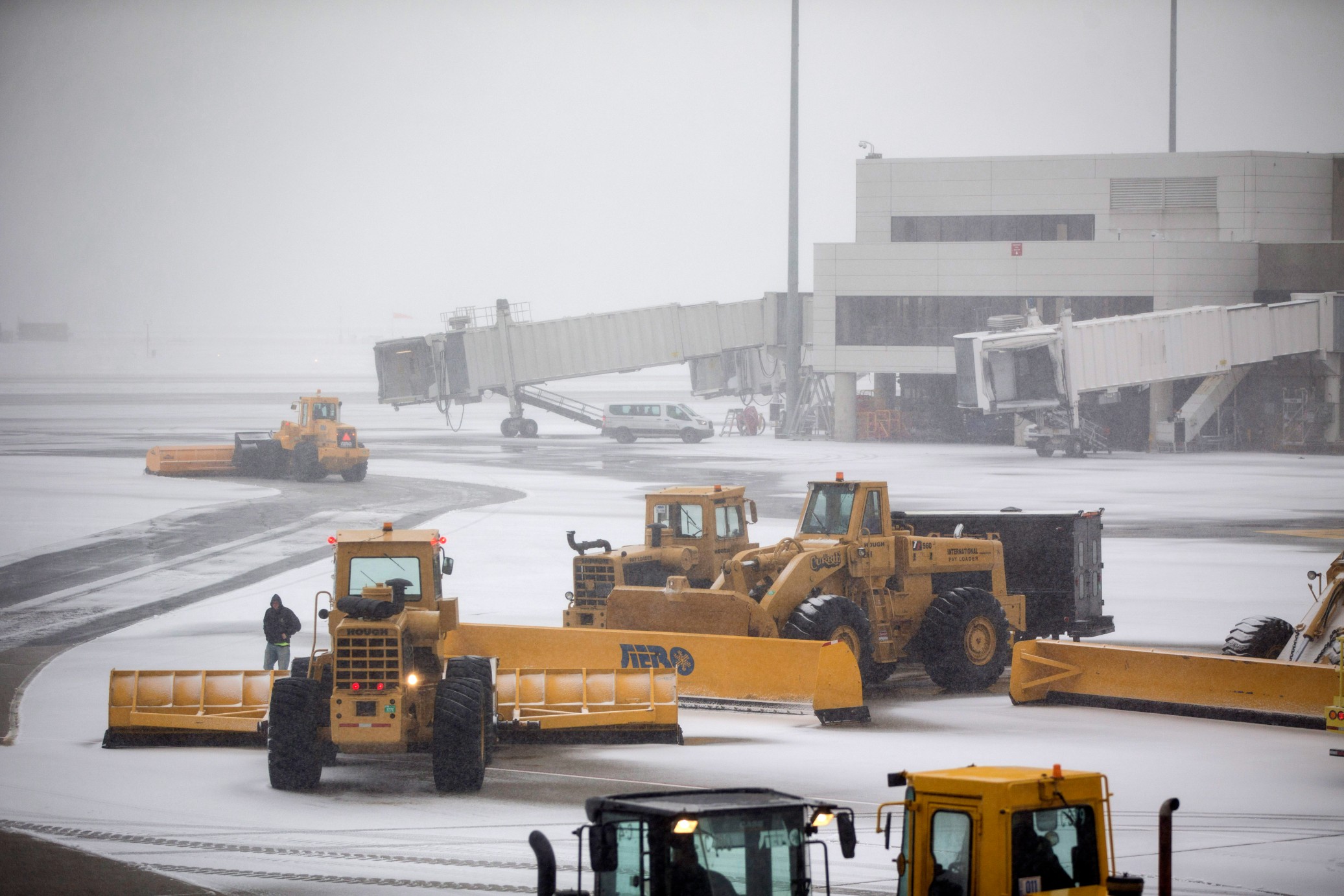
The wintry precipitation also caused mass havoc at busy Boston Logan International Airport on Sunday evening. Arriving passengers were stuck on the tarmac for hours. Departing passengers also reported difficulties with some travelers reporting waiting of up to seven hours on the tarmac before being sent back to the terminal.
Airline officials apologized for the delays, saying that the issues were caused by backups in the deicing process. While Boston had escaped heavy snow, it was the ice causing the issues with temperatures landing below zero degrees all day.
The western part of Massachusetts was the area of the state that saw the most snow. Portions of the Berkshire Mountains in western Massachusetts recorded 9 inches of snow.
The snow was also falling across southern New England. Avon, Connecticut recorded the state’s highest snowfall total for the day, coming in at 6 inches. Many areas of New York state eclipsed the 6-inch mark. For instance, the town of Berlin near the border with Massachusetts saw 9 inches of snow by Monday morning. Other towns that recorded over 7 inches of snow included Salisbury, Perth, and Clifton Park.
Although Pennsylvania was not hit quite as hard as some of its neighboring states, the Commonwealth still saw a few isolated snowfall totals of around 6 inches in the eastern tier. For instance, White Mills reported 6 inches of fresh accumulation.
The edge of the storm system tracked as far south as Maryland early Sunday. However, the impacts came in the form of freezing rain rather than snow.
The worst of this particular storm system is now in the rearview mirror. This corner of the country is already reporting improving conditions as the system moves off land and into the Atlantic Ocean. While the bulk of the accumulation on roads will start to melt, untreated areas may freeze up when the temperature drops again on Monday night.
This early week storm is forecast to be just the beginning of the wintry precipitation for the Northeast in the coming days. A monster storm system is now coming together in the nation’s heartland. This powerful weather maker is already delivering severe thunderstorms to the south-central U.S. and whipping up snow in the central Rockies and the northern Plains.
The storm is forecast to continue its track to the east later this week. The system will likely cause significant travel disruptions by Thursday and Friday for many areas of the Northeast. The moisture and energy associated with this system will meet with temperatures that are hovering below average to create a wide array of wintry conditions. This will likely translate to snow for the interior portions of the Northeast and a rain and snow mix in the Atlantic coastal areas.
Did you find this content useful? Feel free to bookmark or to post to your timeline for reference later.

January 21, 2024

January 19, 2024

January 18, 2024
