
Heavy Rain, Flooding, and Chance of Severe Weather Staring Down the Southern U.S.
January 22, 2024
Posted: June 2, 2023 8:13 am


The severe weather that has been pounding much of the central U.S. this week is set to continue into the first part of the weekend. However, relief may be on the way for next week. Here is a look at the latest storm forecast for the nation’s heartland.
The western Plains has been ground zero for severe weather this week as the calendar flipped from May to June. These threats are forecast to hang on through at least Saturday, bringing a number of impacts to the battered region. At least nine states are expected to see some form of severe weather on Friday and Saturday.
The potential impacts with this weather maker includes strong winds, large hail, heavy rain, and isolated tornadoes. In other words, another typical early June day for the central U.S.
It has been a rocky week for a large portion of the western Plains, the Southeast, and the Rocky Mountain region. Daily thunderstorms have been the story for much of the region, particularly in the late afternoon and early evening hours when the temperature heats up.
There have been hundreds of confirmations of severe weather events across this area since the middle of May.
Thursday was another stormy day across the eastern Rockies, the northern Plains, and the southern Plains. These storms hit the same general area that saw Wednesday’s storm activity, including a large swath of Texas, New Mexico, and Oklahoma.
The good news is that the storm weary region will begin to see a drier weather pattern unfold by later in the weekend. However, residents will need to get through a few more days of tumultuous conditions.

Friday is setting up to be the worst day of the week for severe weather. A moderate risk of severe storms is in place for hundreds of miles, expanding from the Texas panhandle and into the southwestern corner of Kansas. The greatest risk of damaging storms will be in the afternoon and evening hours.
Once again, Lubbock and Amarillo, Texas will see the highest risk of severe weather. Amarillo will wake up to cloudy skies with storms developing in the afternoon. Rainfall amounts could hit over an inch with winds out of the south at 10 to 20 mph. Highs will struggle to get out of the low 70s for a high.
Forecasters are warning that there is a chance of tornadic activity after the sun goes down. Storms that pop up under the cover of darkness can be particularly dangerous, making it important that you stay aware of any developing weather conditions in your community.
In addition to the chance of tornadoes, Friday’s storms could produce large hail and destructive winds. The winds will be capable of sending dirt and dust flying through the air, potentially reducing visibility for motorists.
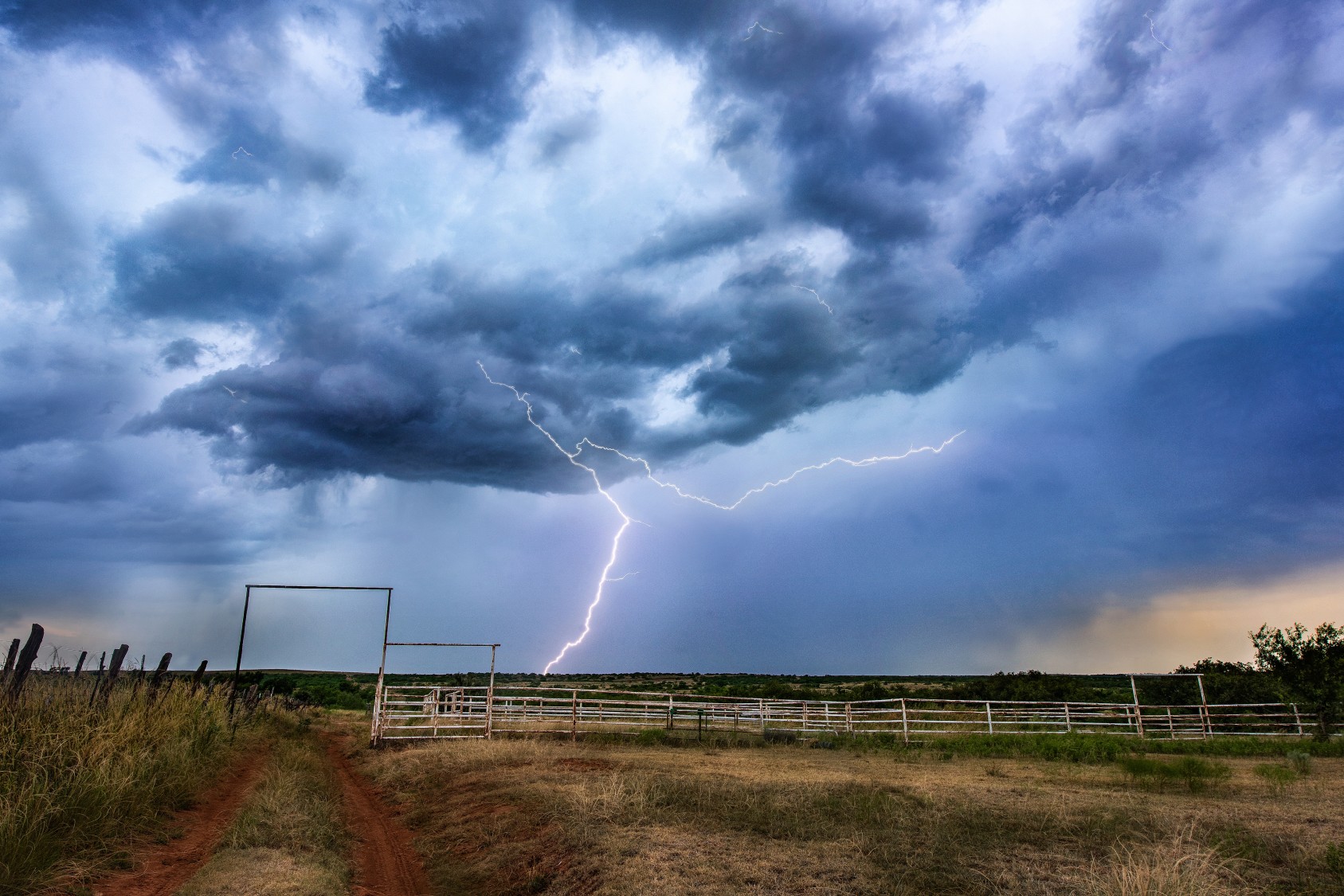
Frequent lightning strikes will be another potential danger accompanying this line of storms. Four people have been killed by lightning strikes this year already in the U.S., drawing attention to the deadly nature of these thunderstorms.
Saturday will bring one last day of severe weather. Western Texas will once again be in the bullseye of these storms. The storm cells may reach as far east as the Texas Hill Country, barely missing the greater San Antonio area. The southeastern corner of New Mexico will also be in the primary impact zone for Saturday’s storms.
As with Friday’s activity, the most likely impacts will be hail, torrential rain, and strong winds. Wind gusts of up to 90 mph are not out of the question for this corner of the country on Saturday.
A calmer pattern is in the cards heading into the new week. A lack of energy circulating in the atmosphere will mitigate the odds of strong storms erupting over the Plains. However, you cannot rule out an isolated storm in the central U.S. through next week.
Did you find this content useful? Feel free to bookmark or to post to your timeline for reference later.

January 21, 2024

January 19, 2024

January 18, 2024
