
Heavy Rain, Flooding, and Chance of Severe Weather Staring Down the Southern U.S.
January 22, 2024
Posted: October 31, 2023 9:30 am


The first Alberta Clipper storm of the season is going to sweep through parts of the Midwest and Northeast this week, creating the potential of travel disruptions during a time of the year not accustomed to seeing these weather patterns. Read on for all of the details about what to expect with this storm system.
Upper Midwest, Great Lakes, and Interior Northeast to Experience Wrath of Alberta Clipper
Alberta Clipper weather makers typically do not push through the U.S. until early December. These storms get their name from their origination point in Alberta, Canada. The systems are known for their propensity to trigger snow squalls and lake-effect snow. This round of wintry precipitation is forecast to impact the Upper Midwest, the lower Great Lakes, and the interior portions of the Northeast.
A sudden drop in the temperatures when compared to last week has set the groundwork for the Alberta Clipper to churn out snow showers. The mercury will land between 30 and 50 degrees lower when compared to the same time last week. For instance, highs that climbed as high as the 80-degree mark will be swapped out with daily highs in the 30s and 40s. Overnight lows will plummet as low as the teens in some areas as the cold grips the region.
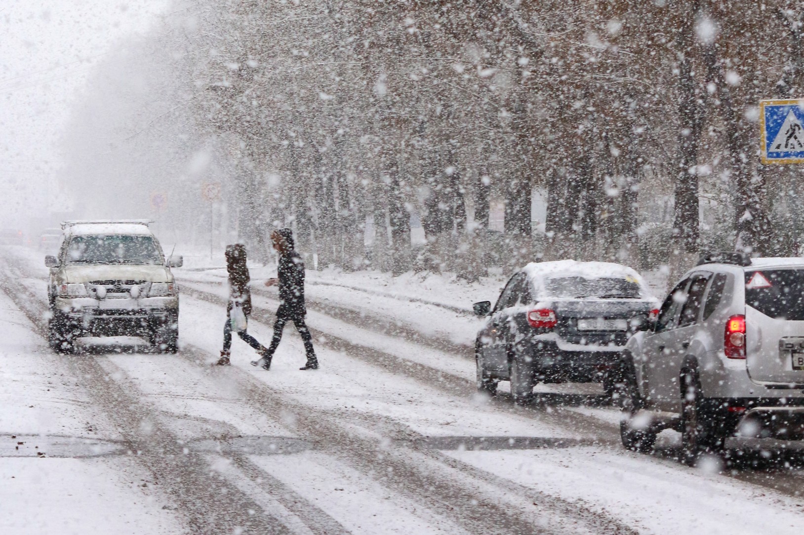
Most areas will escape with light snow showers, however, some of the squalls may produce significant accumulation for a time. These squalls will make travel difficult as they reduce visibility on the roads. Because Alberta Clippers also usher in gusty winds, it is easy to see how the snow and the gusts will combine to create dangerous road conditions.
The good news is that last week’s unseasonably warm weather left behind warmer ground temperatures. This means that much of the snow will melt quickly when it makes contact with the warm ground. However, you cannot rule out the chance of a slushy accumulation on roadways. As is typical, elevated surfaces will be the most likely to see accumulation.
Who Should Expect Snow Accumulation?
The greatest chance of accumulation will be in a zone stretching from Minnesota and across to Wisconsin and Michigan. This snow is predicted to get going late Tuesday, spreading into the interior Northeast by Wednesday. Much of the Northeast will get in on some of this snow action, including the higher terrains throughout the Appalachians in West Virginia and up into Pennsylvania, New York, New Hampshire, and Vermont.
Lower elevations will escape with just a slight chance of a wet accumulation. However, forecasters are warning that areas not expected to see accumulating snow may still see deteriorating conditions on the roads thanks to the quick-hitting nature of snow squalls. This potential impact zone includes portions of Interstate 80 in northern Illinois and into Indiana, Ohio, Pennsylvania, and New Jersey.
Cities in the Midwest that can expect to see the chance of snow showers firing up include Minneapolis and St. Paul, Milwaukee, Chicago, Detroit, and Cleveland. Heading into the Northeast, metropolitan areas such as Pittsburgh and Buffalo should be on high alert for snow squalls.
Worsening road conditions will not be the only travel hindrance. Air travelers may also experience issues in the skies with delays due to deicing operations. Be sure to pack your patience when heading out to the airport.
The clipper will move to the east throughout the day Wednesday, bringing the chance of a few snow flurries to the northern and western edges of the cities along the Interstate 95 corridor, including Washington, D.C., Philadelphia, New York City, and Boston. Most of the precipitation will fall as rain in this area with a small chance of some snowflakes making an appearance.
The temperatures will rebound once the clipper exits the region. This will translate to readings that hover slightly above the historical average for early November for much of the Midwest and Northeast by the end of the week. The warmer temperatures will put an end to the chance of wintry precipitation for now.
Did you find this content useful? Feel free to bookmark or to post to your timeline for reference later.

January 21, 2024

January 19, 2024

January 18, 2024
