
Heavy Rain, Flooding, and Chance of Severe Weather Staring Down the Southern U.S.
January 22, 2024
Posted: July 26, 2022 11:14 am


While the northern half of the nation will see some relief from the heat this week, the clash of two competing weather systems will set the stage for the ongoing threat of torrential rain and the risk of flash flooding. This impact zone will stretch from Kansas through West Virginia along the boundary of the immense heat and the more moderate temperatures.
The central Plains, Upper Midwest, southern Appalachians, and the Northeast will get a much-needed reprieve from the heat over the next few days. The mercury will tumble about 10 – 20 degrees from last week’s readings. Rather than seeing highs in the triple digits, many areas will struggle to get out of the 80s.
The incoming weather system will push the pervasive heat dome farther to the south. While the northern edge of the system will experience cooler temperatures, the extreme heat will continue in places to the south, including Texas, Oklahoma, and the Southwest.
Those located along the boundary of the weather system will be caught in the crosshairs of repetitive rain showers and storms throughout the week. This includes a large portion of the central Plains, Ohio Valley, and central Appalachians.
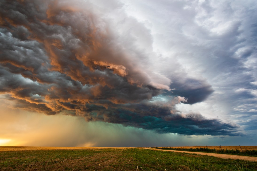
Because this is considered to be a long-duration rainfall event, it is likely that a handful of areas will see some degree of flooding. The ground is moist from previous recent rainfalls throughout the eastern Ohio Valley and into West Virginia. More rain this week will trigger a good chance of flooding in this area of the U.S. over the next several days.
The hardest-hit areas are predicted to be in southern Illinois, Indiana, and Ohio, through the northern reaches of Kentucky, and into some sections of Virginia and North Carolina. This region can expect to see 2 – 4 inches of rain starting Tuesday and continuing through Thursday. Central and southern West Virginia may see a whopping 4 – 8 inches of rain.
Rain of this magnitude is likely to impact travel. The hillsides of the southern Appalachians should be ready for flash flooding. If you are headed out to camp or hike in the coming days, be sure to stay abreast of any developing weather conditions. Because rain has the potential of falling quickly with this type of weather maker, it does not take long for a small stream to turn into a raging river.
This boundary that marks the difference between the relentless heat and the more seasonable weather will move to the south starting on Thursday. As this shift happens, the heaviest of the rains will also move farther to the south through Saturday. This will put the southern tier of the Tennessee Valley, the lower Mississippi Valley, the southern Plains, and the southern Appalachians at a high risk of downpours and flooding.
Although this precipitation could be disruptive to outdoor plans, it may provide relief to areas of the southern U.S. that are still dealing with drought conditions. While much of this region saw significant moisture to kick off the summer, the rain has been limited in recent weeks throughout southern Missouri, eastern Oklahoma, and northern Arkansas.
Cities that could really use a good soaking include Fort Smith, Arkansas and Springfield, Missouri. The area surrounding the summer tourist destination of the Ozark Mountains has also been exceptionally dry this summer. Not only is this good news for lawns but soybean crops could also use this moisture during the peak of the growing season.
Areas farther to the west may also see rain by the end of the week. Moisture coming up from Mexico could trigger showers in parts of Kansas, Oklahoma, and throughout the eastern half of Colorado. However, those in Texas hoping for some rain are not likely to see any significant measurements.
Did you find this content useful? Feel free to bookmark or to post to your timeline for reference later!

January 21, 2024

January 19, 2024

January 18, 2024
