Heavy Rain, Flooding, and Chance of Severe Weather Staring Down the Southern U.S.
January 22, 2024
Posted: April 21, 2023 1:25 pm


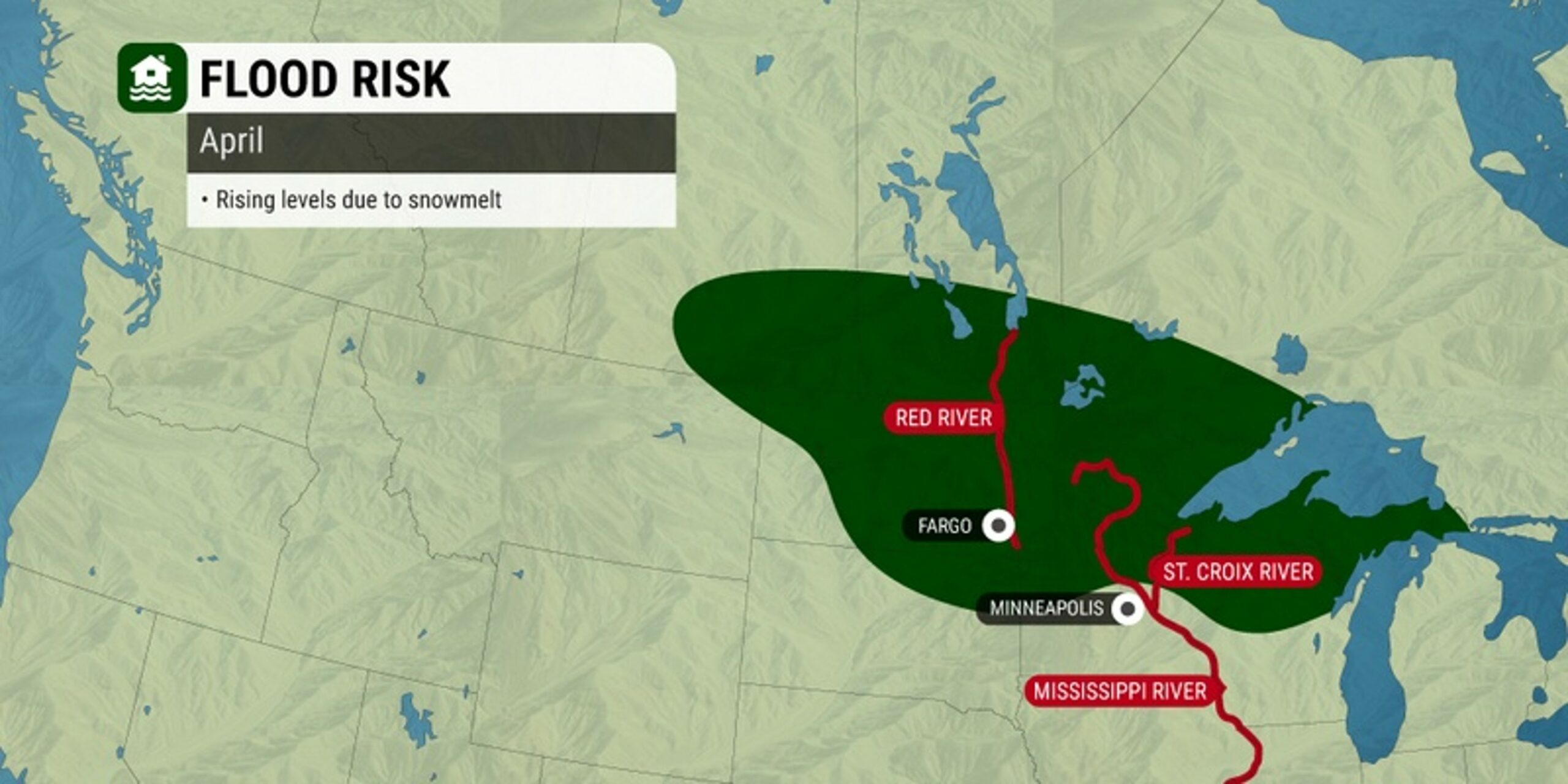
Forecasters have been warning for weeks about the likelihood of a flooding event across the north-central U.S. as the snow left from the harsh winter begins to rapidly melt. Here is the latest on this developing situation.
The rush of high water will begin in the northern portions of the Mississippi River before moving to the south into May. In addition to the Mississippi River dealing with flooding, the various signs of this type of event are already imminent across the Red River of the North.
While the flood stage will likely stop short of breaking any records, the amount of water unleashed will still be enough to cause major impacts to the region. The most populated communities along these waterways are generally well protected by levee systems.
These levees were upgraded in many areas in recent years. However, rural areas could be dealing with a big mess on their hands by the weekend as the water rises.
Experts are warning that some of the region’s key agricultural areas may be cut off as roads become impassable due to the flooding. The flatter terrain of this part of the country slows down the normal flooding cycle, making it take longer for water to drain.
This is particularly detrimental for farmers that may need to delay the start of planting season because of the wet fields.
According to the National Weather Service (NWS), at least 36 gauges scattered across rivers in the north-central portion of the nation will likely hit major flood stage in the near feature.
This includes several locations along the major waterways of the Mississippi and Red rivers.
The process has already begun along the Red River as the massive snowpack from the winter is melting at a fast clip. In North Dakota, Fargo Mayor Tim Mahoney is warning his constituents that the Red River will hit a crest of about 33 feet.
Major flood stage of the Red River in Fargo is 30 feet. While this will certainly be a large crest, it will likely fall well short of the record of 40.84 set in 2009.
The flooding concerns stretch down into the Mississippi River into parts of the Quad Cities in Illinois and Iowa. This flooding is projected to hold off for a few more weeks.
However, the timing could change if temperatures warm at a faster rate or if more rain hits the region. Most forecasters offer predictions of river crest timings up to one week in advance.
A great effort has been made over the past several years to improve the flooding mitigation efforts along the Mississippi River.
This includes the addition of more locks and dams in the area between La Crosse, Wisconsin and Davenport, Iowa. It is yet to be seen how successful these measures have been in capturing the melting snowpack.
Forecasters are predicting that the water level rise across the lower Mississippi River will not be as extreme. This is because much of the Missouri River basin is still under increasing drought conditions.
The bulk of the Missouri and Ohio rivers are in good shape as it relates to holding in the water. Because these are two of the major tributaries that feed into the middle part of the Mississippi River, it is unlikely that this part of the watershed experiences the flooding already in process up north.
This can all change quickly if weather patterns diverge from what forecasters are predicting in the long term. For instance, while the storm tracks of the winter were primarily centered over the north-central U.S., the upcoming systems will track farther to the south.
In addition, it will likely be the end of May before the chance of flooding hits the lower portions of the Mississippi River valley.
Did you find this content useful? Feel free to bookmark or to post to your timeline for reference later.

January 21, 2024

January 19, 2024

January 18, 2024