
Heavy Rain, Flooding, and Chance of Severe Weather Staring Down the Southern U.S.
January 22, 2024
Posted: June 4, 2023 8:16 am


The skies have opened across the central U.S. in recent days, finally providing some relief after an exceptionally dry spring. The spring season brought unusually dry conditions to a large portion of the Plains states.
However, the last few days have brought more rain to this part of the country. Will the moisture continue? Here is a look at the stormy conditions in the central U.S. as well as what is going on in the tropics.
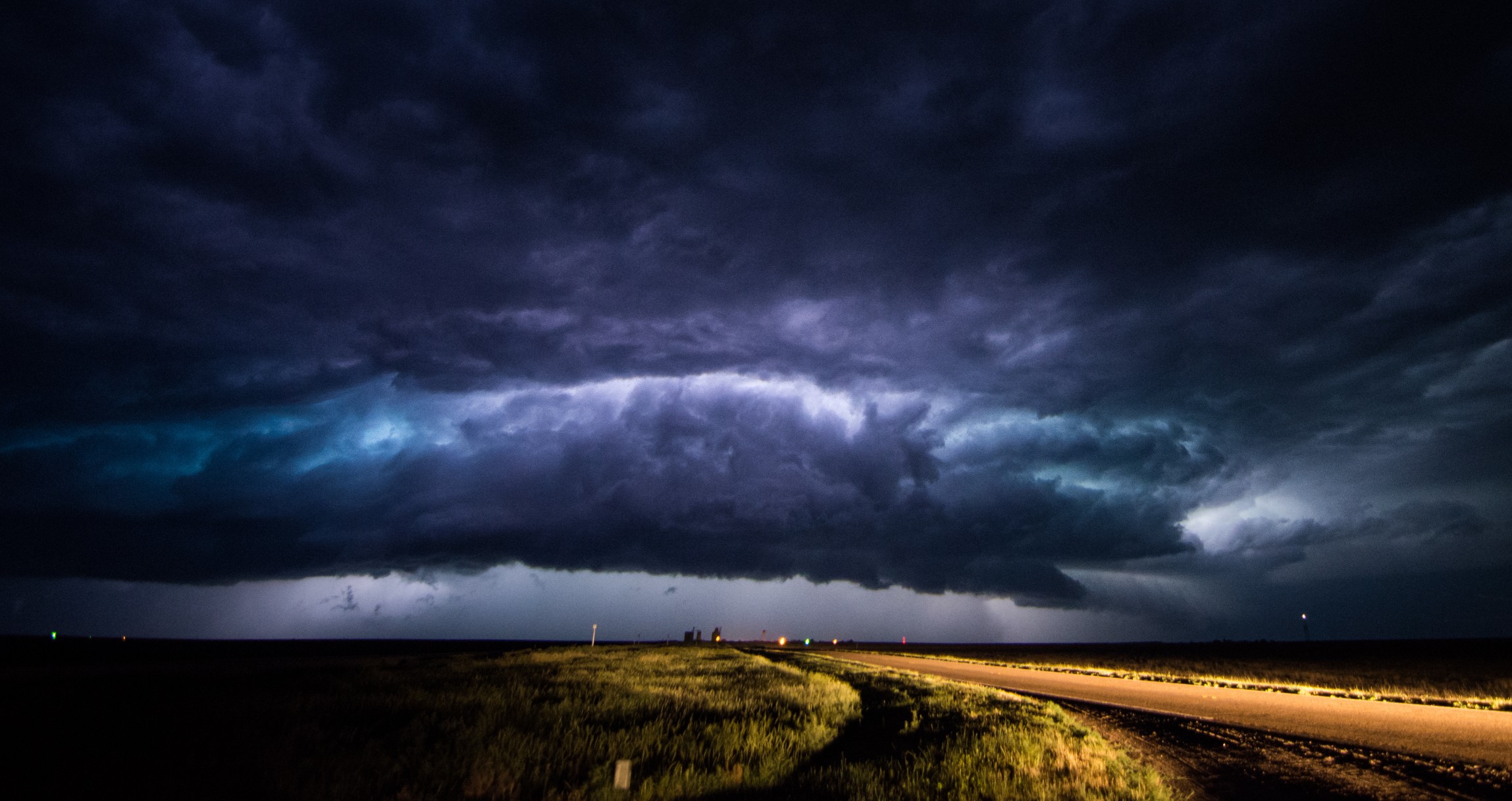
Saturday was another wet and stormy day for the eastern fringe of the Rocky Mountains and into the western Plains. An influx of energy and moisture served as fuel for these severe thunderstorms throughout much of western Texas and northward along the spine of the Rockies.
These storm cells brought a number of hazards to those in their path, including damaging winds and hail.
Sunday’s forecast will bring more storm activity to the Colorado Rockies and westward into some parts of Montana, Idaho, Wyoming, and central Utah.
Afternoon and evening storms will also be in the forecast for portions of western Nebraska and South Dakota and eastern Colorado as more moisture flows up from the Gulf of Mexico to serve as fuel.
Forecasters warn that the storms will bring the chance of flash flooding to a wide swath of the central U.S. through the end of the weekend. Small hail, torrential rain, and strong winds will all be on the table with these storm cells.
The lack of moisture in the central U.S. over the last week has created conditions defined as severe to exceptional levels of drought as defined by the U.S. Drought Monitor. The worst of the drought is spread throughout Kansas, Oklahoma, and Nebraska.

Looking into next week, a northward bulge in the jet stream into the south-central portions of Canada will bring moisture up from the Gulf. This movement will translate to daily afternoon and evening thunderstorms throughout much of the nation’s heartland and up into the northern Plains.
While the heat will be on in the north-central U.S. to start the new week, areas of the southern Plains will see a brief reprieve from the heat. For instance, it will only hit the low to mid 70s in western Texas for a high on Monday. This is a meaningful departure from the historic norm for this time of June.
Meanwhile, the tropics also heated up this week to commemorate the official start of the 2023 Atlantic hurricane season on June 1. Tropical Depression Arlene formed on Friday afternoon in the eastern Gulf of Mexico. The storm was later downgraded back to a tropical depression as it brushed by the Florida peninsula.
Arlene is forecast to continue its journey to the southeast on Sunday, approaching western portions of Cuba by the end of the weekend. Rough seas will churn up surrounding the storm system, impacting shipping interests in the region. High amounts of wind shear are projected to weaken Arlene further.
The primary impacts to Cuba will come in the form of heavy rain, thunderstorms, localized flooding, and high surf. Although the storm is forecast to dissipate quickly as it encounters the wind shear, the island will likely see lingering rain showers into the early part of the week.
Experts at the National Hurricane Center (NHC) will remain on high alert in the coming months as tropical weather season ramps up in the Atlantic basin. The next named storm on the 2023 list will be Bret.
Did you find this content useful? Feel free to bookmark or to post to your timeline for reference later.

January 21, 2024

January 19, 2024

January 18, 2024
